
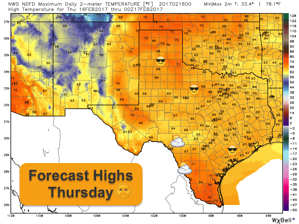
Tranquil weather is expected across the state the next several days with seasonal overnight lows and mild daytime highs. Clear skies tonight will promote good radiational cooling which will allow temperatures to drop down into the upper 20s to low 30s across the panhandle, low 30s across north Texas, upper 30s to low 40s across central Texas with coastal and deep south Texas seeing lows dipping into the 40s. Patchy ground fog will be possible across parts of central and north central Texas tomorrow, but impacts to visibilities early morning on the roadways are expected to be minimal. Highs tomorrow will be quite pleasant across the state. Breezy west/southwest winds across the panhandle tomorrow will cause temperatures to reach the 70s which is a good 10 degrees above average for this time of the year. North, central and southeast Texas will see very pleasant highs in the mid to upper 60s. Deep south Texas and the Rio Grande Valley region will see highs in the mid 70s along with increasing clouds by late afternoon into the evening. We’ll see a few rain chances return for coastal south Texas Thursday night into Friday, but accumulations will be minimal.
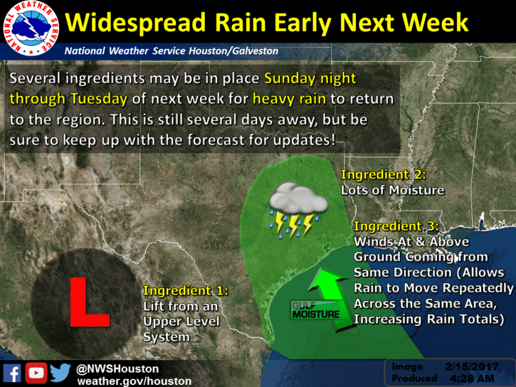
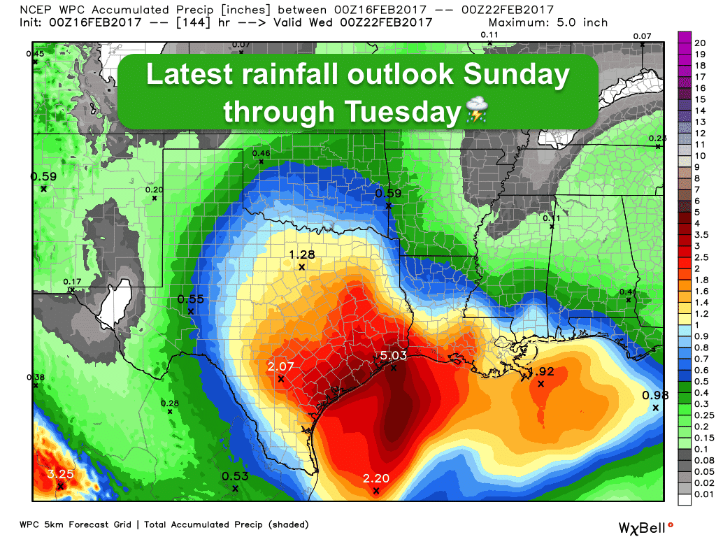
Better rain chances continue to develop starting late this weekend as another upper level low approaches from the west. Rainfall projections for locations south of the I-10 corridor are looking quite healthy with heavy rainfall likely across the region Sunday night, Monday and into Tuesday. Still too far out to nail down exact details but flooding will likely become a concern due to the possibility of storms training over the same areas through the period. We’ll have more updates out on that as we get closer. Elsewhere…rain and thunder likely late Sunday into early Monday beginning out across west/southwest Texas mid-day Sunday then moving east through the afternoon and overnight. We’ll be monitoring for the threat of a few strong to severe storms Sunday afternoon as a dryline develops across west central Texas, but it’s too early to nail down exact details on that as well. Looks like best chances for seeing any severe storms Sunday will be along and west of the I-35 corridor. We’ll have more updates out on that in future blog updates!


0 Comments