
The upper level storm system that brought widespread rain to Texas on Monday and Tuesday is in our rear-view mirror. In its wake we’ll enjoy much quieter weather for a couple of days. High temperatures this afternoon will top out in the middle 50s to lower 60s. Temperatures will warm back above-average by the weekend with highs in the 60s, 70s, and 80s. Those above-average temperatures will continue into the early part of next week as our weather becomes quite unsettled.
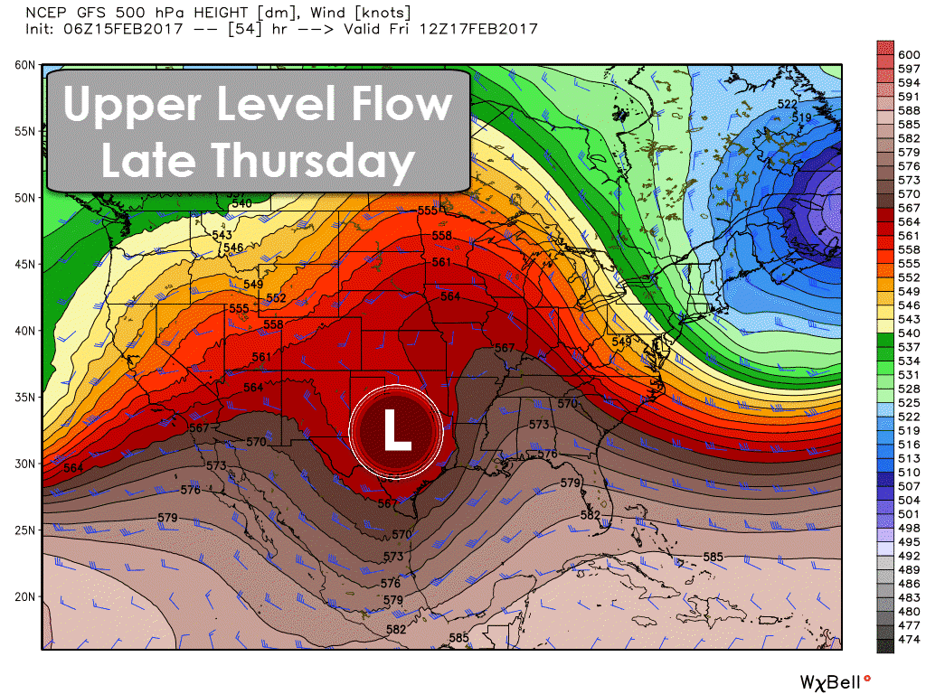
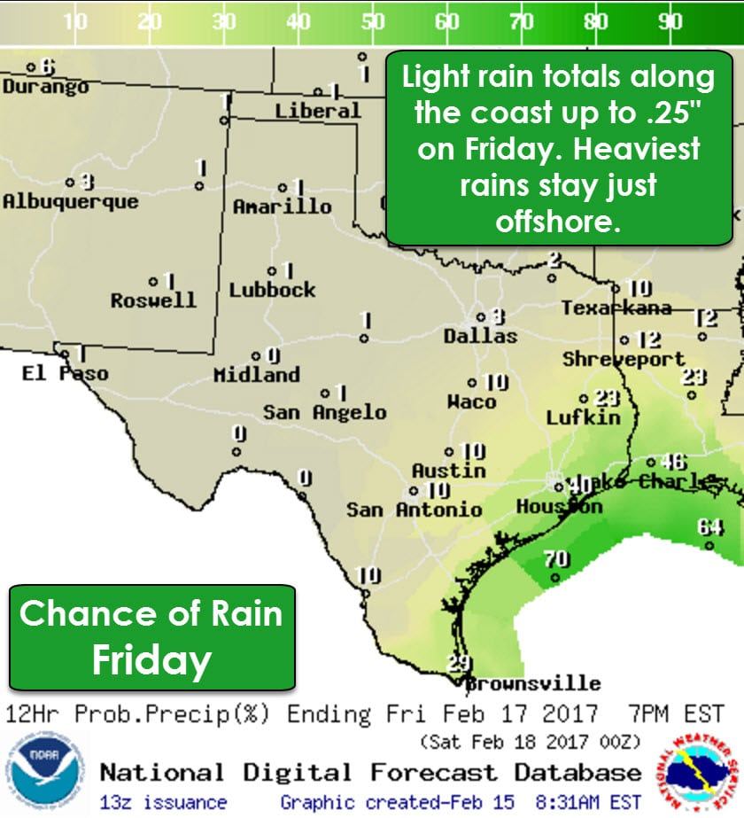
We’ll have a fast-moving upper level storm system move overhead tomorrow night and into Friday. We’ll see scattered showers along the coast and into parts of Southeast Texas in that timeframe. The heaviest rains are expected to remain off-shore where a quick hitting one to two inches of rain will fall in the Gulf. We could see up to a quarter inch of rain along the immediate coastline with a tenth of an inch within about 40 miles of the coast in Southeast Texas. Rain chances rapidly decrease with inland extent. Saturday should be dry across Texas.

Our next big-time weather maker will arrive on Sunday. Confidence on the specifics of the system’s track, timing, and overall intensity remain low thanks to lots of spread in weather model guidance. What does seem apparent at this juncture is that this upcoming system could produce widespread rain across parts of Texas. Pockets of heavy rain are certainly possible in this setup and we may see a heavy rain/flood event evolve.

Lots of moisture will move in ahead of our storm system by Sunday. The nature of the upcoming storm system, which may allow for training areas of heavy rain, combined with lots of moisture could prove supportive of a good soaking across Texas. We’ll have to wait for specifics on the upcoming system to iron themselves out before we can gain confidence on any potential flooding or severe weather issues. There could be some severe thunderstorms and a threat for heavy rain/flooding starting Sunday and continued through Tuesday. The highest threat for potential heavy rain/flooding seems to be in Southeast Texas where we could see several inches of rain. Lets get through Thursday and we should have a much better idea of the overall setup by Friday.


0 Comments