
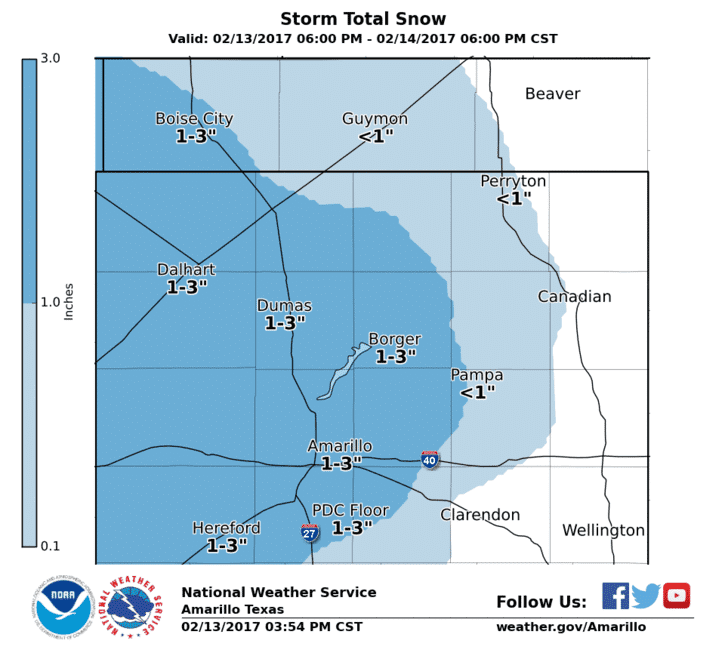
For the sake of simplicity I won’t go into overdrive on the nerd factor in this post. We’re seeing convection increasing across the western half of Texas this evening as our upper level storm system – and surface low – take shape. A changeover to a rain/snow mix may occur overnight in the Texas Panhandle as surface temperatures hover near freezing. Warm soils and the overall marginal temperature profile should prevent most accumulations of snow. We may see up to an inch in some spots across the western Panhandle by Tuesday morning, but we’re just as likely to see only a dusting. Regardless, take it easy on the bridges since those can ice over more quickly.
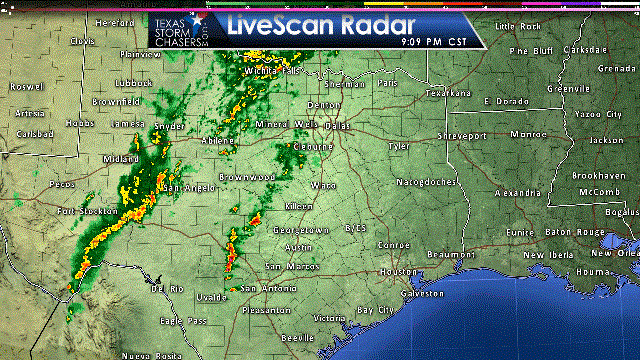
Cold air aloft has allowed for some of the storms in West Texas and the Permian Basin to produce small hail and very frequent lightning this evening – with surface temperatures in the 30s and 40s. This is what happens when you combine a shallow layer of cold air with a more unstable, warmer air mass above it. We’ll see widespread showers and storms continue to develop and move east into North Texas, the Big Country, Concho Valley, Hill Country, Central Texas, and Southwest Texas late tonight. Some of the precipitation may be heavy with rainfall rates up to one-half inch to one inch per hour. Some spots may receive two to three inches of rain by lunchtime Tuesday.
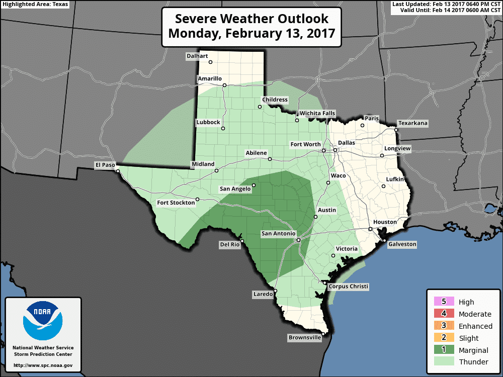
Severe weather outlook for late tonight through 6 AM Tuesday.
A marginal risk for severe thunderstorms may develop by late evening across portions of the southeastern Concho Valley into the HIll Country and Central Texas. Some of our high-resolution weather models are indicating just enough instability will combine with strong wind shear to produce one or two more organized thunderstorms – within the area of larger rain. Should that solution verify we could see a few severe storms with a threat of large hail, localized damaging wind gusts, very heavy rainfall, and a very low risk for a brief tornadoes. Again, all conditional on there actually being one or two more intense storms this evening. Regardless, widespread severe weather isn’t expected with this activity tonight. We may see a low risk of brief tornadoes materialize with the squall line as it moves near and east of Interstate 35 in Central Texas and South-Central Texas by pre-dawn Tuesday.
As the surface low starts to move east early Tuesday we’ll see a modestly unstable surface-based air mass advect inland across Southeast Texas. Questions remain on how far north this airmass will progress ahead of the thunderstorms. At this time it looks like the great threat for surface-based severe storms, including the possibility of a couple tornadoes, will be within about 40-50 miles of the coast in Southeast Texas – or along and south of Houston. Strong storms with high winds could occur across far East Texas into Southeast Texas. If we can get away with the storms staying in a line on Tuesday the threat of damaging wind gusts will be the primary threat with a secondary concern of brief tornadoes. If we end up with a few discrete, organized storms ahead of the squall line tomorrow morning the potential for a couple of tornadoes would be increased. By far not everyone will experience severe weather tomorrow morning in Southeast Texas – or in Houston for that matter. However, we must remain vigilant as conditions could come together to certainly support the threat of severe storms, including a couple of tornadoes. The timeframe for storms in the Houston metro looks to be 10 AM to 2 PM, but that window could change depending on what happens out west tonight. Severe weather seems unlikely north of Interstate 20 in Northeast Texas as the atmosphere should remain too stable. In fact, we may not see much in the way of a severe weather threat north of a Palestine to Center line. That said, Al Mollar used to say that we should always expect the unexpected when it comes to storms. As such, we’ll remain diligent.
The line of storms should move out of East Texas and Southeast Texas by the mid-afternoon hours. Wrap-around moisture in the form of light rain could continue in North Texas and Northeast Texas until Tuesday evening.


0 Comments