
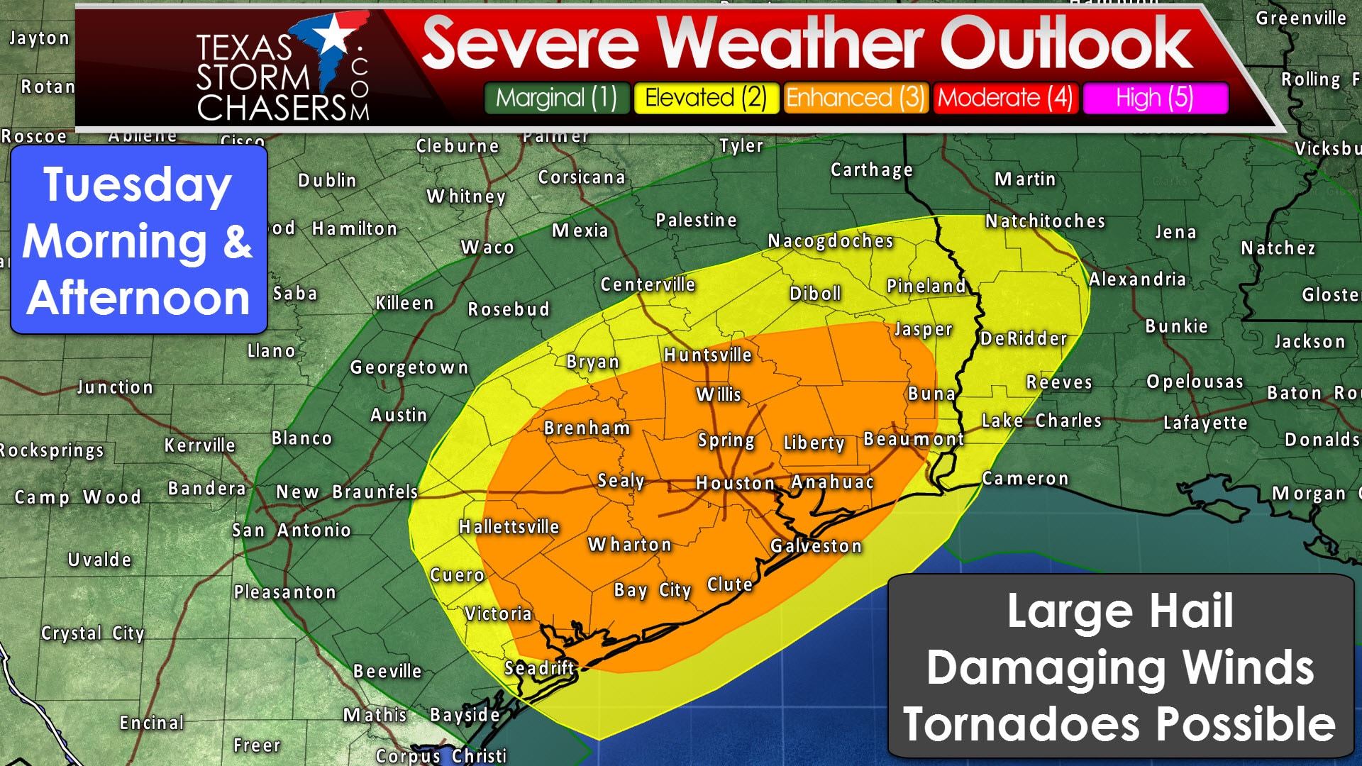
The Storm Prediction Center has upgraded portions of Southeast Texas to a category 3 risk of severe storms for Tuesday morning and afternoon. Hallettsville, Bay City, Brenham, Houston, Huntsville, Liberty, and Beaumont are cities included in this risk. A category 2 risk surrounds the category 3 and includes Cuero, Bryan/College Station, Nacogdoches, and Pineland. A category 1 risk runs from San Antonio north to Waco and east to Tyler and Shreveport. The primary risk in the category 1 zone will be localized damaging wind gusts and hail.
With the outlook upgrade comes an increased potential for tornadoes Tuesday morning and Tuesday afternoon in Southeast Texas. Damaging straight-line winds and hail are also severe weather threats. I encourage those in Southeast Texas to have a way to receive severe weather warnings tomorrow morning and afternoon. I’ll have a more detailed blog published later this afternoon regarding the potential for severe storms tomorrow, along with a few stronger storm further west late tonight.


0 Comments