
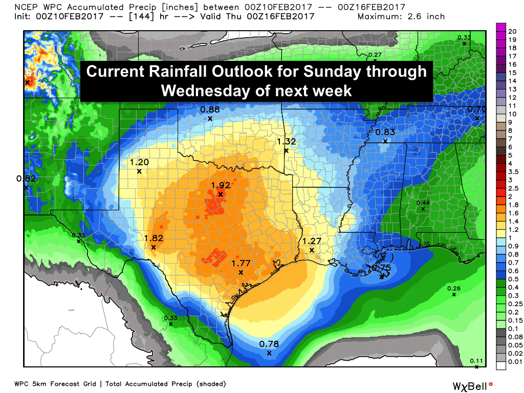
We joke that Texas can get all seasons of weather in a span of just a day or two, but that will certainly be a reality this weekend and into early next week. Near-record to record breaking heat is expected this weekend, then a strong cold front will arrive Sunday with sharply colder temperatures behind it and a threat for wintry weather for the Texas panhandle. Outside of the Texas panhandle, we won’t see snow, but we will see plenty of rain in the forecast through at least Wednesday of next week. Quantitative rainfall forecasts are trending down just a bit from what we saw yesterday, but with this system still being quite a ways out, and not yet sampled by our weather balloon network, there’s obviously still details in the forecast that will need to work themselves out before we get into next week.
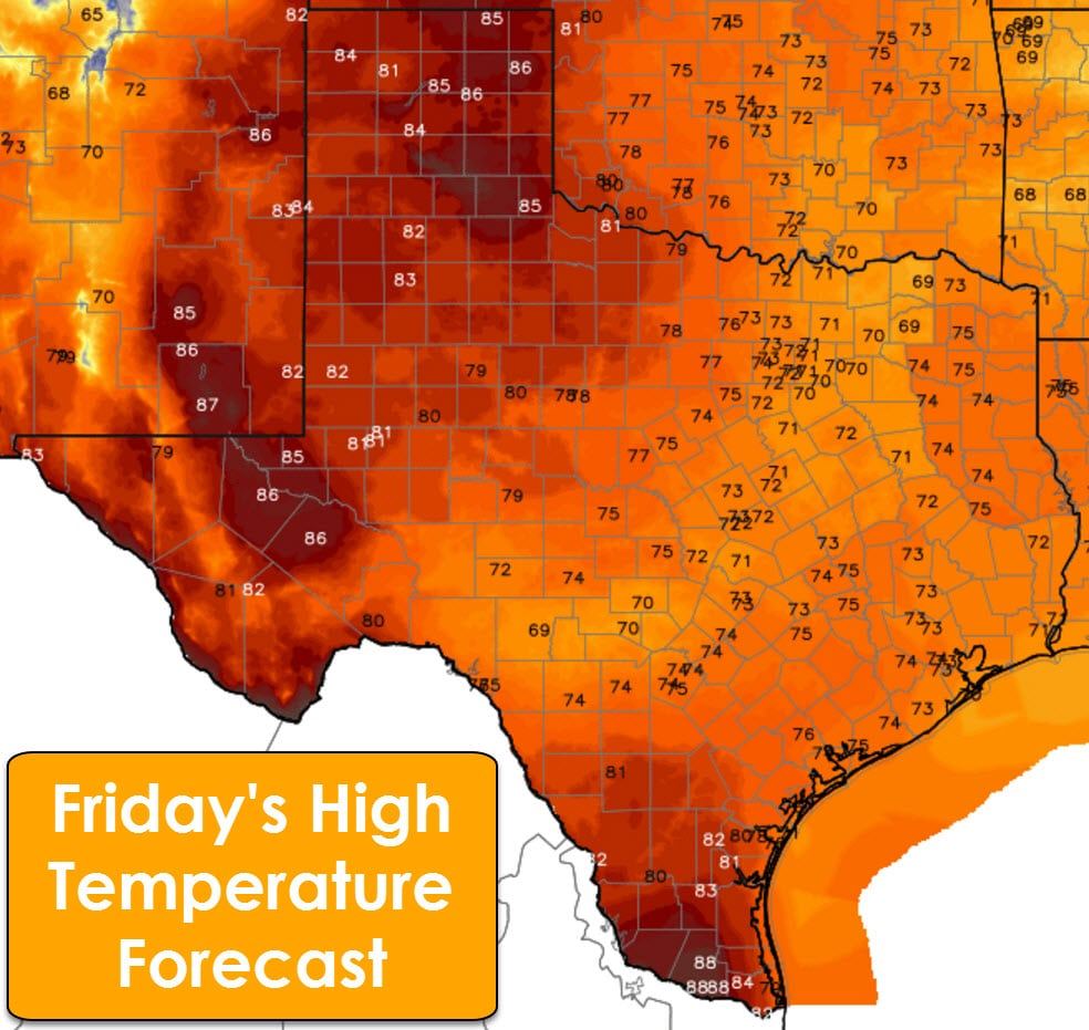
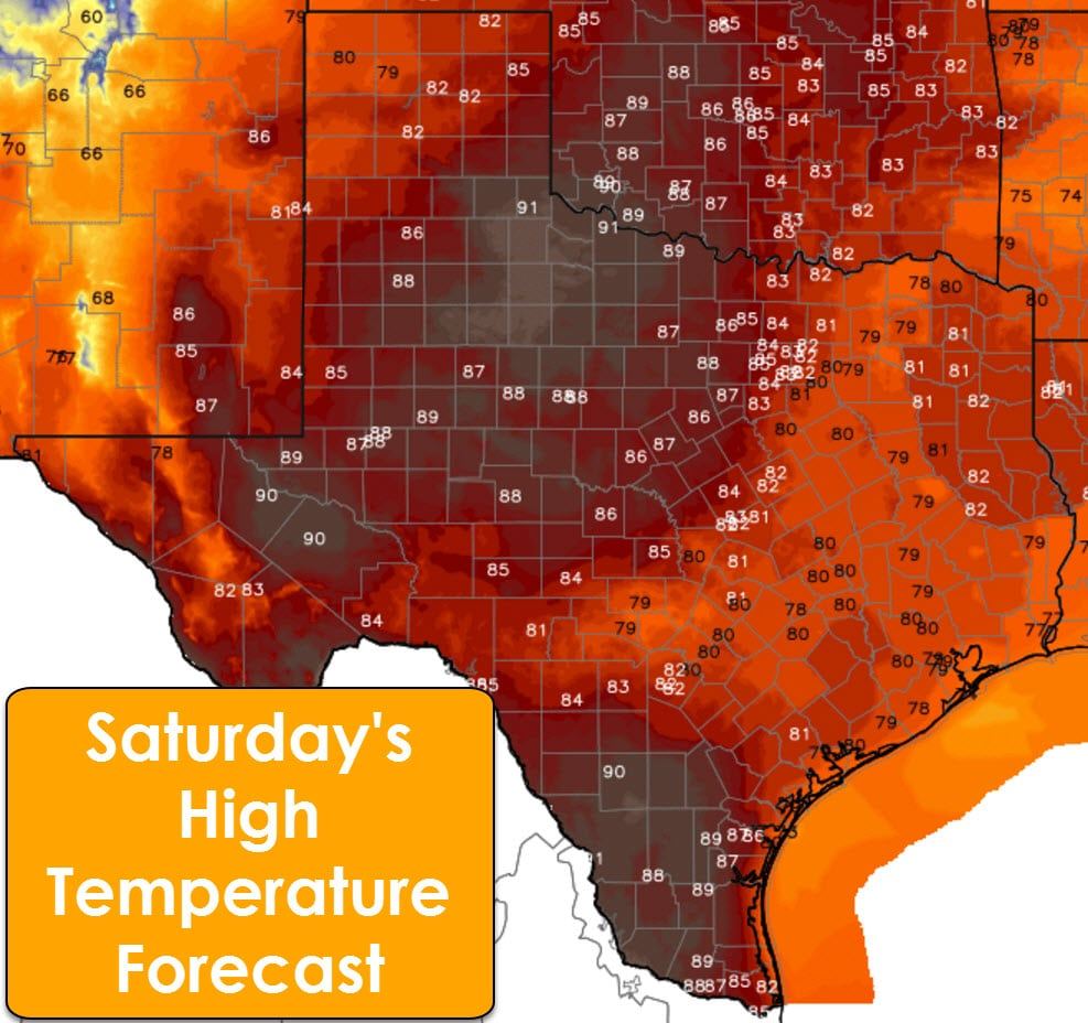
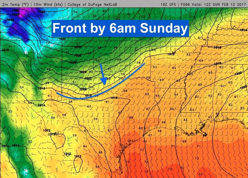
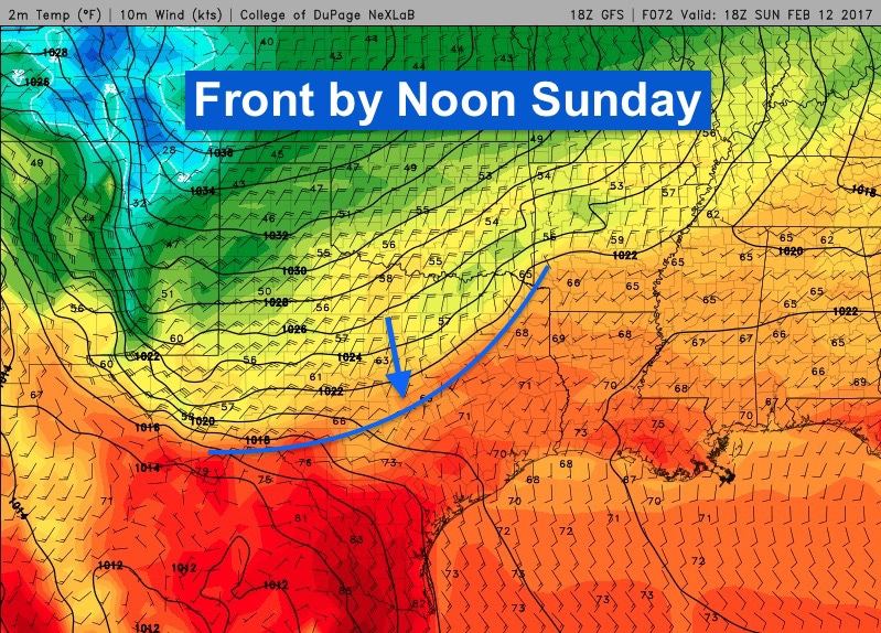
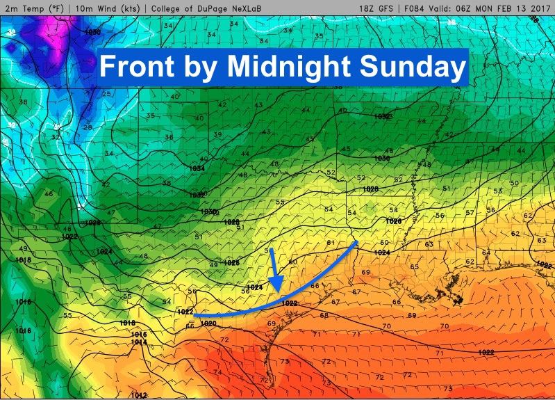
At any rate, here’s the current thinking. Friday and Saturday will feature temperatures well above seasonal averages. Saturday will be the warmest day with record highs threatened in numerous areas across west central Texas, northwest Texas and the Texas panhandle region. On Sunday, a strong cold front arrives. Timing of the front seems to be speeding up just a bit in the forecast models which bring it through the panhandle region early Sunday morning before dawn, across north Texas before noon and into central Texas by mid-day. By late Sunday, the front looks to slow and stall out…perhaps forgetting its purpose in life…just shy of the coast, so it may take another day or two before areas closer to the coastline begin to feel its impacts.
Now for the wintry weather potential across the panhandle and far west Texas regions. The front will arrive dry, but off to the west, an upper level low is forecast to become cut off and spin across southern Arizona/northern Mexico for a few days before finally ejecting northeast by the middle of the week. As this low sits and spins out west, this will generate lift and draw a good amount of moisture up across the state. Temperatures behind the front late Sunday and into Monday across the panhandle will likely be at or just below freezing by the time the lift and moisture arrive. This will generate chances for wintry weather…perhaps a mix of freezing rain/sleet or even a snow and sleet mix (#sneet) for the panhandle region late Sunday and through Monday. Some of the forecast models generate a good amount of snowfall across the region, but it’s still too far out to get into those details just yet. For far west Texas, higher elevation regions will likely also see temps at or near freezing which means anything precipitation that falls may be a mix of freezing rain and sleet with some snow mixed in. So in summary…we go from Summer to Winter pretty much within a 24 to 48 hour timeframe! Go Texas!
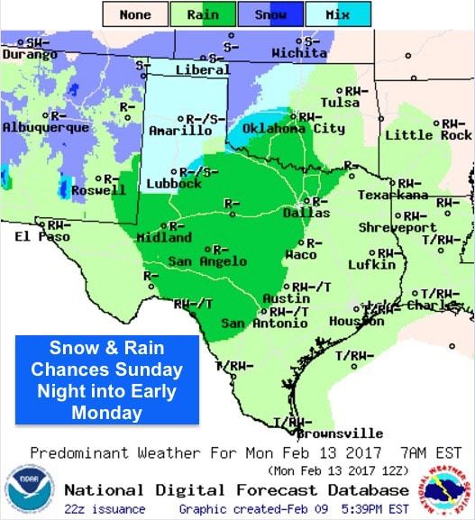
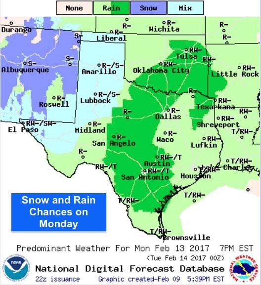
And for the rest of the state, no wintry weather is expected, but we will see a sting of dreary, cold and wet days to remind us that it’s still Winter. We can’t nail down exact rainfall amounts just yet, but it does look like a good swath of the state has the potential to pick up at least an inch or more of rain between Monday and Wednesday. Be sure to check back with us over the weekend as more of the forecast details arrive.


0 Comments