
The next five days will feel more like April versus February. I’ll go ahead and say now that our next decent cold front looks to be early next week. Until then we’re going to see above-average temperatures across Texas with several days of record-highs possible. The ‘coolest’ day will be on Thursday as a weak cool front brings temperatures back down into the upper 50s to 70s across Texas. The rest of this week will feature well above-average temperatures with 70s, 80s, and 90s. Many cities are forecast to approach or easily exceed previous records, especially today and on Tuesday. Honestly, this isn’t a bad week to get out on the beach… in February.
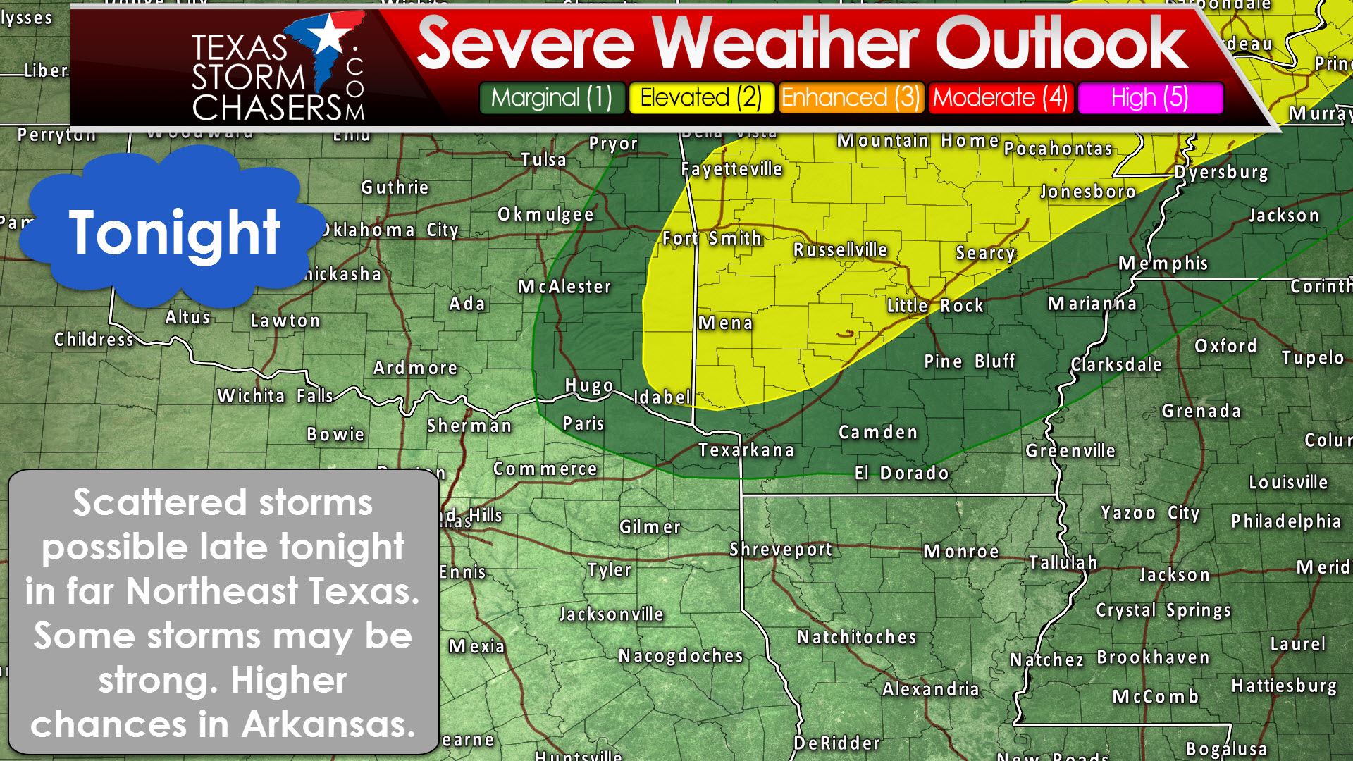
There is a low risk for a severe storm later tonight, after midnight, in far Northeast Texas. Scattered storms may develop east of a dryline/trough that will be moving toward Arkansas. We could see a few storms fire up in Northeast Texas before the trough moves into Arkansas. This will result in a low risk for a strong to severe storm with hail and gusty winds for a few hours late tonight/pre-dawn Tuesday. Its possible all we end up dealing with is a few light showers and fog, with the storms forming in Arkansas.
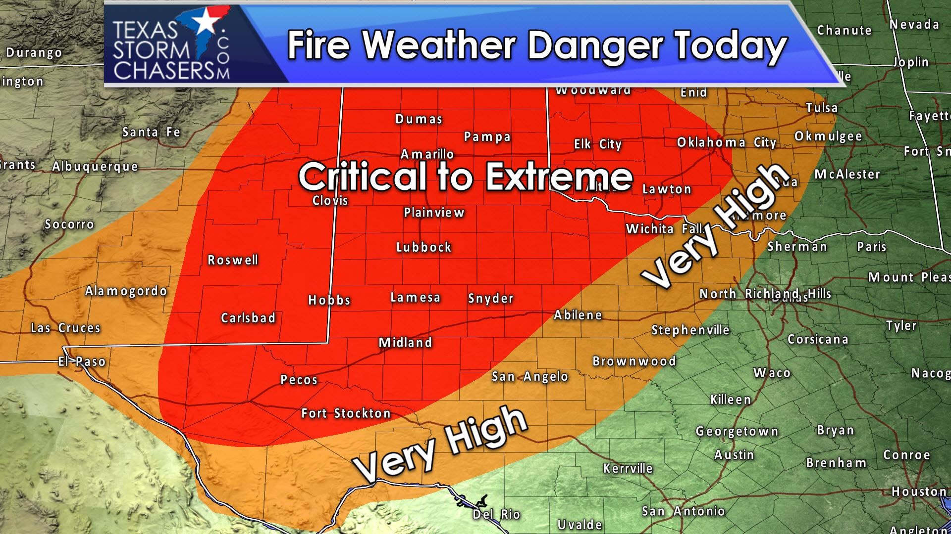
By far the most concerning weather will revolve around the risk of wildfires across Texas this week. We will have widespread critical to near extreme fire-weather conditions this afternoon across the Texas Panhandle, West Teas, the Permian Basin, the Big Country, and Northwest Texas. Relative humidity values below 15 to 20 percent, temperatures near record high levels, and winds gusting over 25 MPH out of the west/southwest will result in potential major fires today. Surface fuels are dry and primed, and we’ve seen fast rates of fire spread in grasses with relative humidity values above 80 percent this past weekend, so relative humidities below 20 percent with high winds will be quite problematic.
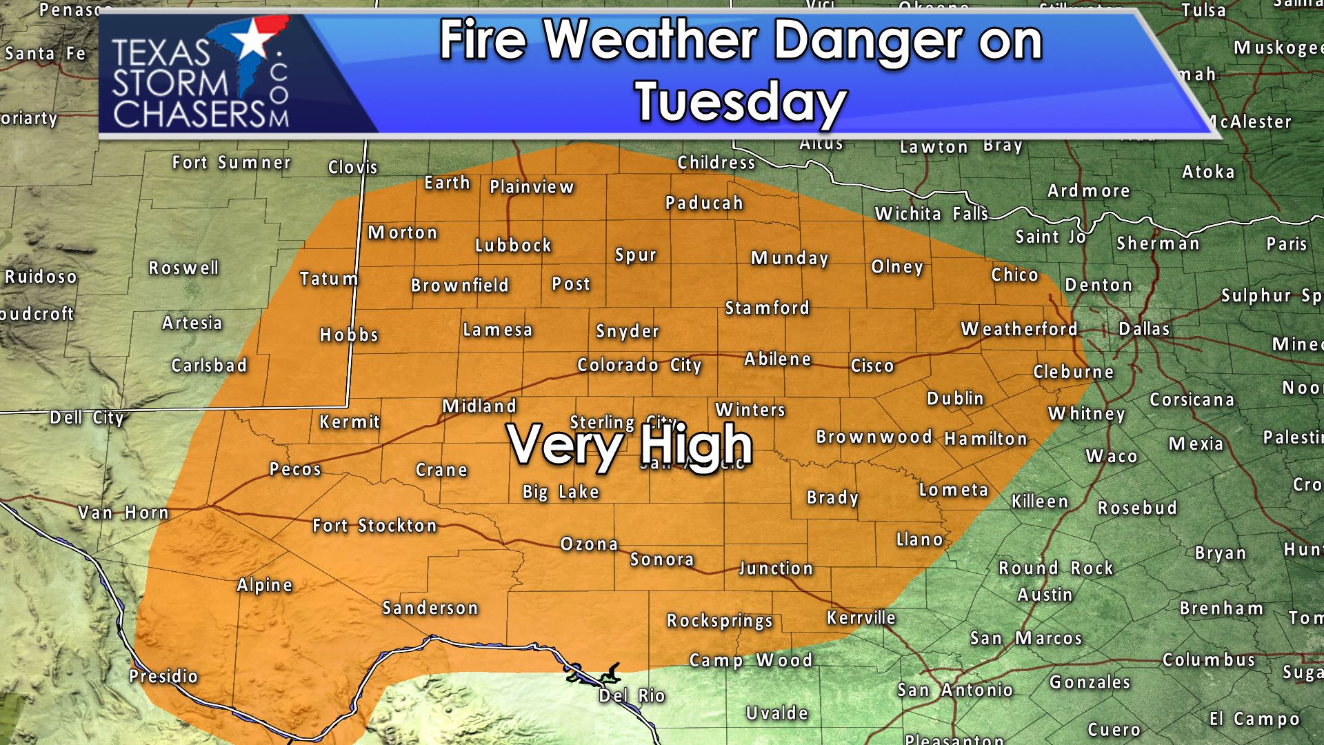
Very high to critical fire weather danger will again develop on Tuesday across the Permian Basin, Concho Valley, Big Country, West Texas, Northwest Texas, into the Hill Country, and North-Central Texas. Record high temperatures, low relative humidity, and winds of 15 to 25 MPH will again prove favorable for fast-moving fires. While wind speeds will be less impressive tomorrow compared to today, surface fuels are quite dry and favorable for fast-moving fires. Fire danger will moderate some on Wednesday and Thursday with lower winds and improved humidity values. Higher fire danger may re emerge by Friday and into the weekend.


0 Comments