

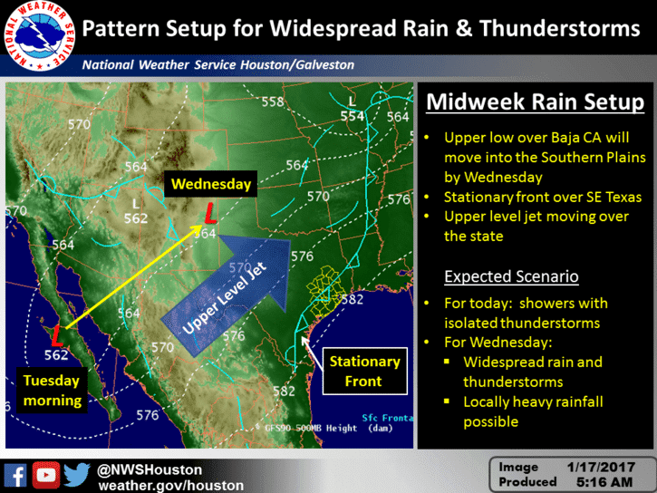
An active weather pattern will continue over the next week with no signs of another arctic outbreak in that timeframe. A trough is sitting off to our west in Mexico extending north to southern Arizona. A southwesterly flow ahead of that system is overspreading Texas. At the surface we have a stationary front bisecting the state with copious amounts of moisture in place. This system will bring a good chance of precipitation today, tonight, and into Wednesday.
Showers and thunderstorms are likely today in the Permian Basin east through the Concho Valley, Hill Country, Central Texas, South-Central Texas, into the Brazos Valley, East Texas, and Southeast Texas. Scattered showers are expected in Southwest Texas, West Texas, and with scattered storms possible in the Middle Coast. Numerous showers and thunderstorms can be expected tonight with locally heavy rainfall along the Interstate 35 corridor from Laredo north to the Red River. High rain chances will also extend into Northeast Texas, East Texas, the Brazos Valley, Southeast Texas, the Middle Coast, and to a slightly lesser extent westward into the Concho Valley, Big Country, West Texas, and Permian Basin. Rain chances will shift east of Interstate 35 on Wednesday and continue into Thursday across Northeast Texas, East Texas, Southeast Texas, into Deep South Texas.

The Storm Prediction Center has a marginal risk of severe weather in place this afternoon across South Texas, east through the Middle Coast, to the Southeast Texas coast. The risk runs along and south of a line from near Eagle Pass to Nixon to Houston. We’re not expecting many severe storms, but we can’t rule out the risk of an isolated severe storm capable of producing localized damaging wind gusts or a tornado. We’ll keep an eye on trends and update this forecast as needed. The risk of any severe weather threat should remain south of Interstate 10 today.
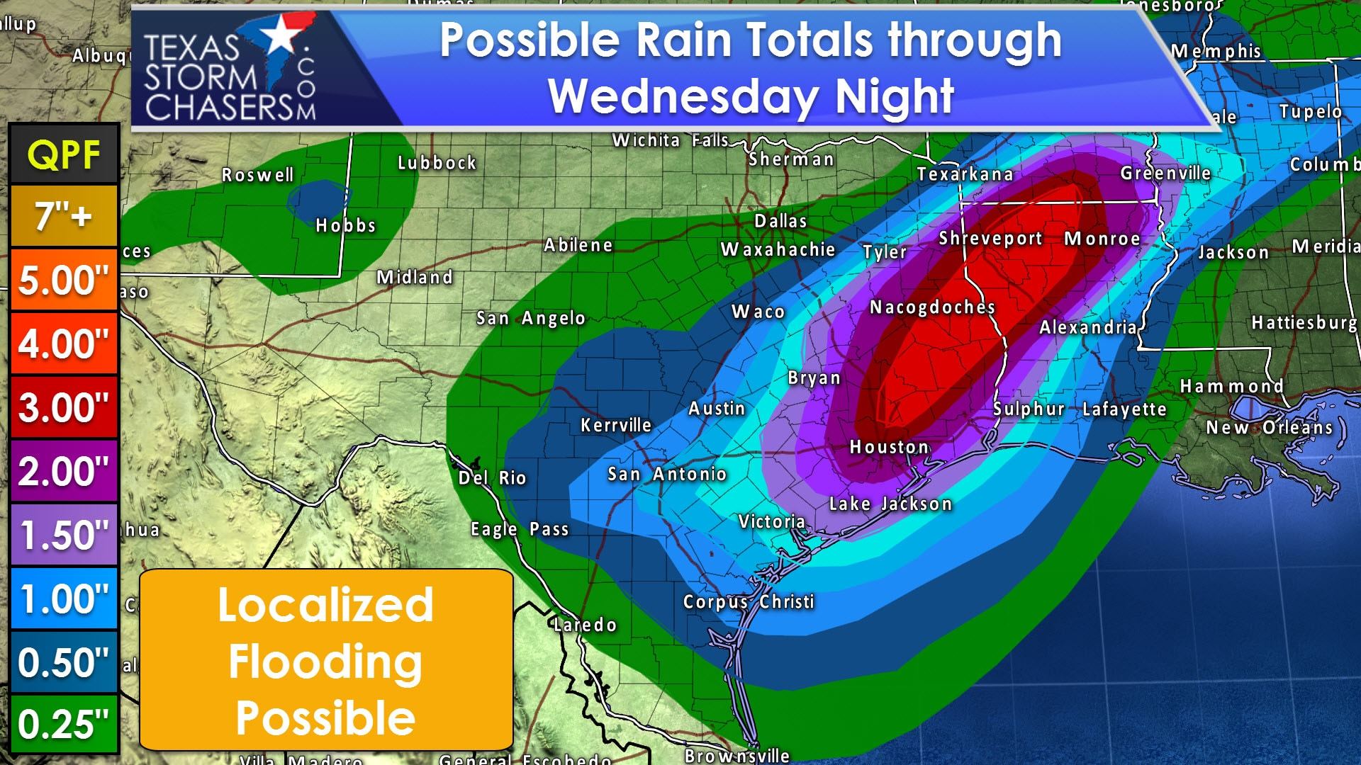
What will be the primary weather story for the next two days is the potential for a good soaking. With copious amounts of moisture in place we’re anticipating widespread rain totals of one half inch to two inches through Wednesday southeast of a Del Rio to Waco to Texarkana line. Some locations could receive localized amounts up to four inches. Widespread flooding is not expected at this time, but we are more mindful of a localized flooding risk since soils are more saturated than this past weekend’s system. Some flooding may develop where the heaviest rainfall axis sets up tonight into Wednesday.
After Wednesday the highest rain chances will be in far East Texas, far Southeast Texas, into Deep South Texas with a stationary front. Our next upper level storm system looks to arrive this weekend. We will have to keep an eye on the potential for severe thunderstorms east of Interstate 35, but as of now no official risk designation has been placed.


0 Comments