
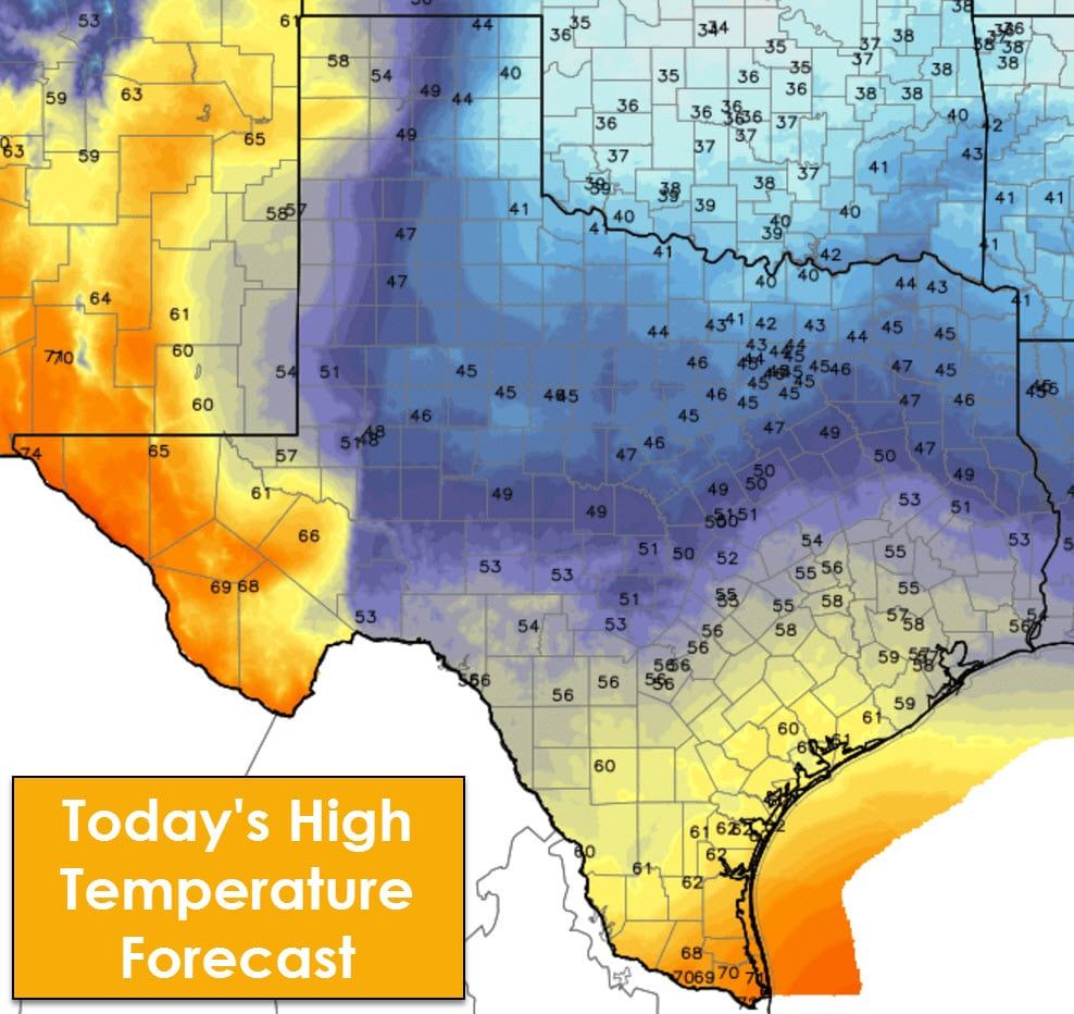
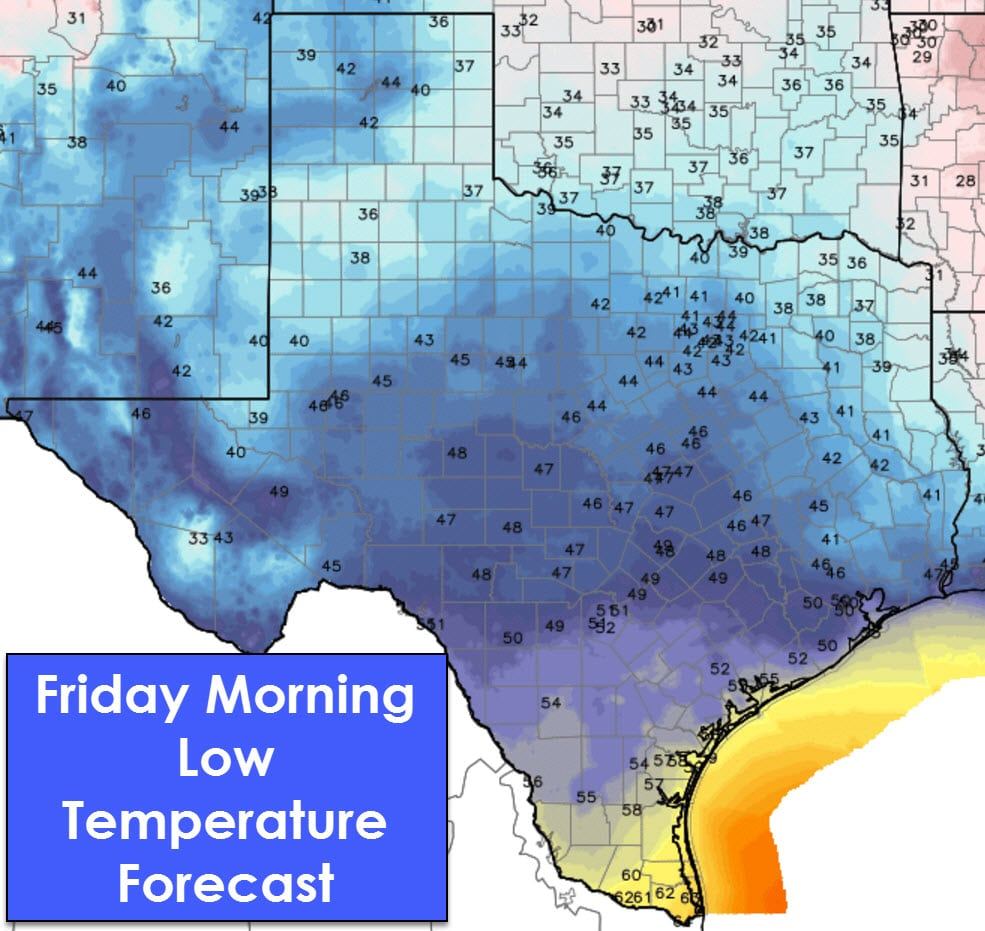
It will be a cooler day across most of Texas with high temperatures ranging from the upper 30s in the eastern Texas Panhandle and Red River upwards into the 50s by the time you get south to South-Central and Southeast Texas. The Borderland, Davis Mountains, Alpine area, and Rio Grande Valley will be our warmer spots today with highs in the 70s. Drizzle is possible tonight along with patchy fog. A few spots may pick up a few hundredths of an inch of rain, but overall tonight’s activity will be more like a mist/drizzle versus actual rain showers. Tonight’s drizzle will be accompanied by south winds that should help increase temperatures through the night. As such the low temperatures depicted may actually occur around or before midnight in some locations. Freezing drizzle isn’t expected since temperatures will be above freezing.
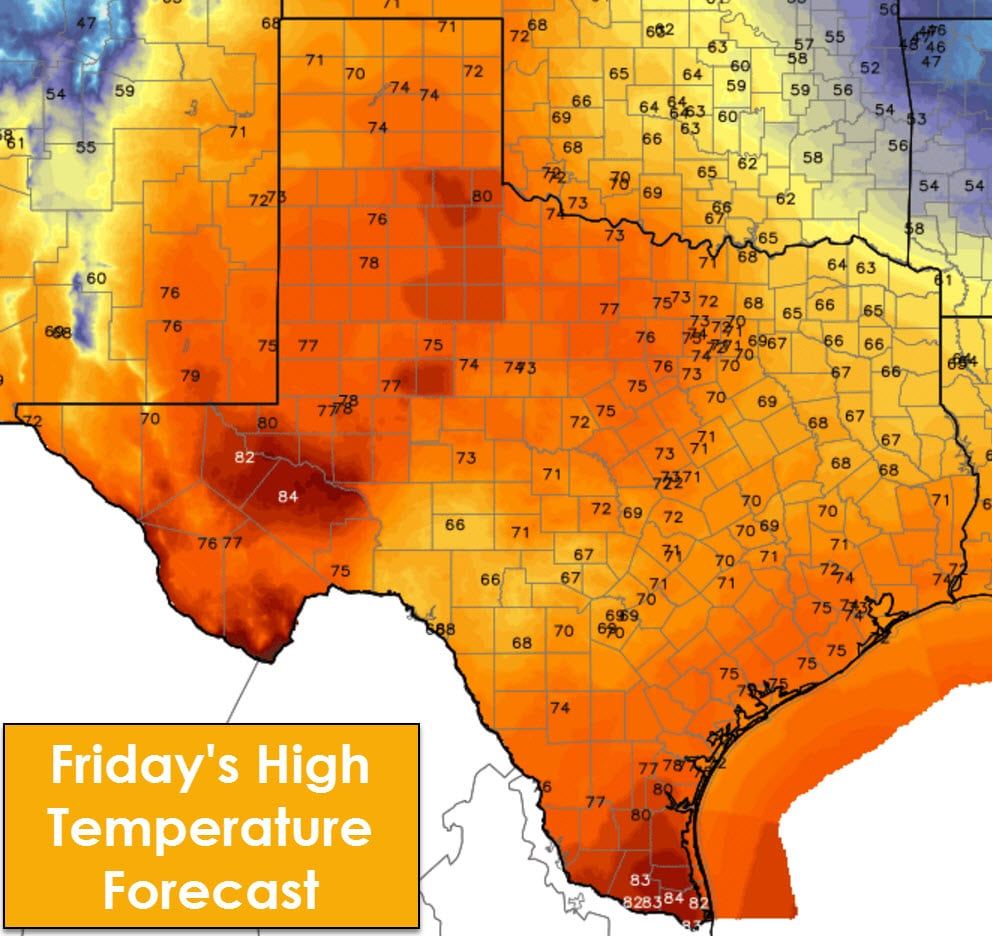
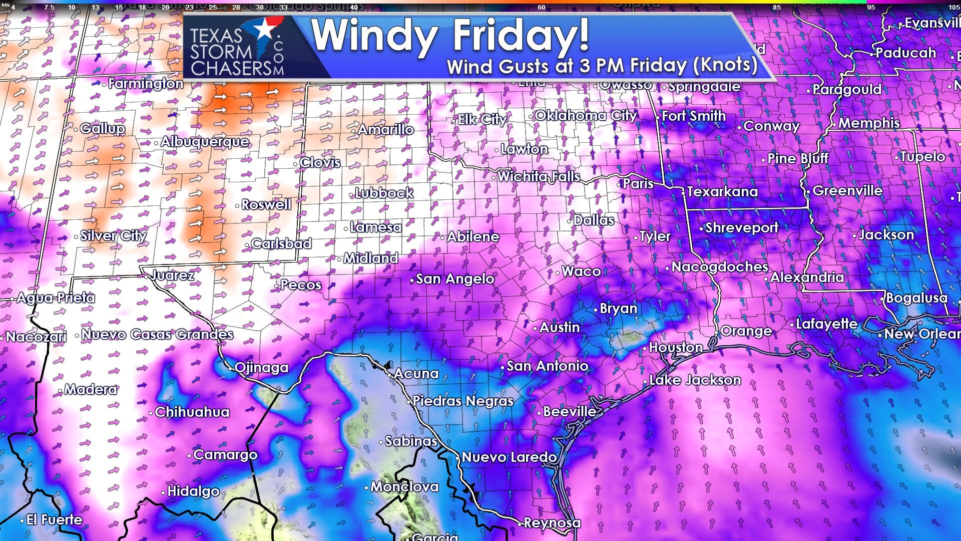
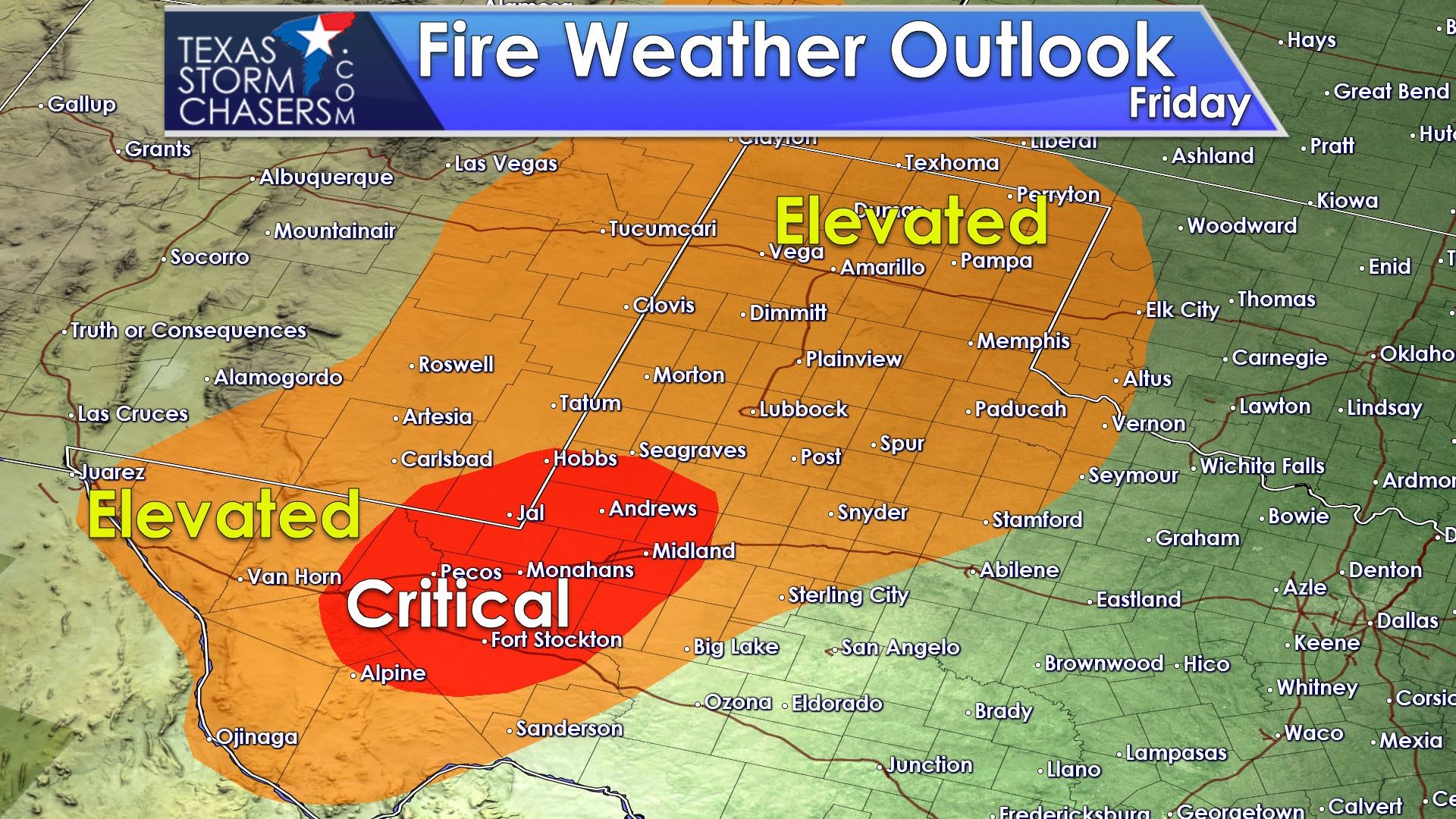
Friday will be a different kind of day with strong south/southwesterly winds and high temperatures soaring into the 60s, 70s, and 80s. Wind gusts up to 60 MPH will be possible in the western Texas Panhandle on Friday, with the rest of Texas experiencing 30-45 MPH wind gusts. The Permian Basin, parts of West-Central Texas, and Deep South Texas are all progged to make it into the lower 80s tomorrow afternoon. Highs elsewhere will range from the upper 60s into the middle 70s. These readings are generally above-average for December, and those who have lived in Texas long enough know that if we get that warm we’ll end up paying for it down the road. We certainly will pay for the warmer weather in a big way by this weekend.
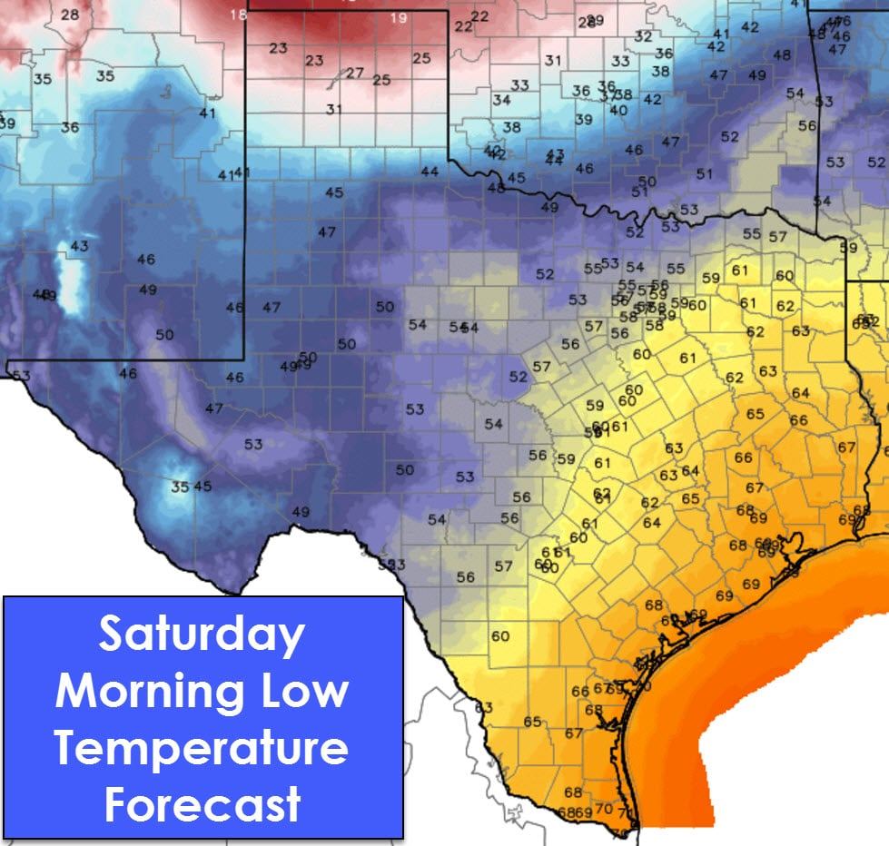
Our much-discussed arctic cold front starts to push south into the Texas Panhandle by the morning hours Saturday. You can pretty easily see it in our morning low temperature graphic, which runs until 7 AM Saturday. On the other side of the spectrum low temperatures Saturday morning won’t get below the middle 60s across the eastern third of Texas. Expect drizzle and fog overnight Friday into the morning hours Saturday. Patchy fog and drizzle are likely to continue until the cold front’s arrival at your location in the eastern half of Texas on Saturday.
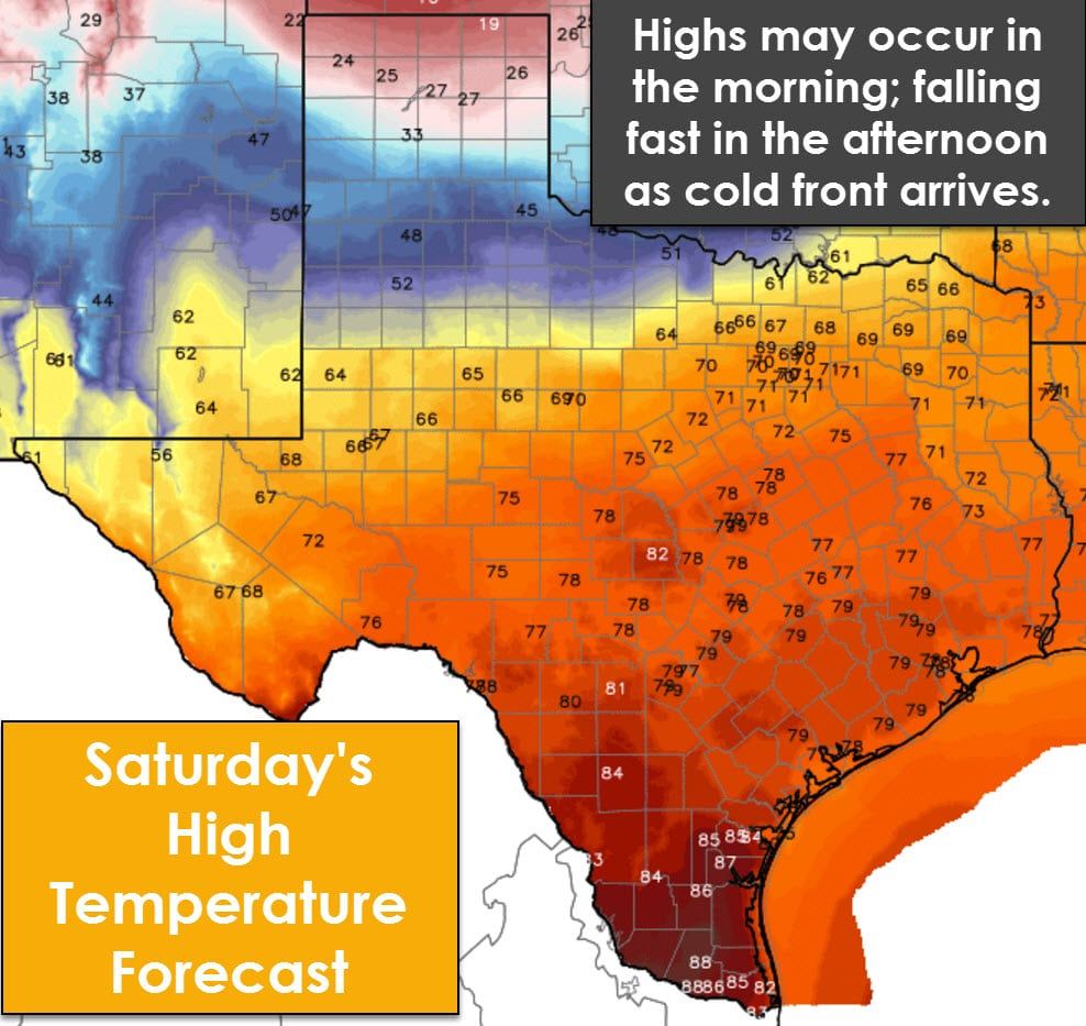
High temperatures on Saturday look warm across most of Texas, but may actually occur during the morning hours Saturday. As the arctic cold front arrives at your location temperatures will drop from the 60s and 70s into the 30s. North winds will gust up to 40 MPH and the wind chills will be unpleasant. Current projections have the cold front arriving around the Red River at noon Saturday, Interstate 20 from Sweetwater to Canton around 4 PM, Midland to Austin to Shreveport around 7 PM. The front’s specific timing is still subject to change by a few hours, either slower or later. Temperatures north of the front will fall into the 20s and 30s pretty quickly with wind chills in the 20s. Temperatures in the Panhandle and West Texas by dinnertime Saturday will be in the 10s and 20s. Wind chills will be in the single digits.
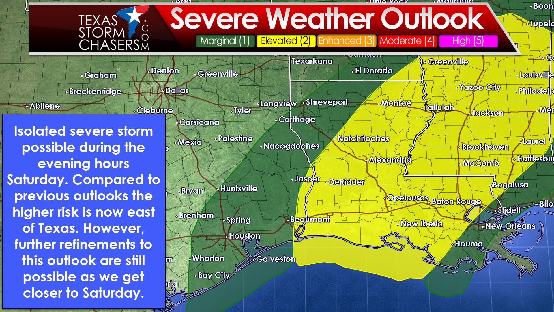
The severe weather outlook for Saturday evening is looking a bit better for Texas. The new outlook from the Storm Prediction Center has moved the higher probabilities east of the state. A category 1 marginal risk does still include East Texas and Southeast Texas. The category 2 risk, the standard risk level, is in extreme Southeast Texas into Louisiana and Mississippi. A strong cap may prevent thunderstorm development in Texas until the cold front is almost east of the state. We’ll have to keep an eye on new data as it arrives into Friday to see if the cap will be weaker. As it stands now an isolated strong storm is possible Saturday evening in Southeast and East Texas, but the overall risk is on the low end. Rain totals will also be very light, with perhaps a quarter inch of rain in extreme Southeast and East Texas. Flooding is not expected.
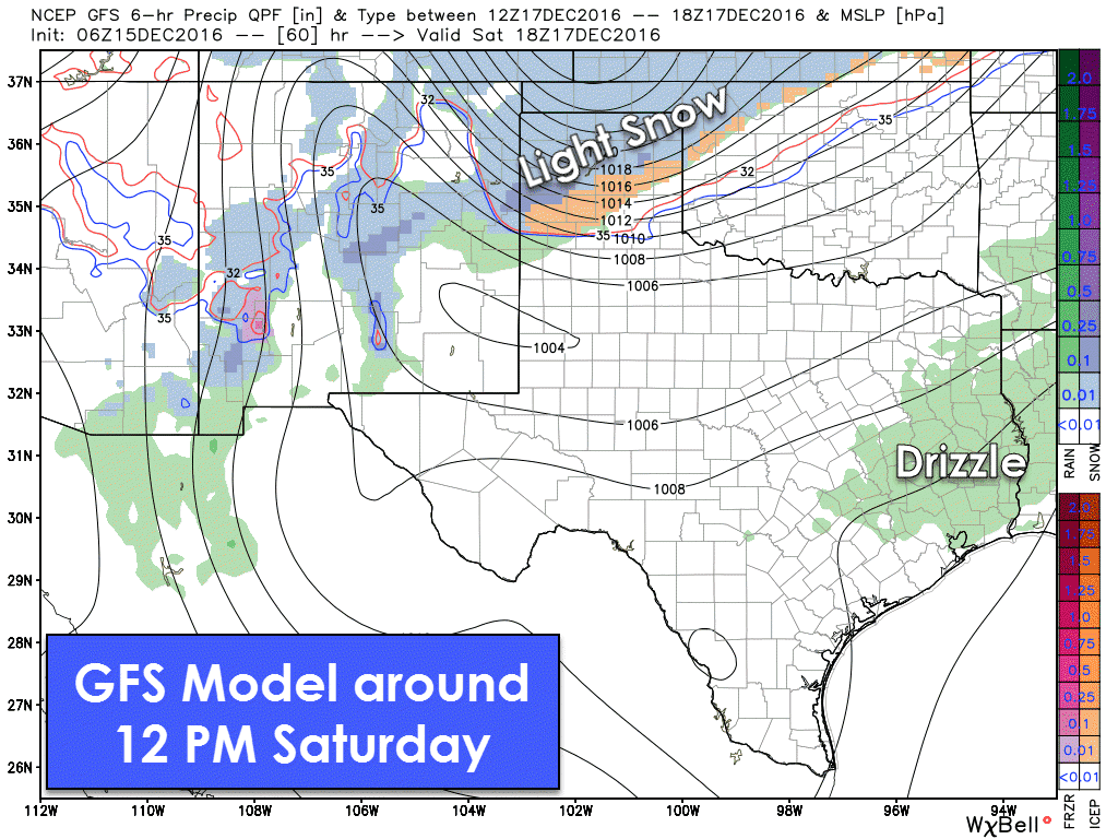
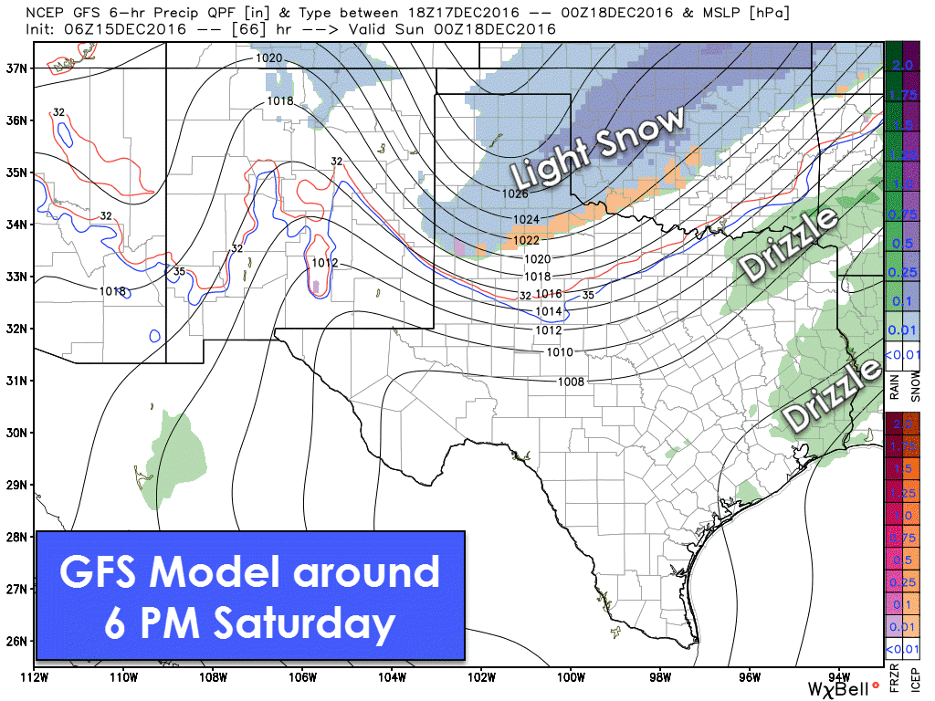
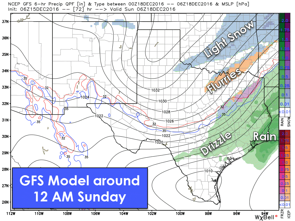
From storms to snow, winter has arrived in Texas. Let me be clear now in saying any potential winter weather will be light and this will be a low-end impact event. Light snow will be possible in the Texas Panhandle during the afternoon hours Saturday. Strong north winds up to 45 MPH and the light nature of the snow should prevent more than a dusting to inch of snow. Some slick spots are possible on roadways and especially on bridges. Snow may end up being of the drier variety which would promote blowing snow and reduced visibilities in the strong winds. Light snow will be possible during the evening hours in the Texas Panhandle, West Texas, and portions of Northwest Texas. It’ll probably be flurries or very light snow with only a dusting to half an inch of snow possible. Flurries will be possible along the Red River east into North Texas during the late evening hours Saturday. Accumulations are not expected at this time in North Texas.
Sunday and Monday are going to be very cold. Wind chills during the morning hours Sunday and Monday will be near zero in the Texas Panhandle, West Texas, Northwest Texas, into Texoma. Single digit wind chills are expected into West Texas, the Big Country, and North Texas. They’ll still be quite cold with teens and twenties into South-Central and Southeast Texas. Low temperatures on Sunday and Monday will drop into the single digits in the Texas Panhandle with teens as far south as the Permian Basin, Concho Valley, North Texas, and Northeast Texas. The freezing line could make it into portions of South Texas by Monday morning. We do start to slowly moderate by Tuesday.


0 Comments