
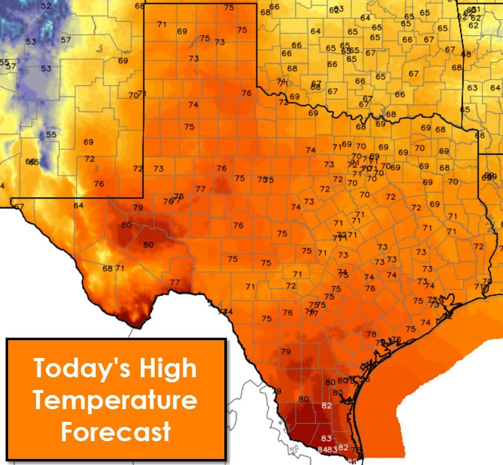
We’re starting off the work week with a continued warming trend. Temperatures this afternoon will top out in the upper 60s in Northeast Texas up into the lower 80s in the Permian Basin, South Texas, and the Rio Grande Valley. Everyone in-between will enjoy highs in the lower to upper 70s. Southerly winds will continue to advect higher moisture levels into Texas today, mainly along and east of Interstate 35. You’ll notice humidity values increasing. There will be a chance for isolated showers in the Borderland today and tonight. Only very light precipitation amounts are anticipated.
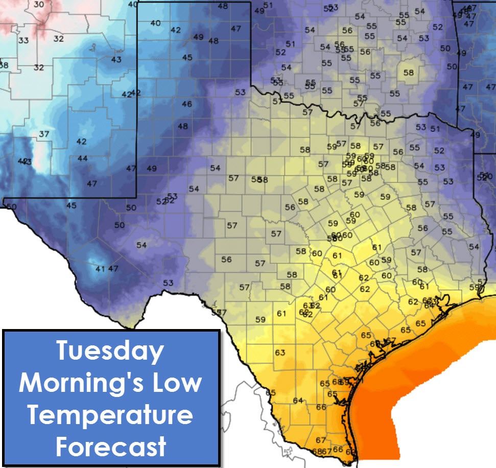
A cool front/dryline combination will push east on Tuesday. By the late afternoon hours the front should be located over North Texas extending south/southwest through Central Texas into the Hill Country. Conditions west of the dryline will be warm with temperatures in the 60s and 70s with gusty west winds. Along and east of the dryline it’ll be noticeably more humid with cloudy skies and scattered showers. We’ll probably start off the morning hours Tuesday with fog across Central Texas, the Brazos Valley, South Texas, and Southeast Texas.
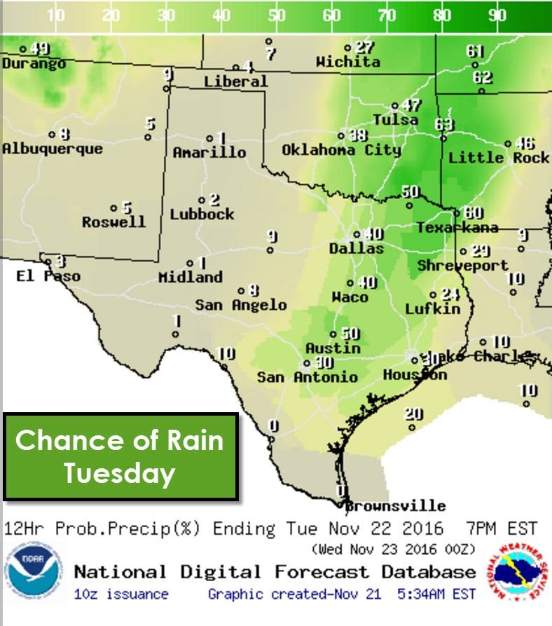
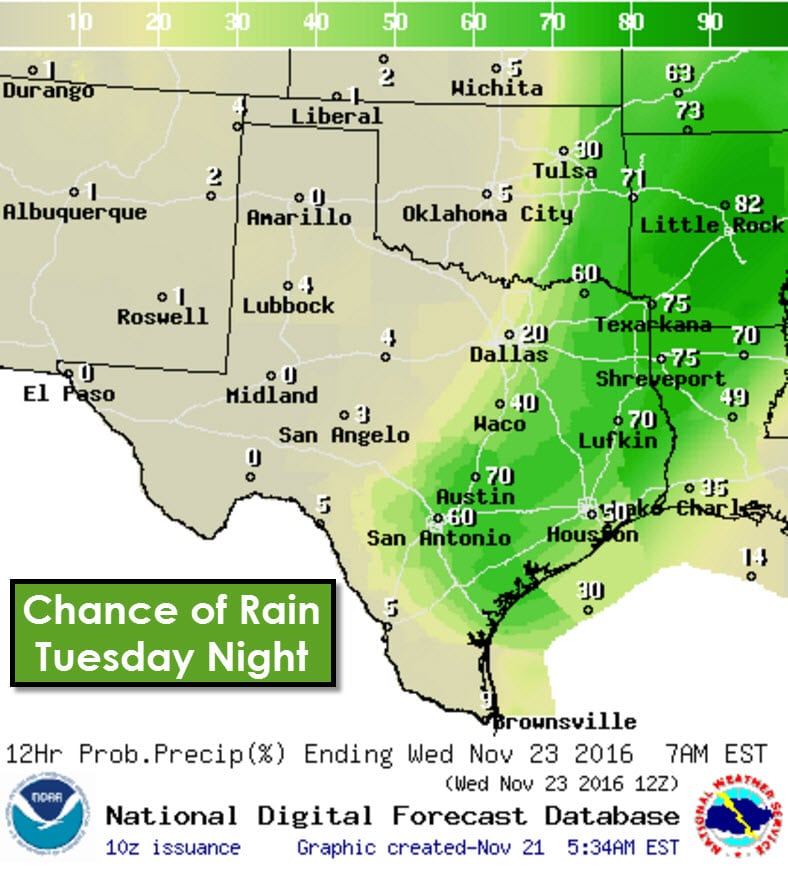
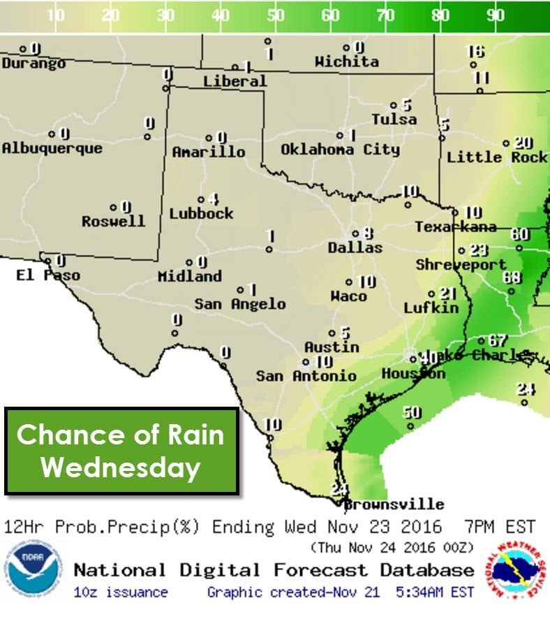
Scattered light showers will probably be underway by the mid-afternoon hours Tuesday east of the dryline. A capping inversion should prevent thunderstorms from developing until the late afternoon or evening hours. An upper level disturbance will arrive by late afternoon or early evening. That disturbance will help eliminate the capping inversion with a line of thunderstorms developing along the cool front. That front and associated thunderstorms will move east Tuesday Night into Wednesday Morning. Conditions quickly dry out behind the cool front and we should have most convection moving offshore or to our east by Wednesday afternoon.
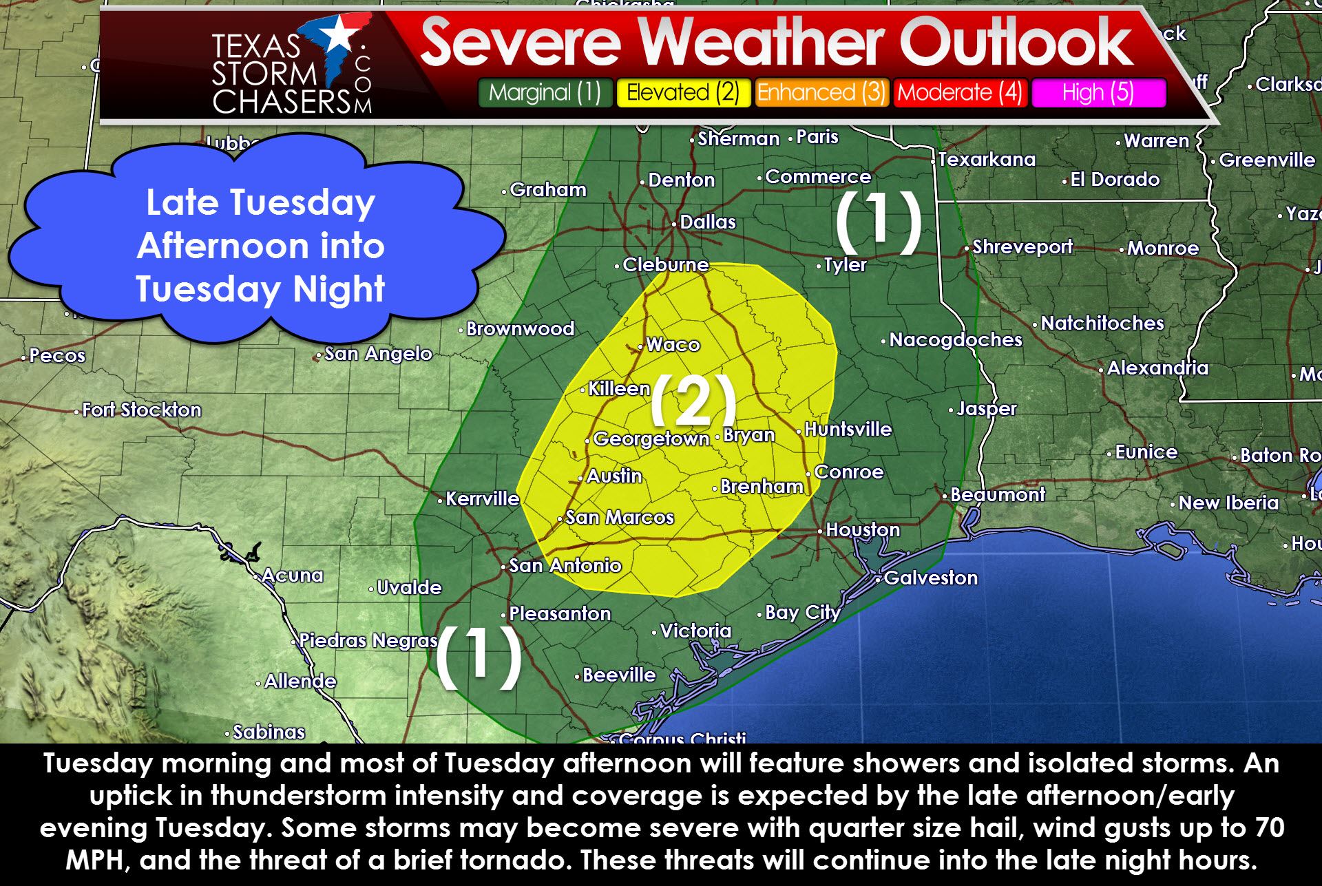
The incoming upper level disturbance will increase wind shear values tomorrow. The capping inversion should prevent organized thunderstorm development until the late afternoon or early evening hours. Current weather model guidance suggests the atmosphere will become modestly unstable ahead of the cool front tomorrow evening. These severe weather setups are called high shear – low instablity events. Once storms develop along the cool front we could see a few of them produce hail up to the size of quarters and wind gusts of 45 to 65 MPH. A second possibility is we may see a few individual thunderstorms develop ahead of – or in advance of the line of storms tomorrow afternoon/night. If we are able to get organized, discrete storm development we’d have to watch for a brief tornado in the Brazos Valley and Southeast Texas.
This will likely be a low-end severe weather event, but if we have one tornado tomorrow and it comes down your block it’ll be anything but low-end to you. If the atmosphere remains more stable tomorrow the severe weather threat will remain very low. If we see more instablity in place we could see the severe storm threat increase slightly. Either way I don’t expect too many problems.
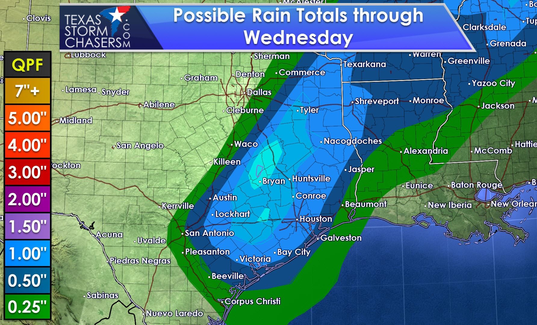
Plenty of moisture will be in place across East Texas, the Brazos Valley, Southeast Texas, and Middle Coast. Thunderstorms will be efficent rain producers and we’ll probably see several locations pick up a quick one to two inches of rain. Widespread flooding is not expected with this rainfall forecast. However, some spots may experience short-term street flooding due to the anticipated heavy rain rates.
Rain chances will end outside of the Rio Grande Valley by Wednesday Evening. A rogue shower will be possible on Thanksgiving in the Rio Grande Valley. Otherwise Thanksgiving and the first half of the upcoming weekend will be pleasant with no hazardous weather. Very light showers may occur Thursday Night through Saturday, but those will be far-between and anything but impressive. High temperatures will range from the 60s up to the lower 80s. A much more significant storm system looks to arrive around Monday of next week. That system will have the potential to produce big-time weather changes and will need to be monitored closely. Active weather looks to continue for at least the first week of December.


0 Comments