
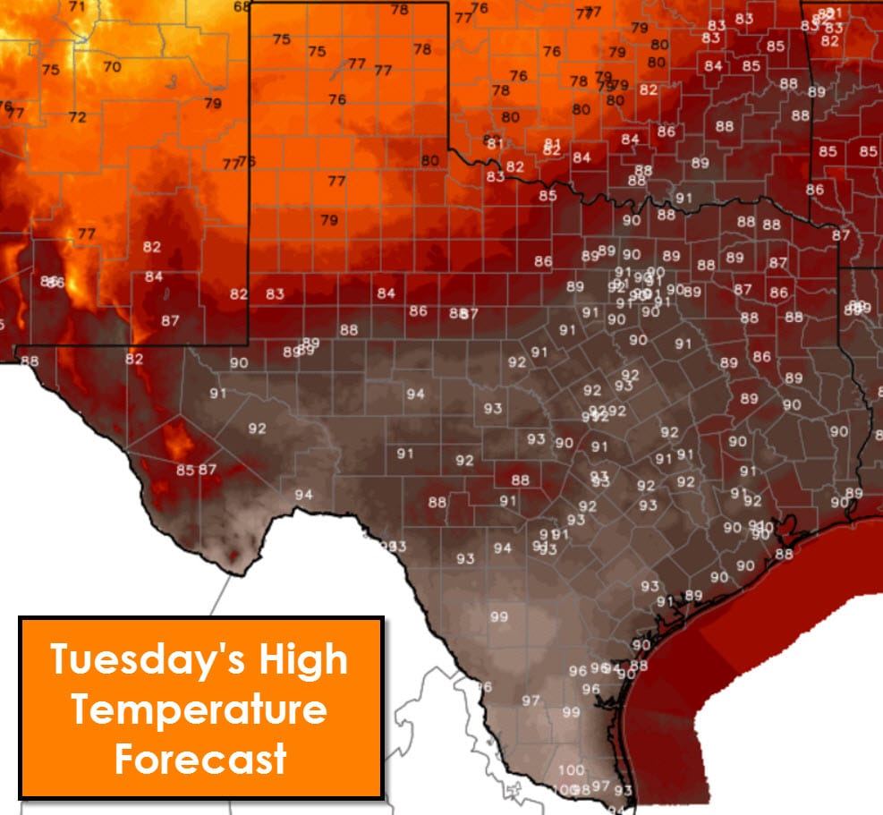
We’re starting off the morning with patchy fog thanks to the abundant moisture in place across most of the state. Any fog that has developed overnight will be outta here by 10 AM. Today’s forecast is fairly simple with a stationary cool front over West Texas and Northwest Texas. Temperatures will be 10 to 20 degrees cooler across the Texas Panhandle, West Texas, and Northwest Texas this afternoon. This front won’t bring any precipitation chances and won’t move any further south today. The remainder of Texas will remain quite warm and in a humid enviornment. Another afternoon with temperatures near record highs with lower to upper 90s. McAllen and parts of Deep South Texas are forecast to hit 100 degrees.

The stationary front won’t make much progress tomorrow morning, but a more powerful cold front pushes into the Texas Panhandle tomorrow. This front will usher in gusty north winds in its wake. The front will make good progress south into West Texas and Northwest Texas by the afternoon hours tomorrow. Scattered thunderstorms may develop by the late afternoon in proximity of the front. A few of these storms could be on the stronger side. Widespread, organized severe weather is unlikely at this time. Winds will become gusty out of the north behind the front with a noticeable drop in temperatures by tomorrow night.

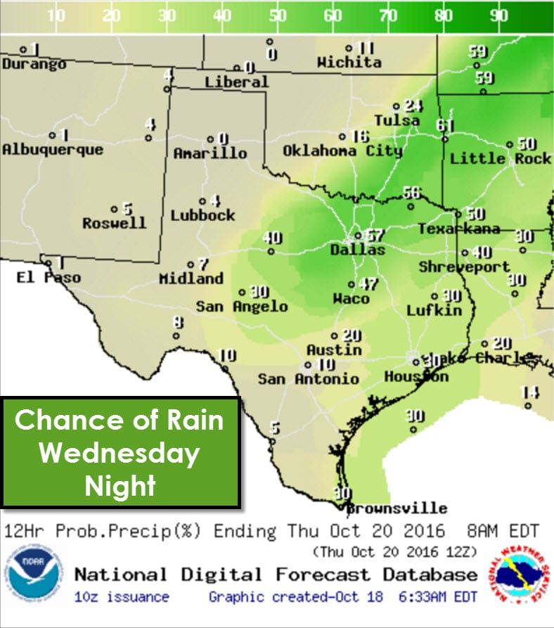
The cold front will continue to push south Wednesday Night. Scattered thunderstorms are expected along or just behind the front along the Red River, the Big Country, North Texas, and Northeast Texas. Gusty north winds are expected behind the front along with a much drier airmass. By Thursday morning the cold front should be in the Concho Valley, Hill Country, Central Texas, and the Brazos Valley.
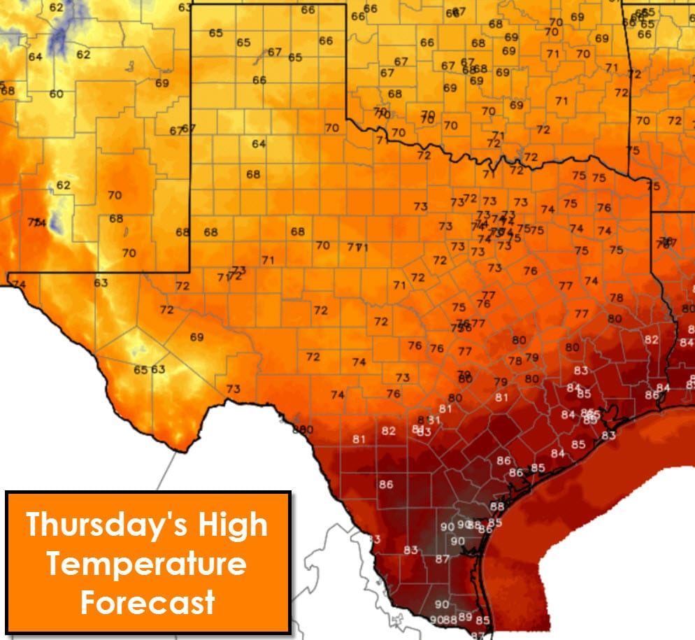
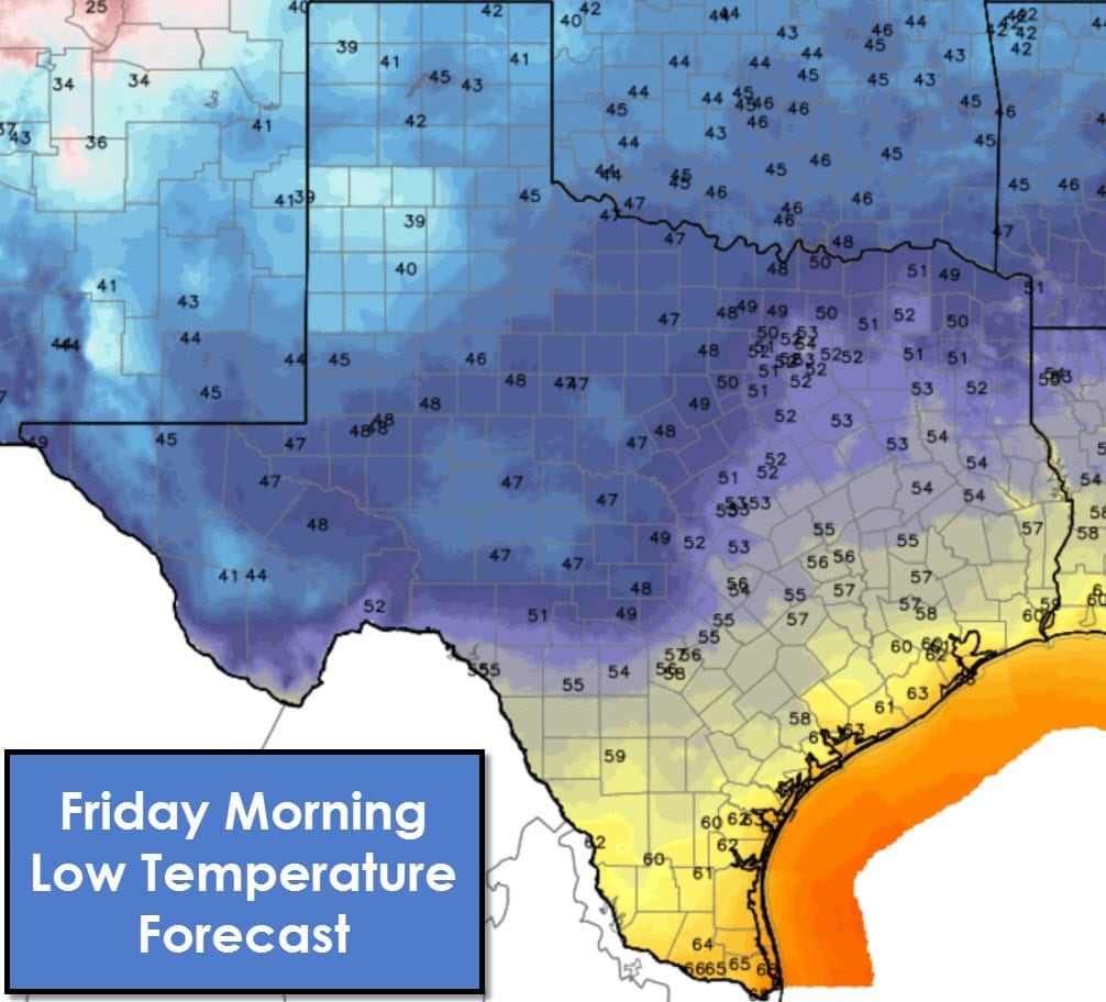
High temperatures on Thursday will be much cooler across the northern two-thirds of Texas with 60s and 70s. Winds will be out of the north. Humidity values will be much, much lower and quite comfortable. High temperatures will still be warm in Southeast Texas, South Texas, and the Rio Grande Valley. The good news is the front should continue to push south through the day Thursday. High temperatures in the 80s and 90s may occur earlier in the afternoon for some folks south of the front. Once the front passes through a given location temperatures should fall back into the 70s to lower 80s. You’ll also notice an appreciable drop in humidity.
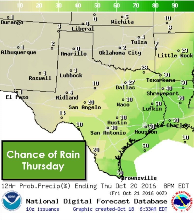
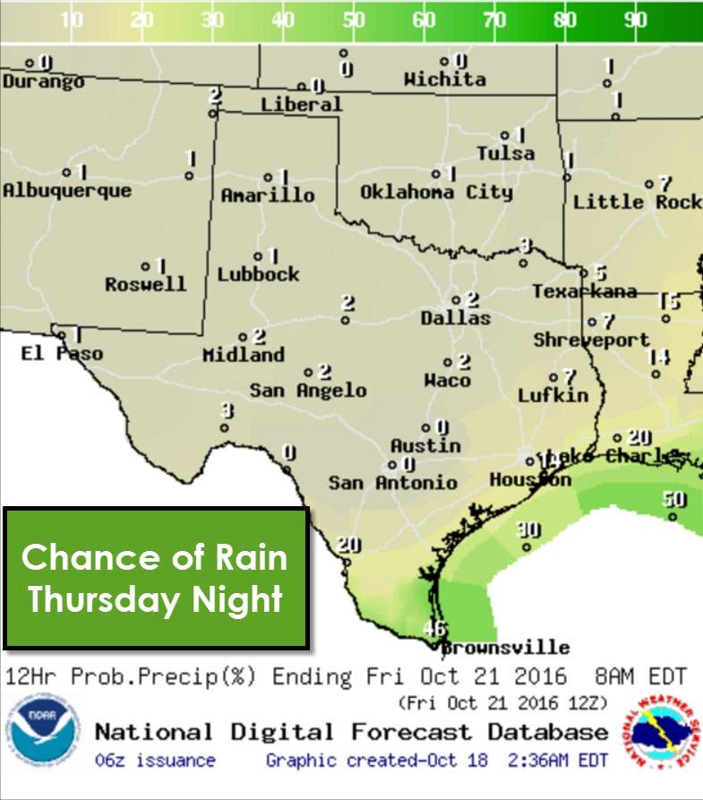
A few showers will probably occur in proximity of the front as it pushes south on Thursday. Unlike Wednesday Night the best upper level forcing will be quite displaced to the north. As such we’re not expecting anything more than a few moderate showers/storms. There will not be a solid line of storms and those who do receive rain shouldn’t get more than 0.75″.
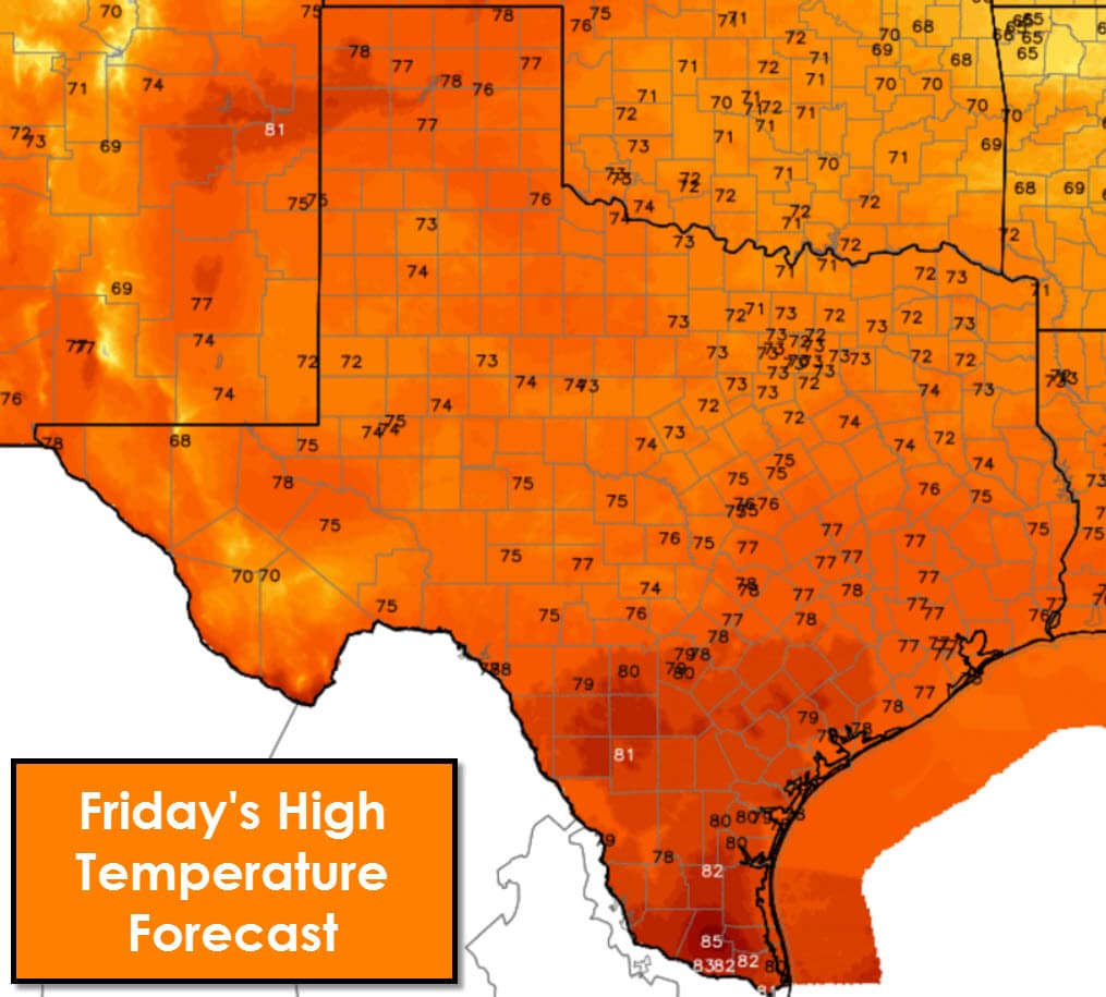
Friday will be a wonderful fall day across all of Texas. For the first time this season the cool front will make it through the entire state. Humidity values will be much lower than today by Friday in Texas. High temperatures will top out in the 70s to lower 80s. Compare that to the 90s expected today. For mid-October this weather will certainly be more appropriate!
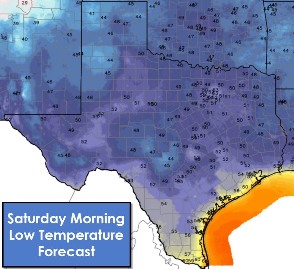
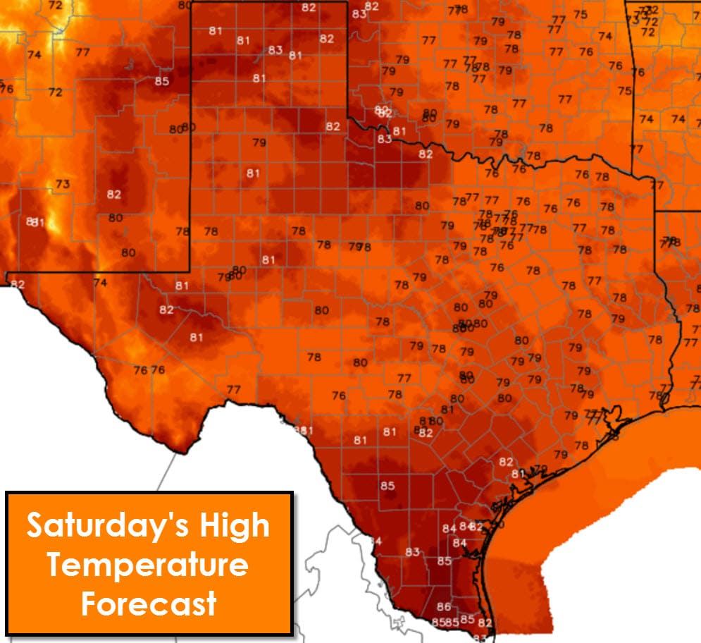
We will start a warming trend on Saturday as southerly winds return. Saturday will still be pleasant with high temperatures in the upper 70s to middle 80s. Humidity values will remain comfortable. Those higher humidity values will start to creep back north from the Gulf on Sunday into next week. Above-average temperatures return to the state for next week as a heat ridge redevelops.


0 Comments