
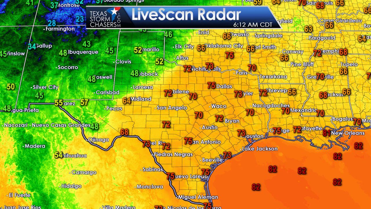
It is warm and humid across the eastern two-thirds of Texas this morning. Temperatures have only made it down into the lower to middle 70s as a very moist airmass remains in place east of a dryline. Some fog has developed in this humid airmass. That fog will burn off by 9-10 AM. West of the dryline the Texas Panhandle, West Texas, Permian Basin, and Borderland have fallen into the 40s and 50s. Personally I would rather be located where its in the 40s this morning – but at least we have relief on the way.
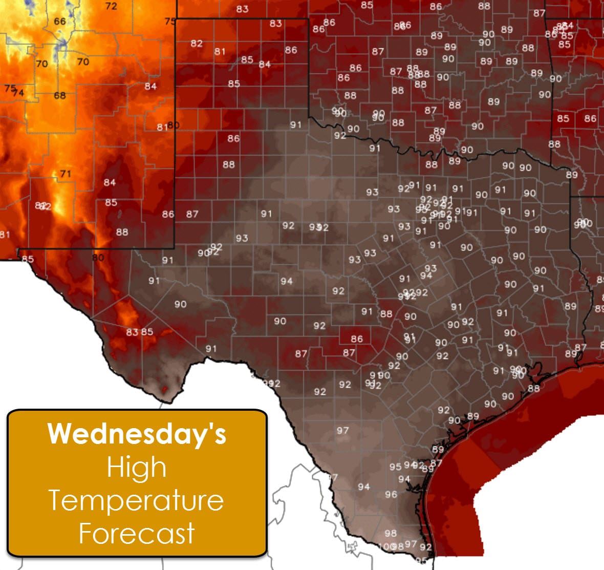
Before our relief arrives in the form of a strong cold front on Friday we have two more days of above-average temperatures. High temperatures this afternoon are going to be on the hot side for early October. The Rio Grande Valley looks to top out in the middle to upper 90s. McAllen may even hit 100°F! 90s are expected for nearly every location east of and including Northwest Texas and Permian Basin. The Texas Panhandle, West Texas, higher elevations around Alpine, and the Borderland will at least be able to say they stayed in the 80s today. The heat isn’t record breaking for early October, but its still on the hotter side. Thursday will bring similiar conditions.
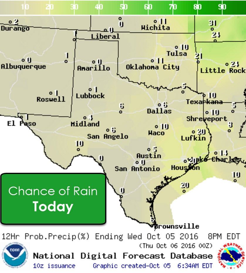
With a warm and humid airmass in place a few afternoon popup showers may occur in Southeast Texas and East Texas. Any activity that develops wouldn’t last more than 45-60 minutes and would only give a few lucky folks a quick shower. Outside of that small rain chance the remainder of Texas looks to remain warm and dry today and tonight.
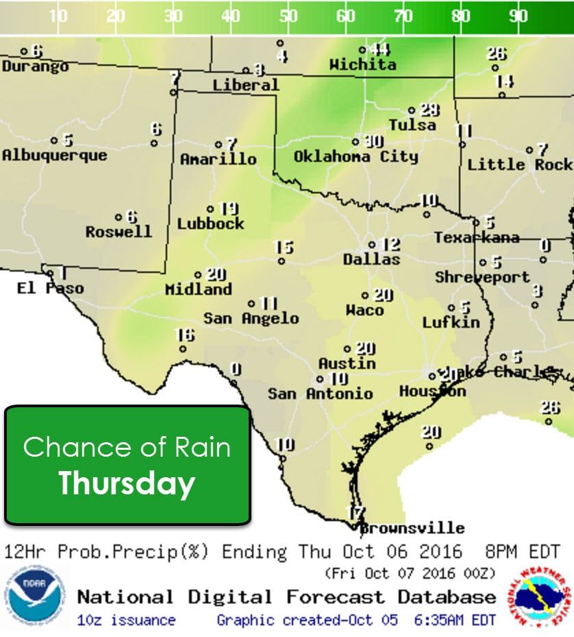
We start to see a few changes on Thursday. A strong cold front will be located over Kansas. That front is going to move south Thursday Night and Friday into and through much of Texas. Isolated thunderstorms will be possible Thursday afternoon from the Permian Basin northeast through West Texas and Northwest Texas. At this time widespread/organized thunderstorms are not expected during the day tomorrow due to a strong cap. Isolated popup showers may occur along the coast, inland along the Middle Texas Coast, into Southeast Texas, the Brazos Valley, and Central Texas. Like the potential popup showers today these won’t do too much.
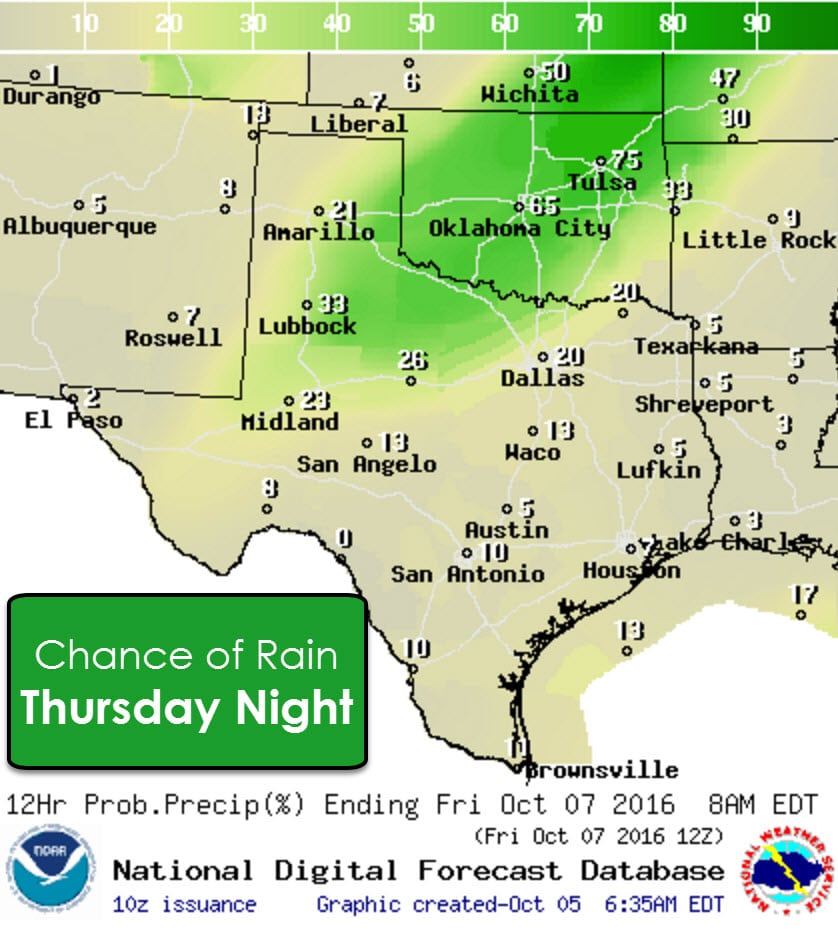
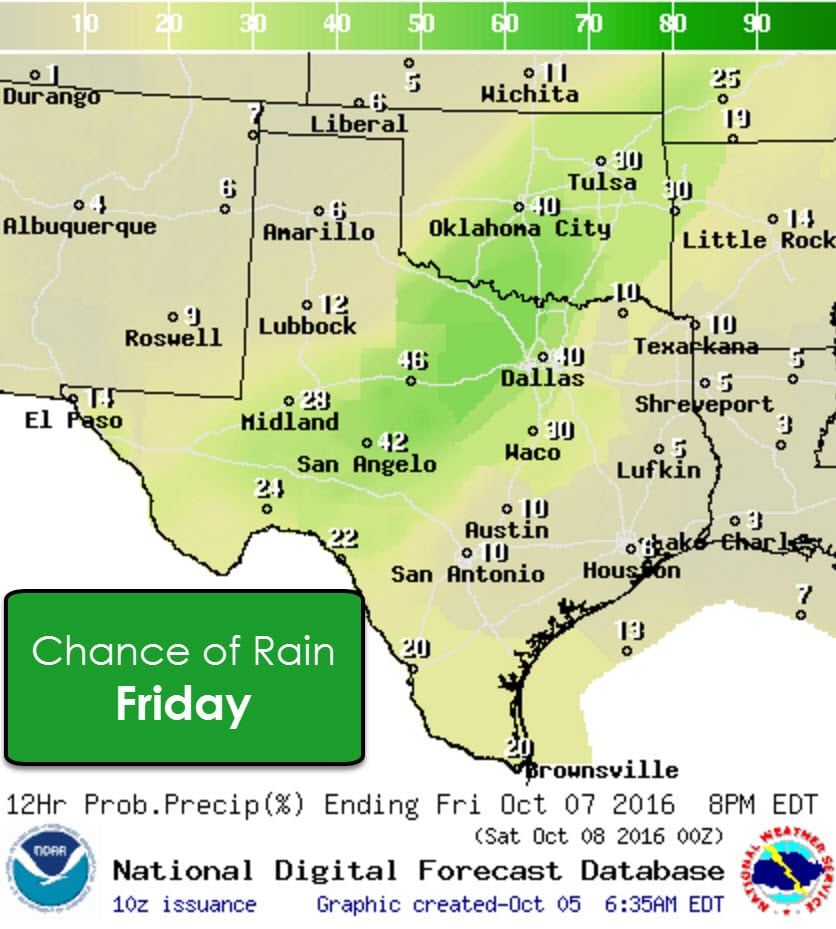
Rain chances quickly increase Thursday Night across the eastern Texas Panhandle, Northwest Texas, West-Central Texas, and northern sections of the Big Country and North Texas as the cold front pushes south. A line of thunderstorms will likely be underway as the front moves south from Oklahoma. Some of the storms in Oklahoma could be on the stronger side with gusty winds. Widespread severe weather is not expected. Present indications are that the line of storms will be weakening and diminishing in overall coverage as the cold front moves south early Friday. Rain chances drop from the likely category down to scattered south of Interstate 20 by Friday morning. It’s possible this becomes a dry frontal passage during the day Friday as most of the upper level lift will be well to our north/northeast. A few showers/storms will be possible as the front moves south on Friday.
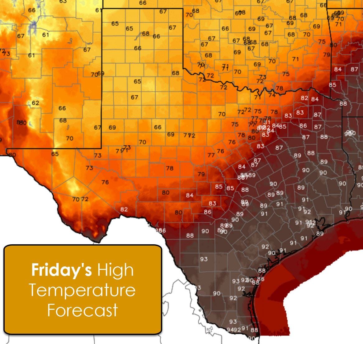
The high temperature forecast for Friday clearly reflects the cold front’s position at the onset of the day. Keep in mind that we may see some locations set their high temperatures during the late morning or early afternoon – before cooling off as the cold front arrives at a given location. Temperatures north of the front will fall into the 60s and 70s on Friday. South of the front it’ll be another hot day with upper 80s to 90s.
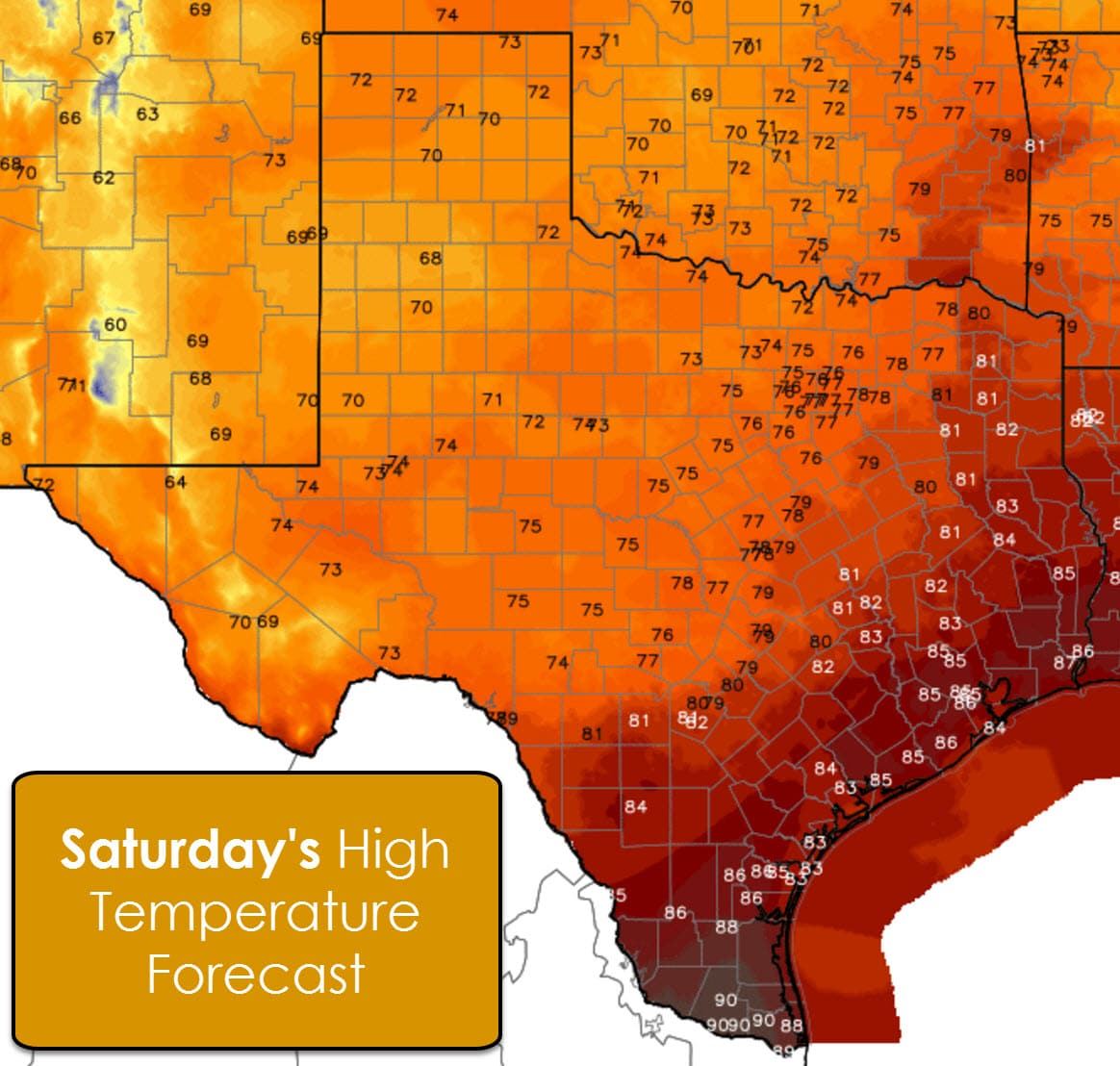
Worry not though because by Saturday the cold front will have pushed south into Deep South Texas. High temperatures north of the front on Saturday look to top out in the upper 60s, 70s, to lower 80s closer to the coast. The Rio Grande Valley, Deep South Texas, into the MIddle Texas Coast will be a tad warmer with middle to upper 80s.
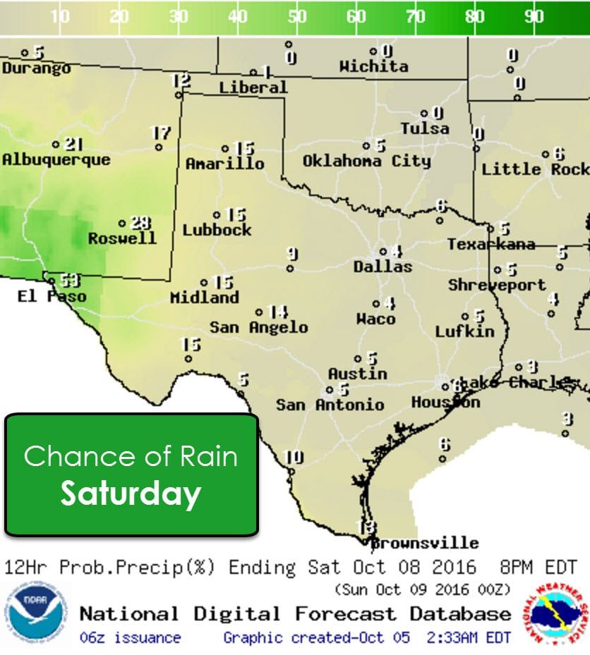
Rain chances will be slim to none across most of Texas on Saturday – with the exception of the Borderland. There we could see some scattered showers and storms. Overall its looking like a pretty great Saturday to be outdoors!
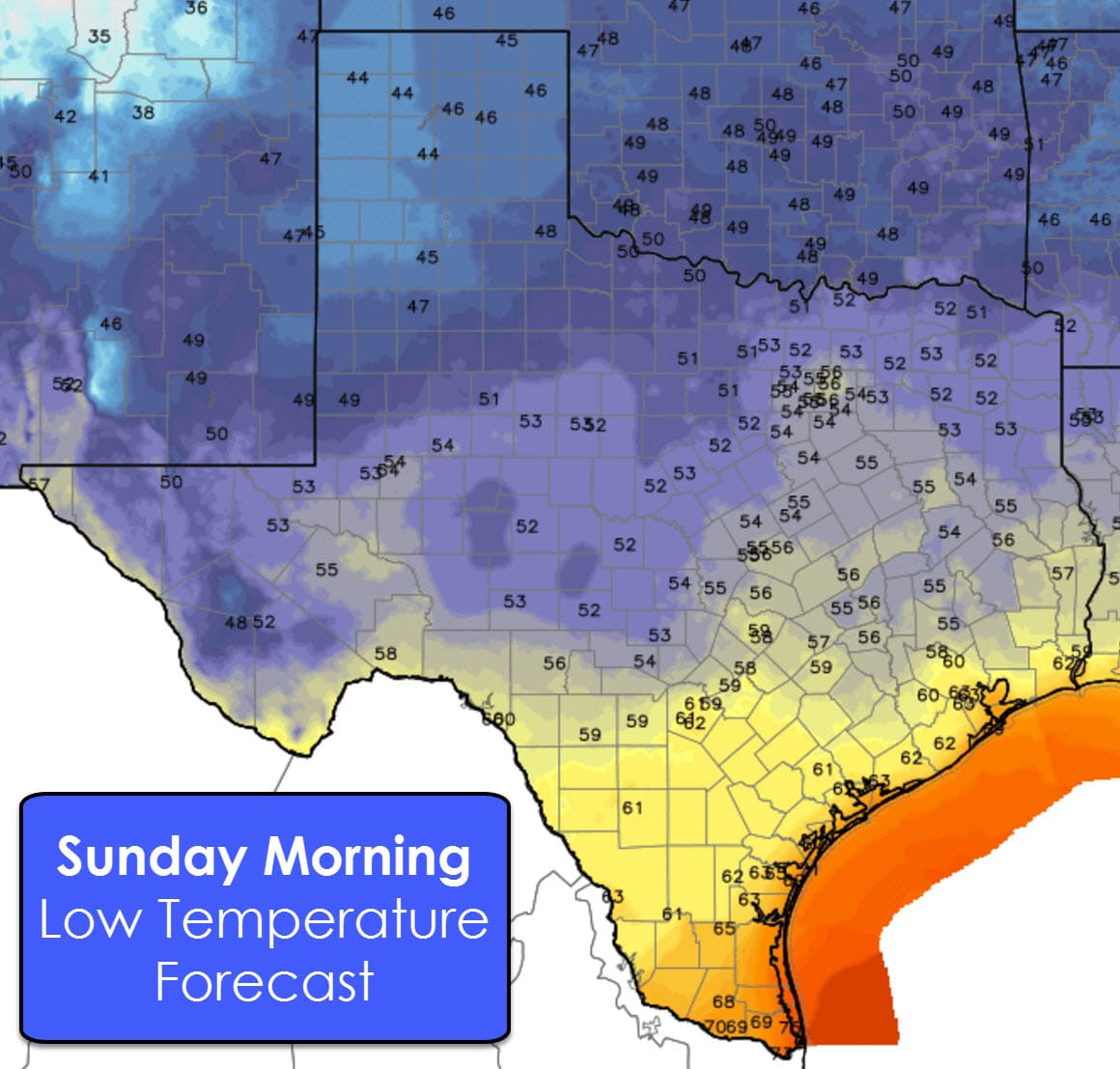
Finally I’ll leave you with the Saturday Night temperature forecast. With a dry airmass in place temperatures will fall off quickly after sunset across the state. By Sunday morning we should see most locations ranging from the 40s into the lower 60s.


0 Comments