
The story for the next three days will be the above-average temperatures. Rain chances will remain low today and on Thursday, but changes begin to arrive for Friday. We’ve had slightly drier air filter into Texas overnight. The drier air should help keep heat index values in check this afternoon. It’ll still be plenty warm with high temperatures in the 90s and heat index values near 100 degrees.
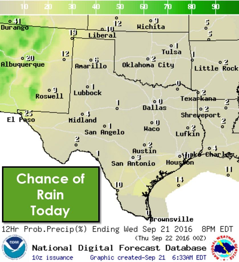
An isolated storm is possible along the coast this afternoon, but 95% of folks will remain dry today. As usual these afternoon storms are diurnally driven by peak-heating. Any storm that fires up could produce brief heavy rain, gusty winds, and lightning. Any activity that develops shouldn’t last too long and will be outta here by 7-8 PM.
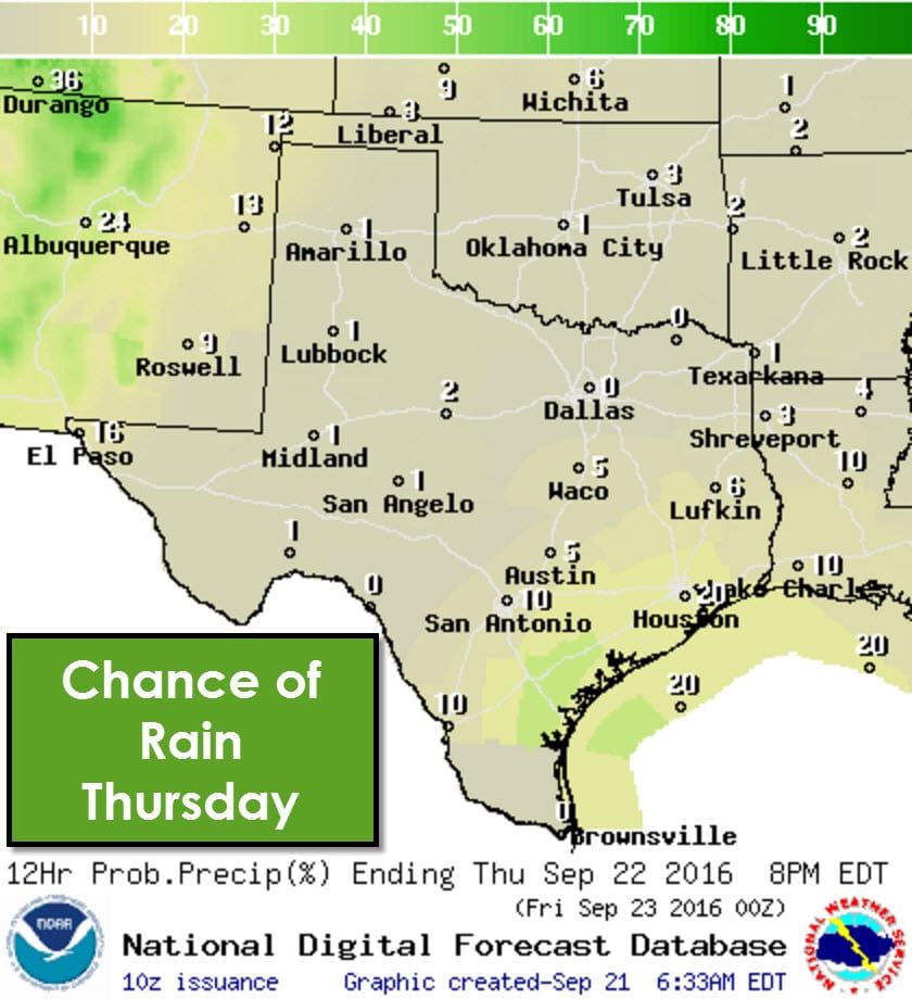
On Thursday the atmosphere will start to undergo changes as a storm system in the southwest United States starts to influence our weather. Higher moisture content will begin advecting inland from the Gulf of Mexico tonight into Thursday. The increased moisture will help spark off a few afternoon storms in Southeast Texas into the Middle Texas Coast. The chance of rain will remain below 30 percent – meaning 70 percent of folks in those two regions should remain dry. Rain chances decrease quickly with inland extent.
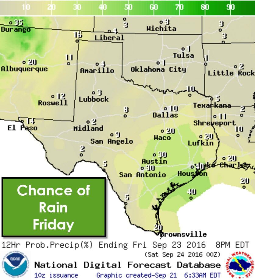
Weather changes will continue into Friday as moisture will have increased further inland by that point. Scattered afternoon thunderstorms are forecast across South-Central Texas, Central Texas, the Brazos Valley, Middle Texas Coast, and Southeast Texas. The highest coverage and number of storms will be during the mid to late afternoon hours. A few of those storms could pulse up and produce gusty winds, dangerous lightning, and heavy rain. Most storms should be on their way out of the picture by sunset. I’m optimistic that a vast majority of evening outdoor events will go on as scheduled.
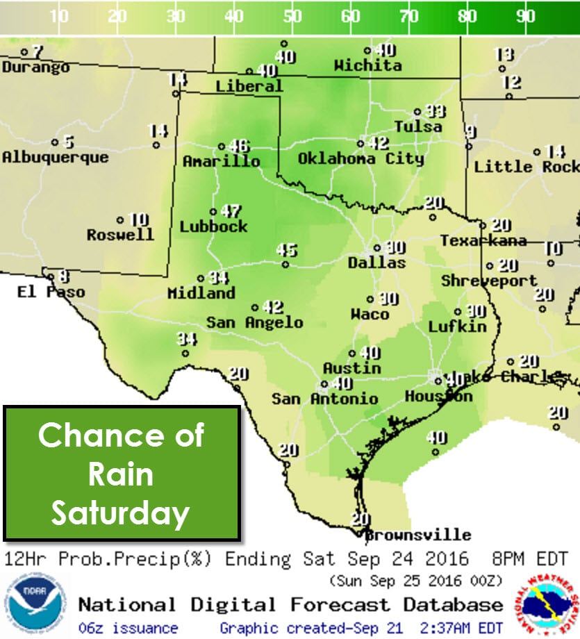
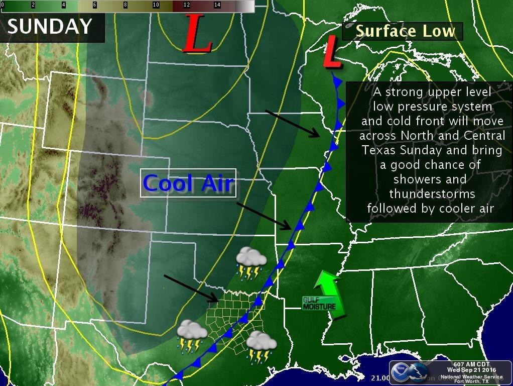
Saturday is when we finally move out of a dry, hot pattern into an active one. We’ll have varying degrees of rain chances across the state. The one region that looks to remain dry on Saturday is the Borderland. Everyone else will have the chance of isolated to scattered thunderstorms. These increased rain chances will be due to a southward moving cold front and a slow-moving upper level disturbance moving in from the Southwest United States. It won’t rain everywhere all the time, although rain chances will continue into Saturday Night. Some storms could produce heavy rain which may result in localized flooding. Widespread severe weather is not anticipated at this time.
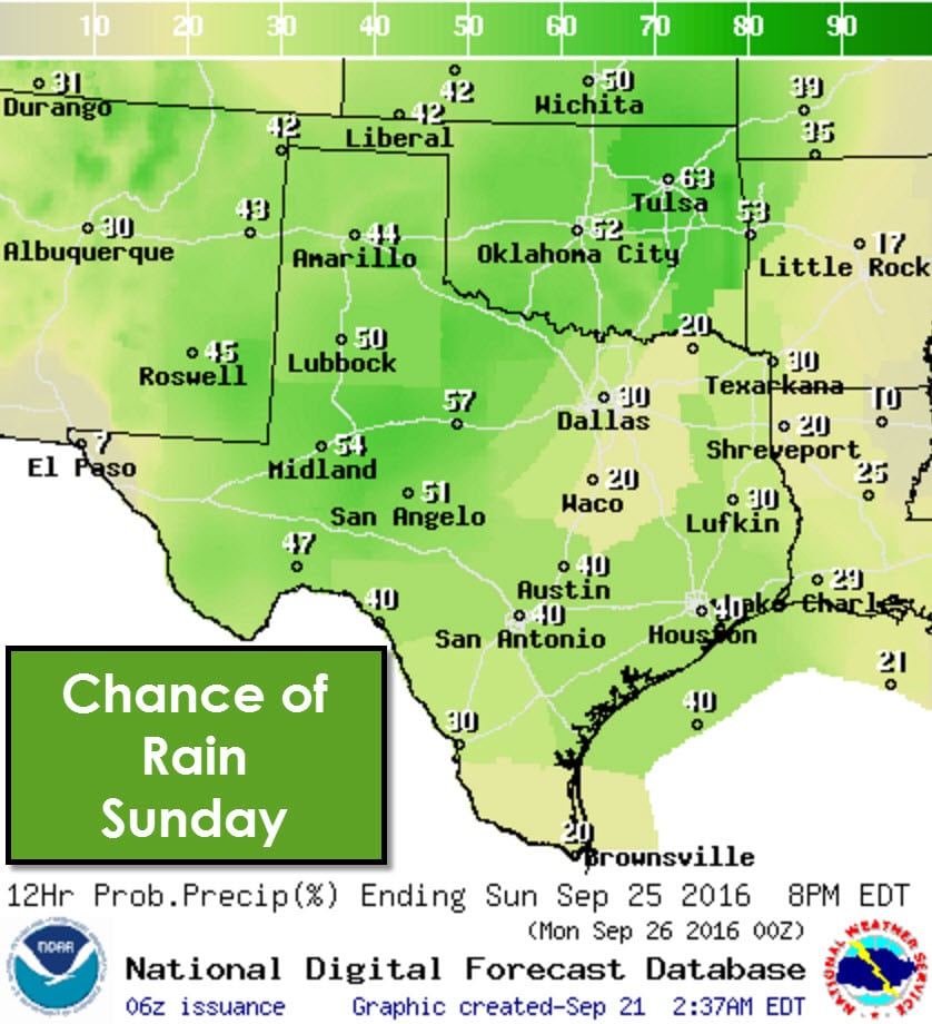
Rain chances continue on Sunday although we’ll refrain from commenting on where the highest rain chances may occur. Timing differences in the incoming upper level storm system mean we could see spatial and timing changes in future forecasts. Either way Saturday, Sunday, and even Monday are looking wet.
A cool front will move south into Texas this weekend and hopefully make decent progress south, although the storm system’s eventual strength will determine where the front sets up. Temperatures north of the front should top out in the 70s and 80s north of the front with low temperatures in the 50s and 60s. Temperatures may even end up being cooler if the front is stronger than anticipated. I’ve included a few temperature plots from the overnight run of a weather model ensemble (several models run with slightly different parameters). Don’t take these temperatures as a forecast, but they do show the overall trend for the next few days.


0 Comments