

Light showers are moving northeast from Matador east to Paducah and Guthrie in West-Central Texas. This activity is quite light and just enough to wet the ground. Other sprinkles or light showers are moving northeast in parts of the Permian Basin. Again, this activity might wet the ground but no other impacts are likely. These sprinkles may continue through the mid-morning hours. In addition, pockets of fog are possible across pretty much the entire state. Any fog will dissipate by 9-10 AM.
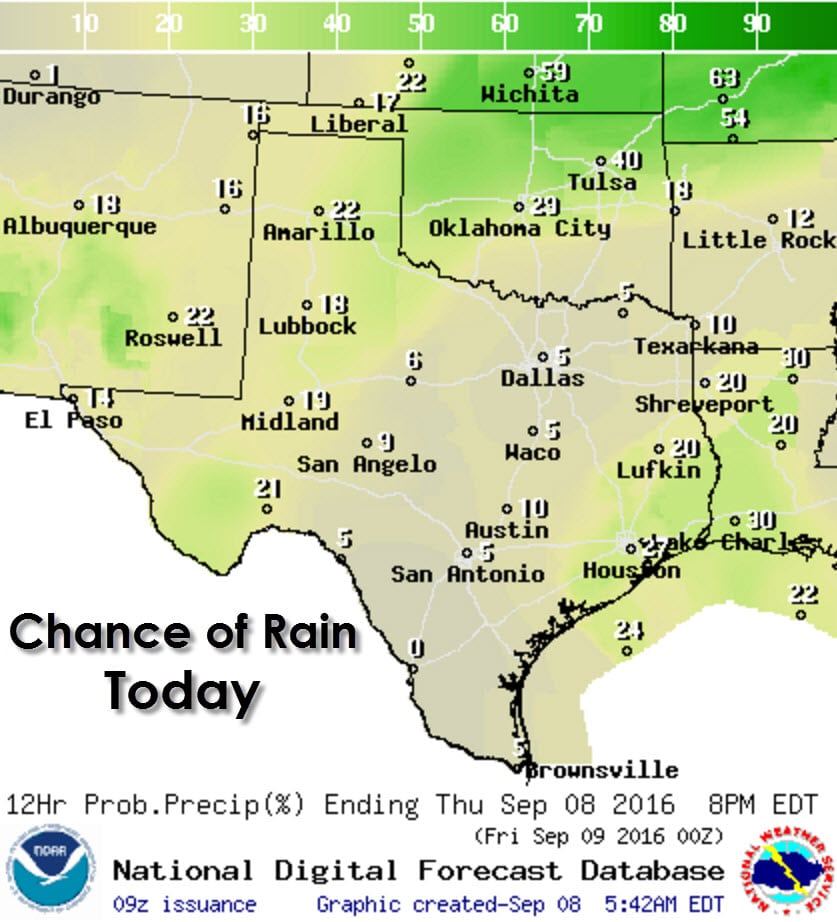
Rain chances today and tonight will be confined to Southeast Texas, and further west in the eastern Texas Panhandle, West-Central Texas, southwest into the Permian Basin. Coverage of activity today will remain on the low-side with isolated showers and storms possible this afternoon. The best chance for popup storms in Southeast Texas will be from midday through the late afternoon. A few folks will get a quick downpour and a cool-off.
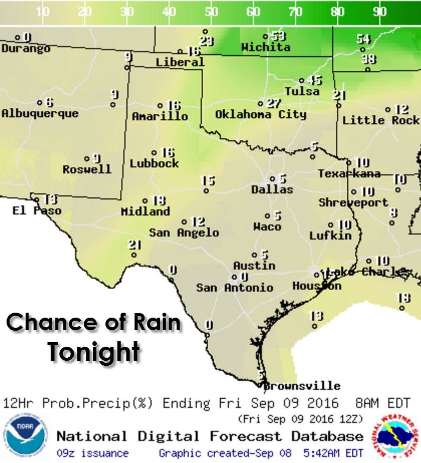
Later this afternoon and evening isolated strong storms may develop in the Oklahoma Panhandle and far Northwest Oklahoma. Some of those storms may skirt the far northeastern Texas Panhandle as they move east/southeast. Those storms may contain gusty winds and hail. As time progresses the storms may grow upscale and move east near the Kansas/Oklahoma border towards Interstate 35. Overall it looks like tonight should be fairly dry across Texas. The best chance for isolated activity will be in the eastern Texas Panhandle southeast into Northwest Texas and West-Central Texas.
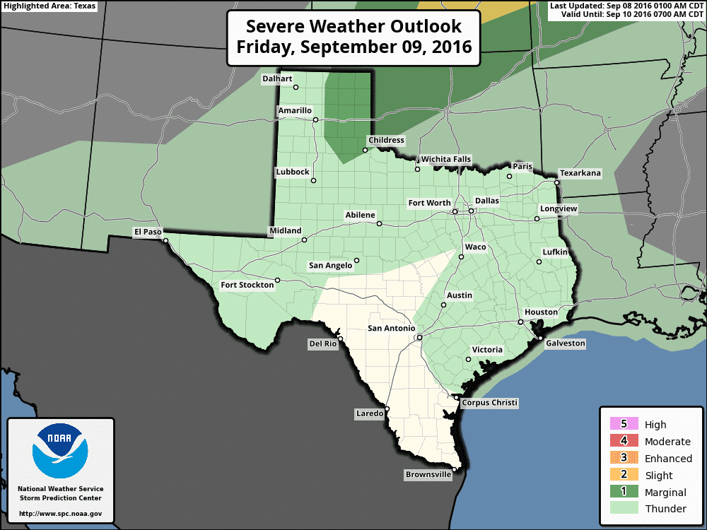
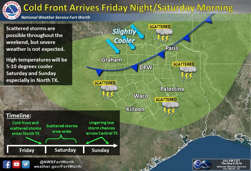
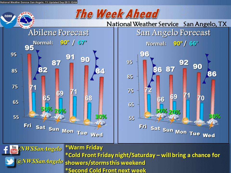
On Friday a cool front will progress to the south into the Texas Panhandle from Kansas and Oklahoma. As the front moves south a broken line of thunderstorms is expected to develop by the late afternoon hours. The Storm Prediction Center has placed the eastern half of the Texas Panhandle in a category 1 marginal risk of severe weather for tomorrow and tomorrow night. The strongest storms may produce hail up to the size of quarters and localized wind gusts over 60 MPH. The relatively higher severe weather risk will likely be further northeast in Oklahoma and Kansas. Locally heavy rain will also be possible.
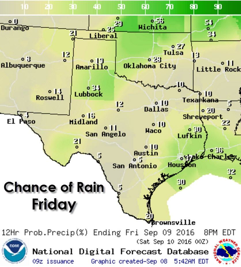
Scatterded thunderstorms will once again popup in Southeast Texas during the afternoon hours Friday. As usual the strongest activity will produce plenty of lightning and brief heavy rains. The bulk of the popup activity will be gone after 8 PM. Isolated activity will be possible in the Texas Panhandle, West Texas, and the southern half of the Permian Basin.
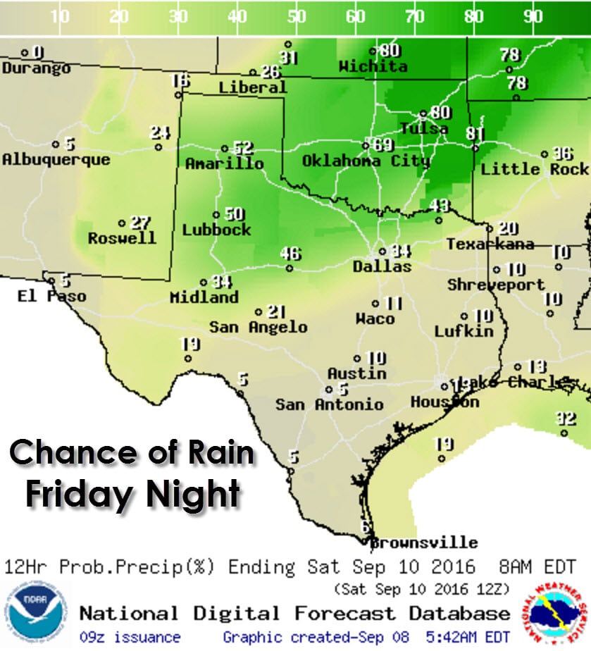
As a cool front progresses south Friday night rain chances rapidly increase across the northwestern half of Texas. A broken to solid line of thunderstorms will move south with a cool front tomorrow night. Some of the storms may be strong, but widespread severe weather is not expected at this time. Some storms may produce a quick inch of rain, but the good news is the risk of flooding should also be low.
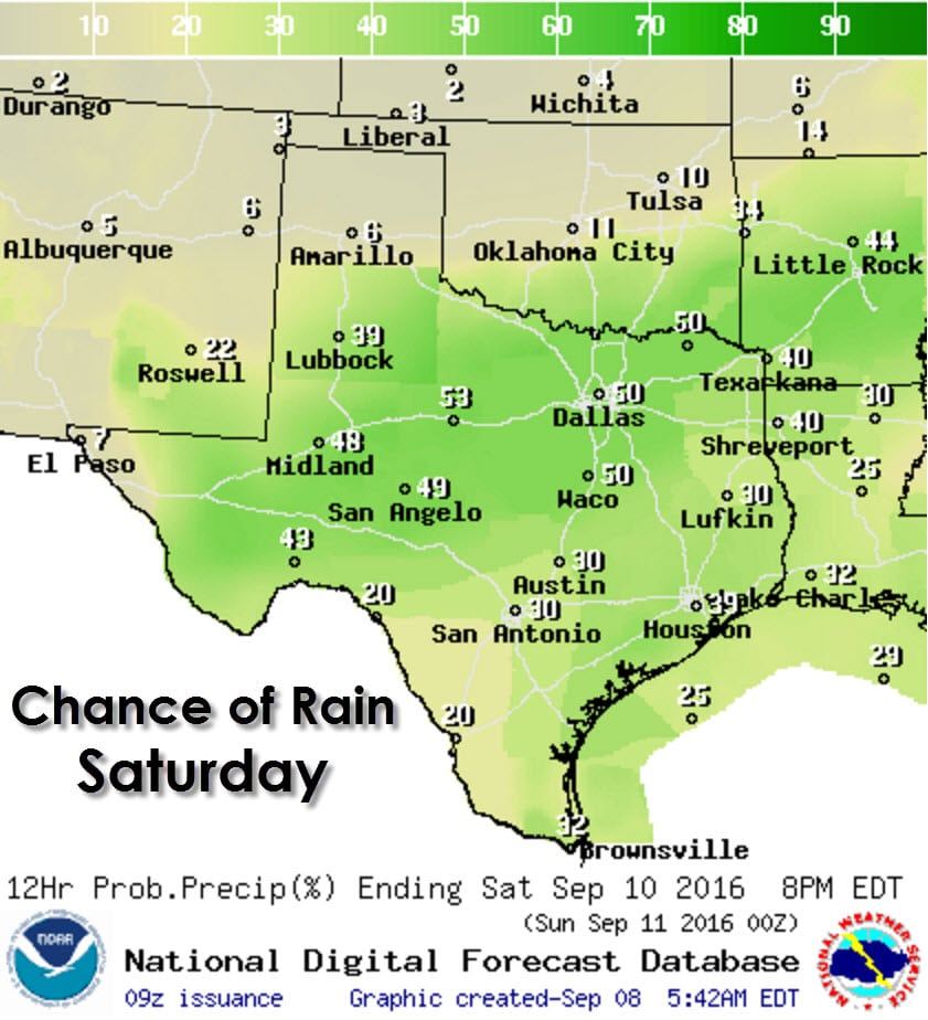
Rain chances continue to increase with southward extend on Saturday across West Texas, the Permian Basin, Big Country, Concho Valley, North Texas, Central Texas, Northeast Texas, East Texas, and Southeast Texas. Storm coverage will be highest in proximity to the slow moving to stationary front. Locally heavy rain will be possible along with a few gusty wind reports. Widespread severe weather and flash flooding is not expected, but lightning will be a danger with any storm. A wash-out isn’t expected for most locations. By the way, high temperatures behind the front should drop off into the 70s and 80s on Friday and Saturday with a noticeable drop in humidity.


0 Comments