
Showers with heavy rain are moving north across South-Central Texas this morning. These showers are moving into the San Antonio metro just in time for the morning rush hour. I’ll go ahead and apologize for those who are about to deal with rush hour headaches. The heaviest rains extend from Jourdanton to Whitsett to Pawnee. This activity is moving north towards Elmendorf and Floresville. Other showers are occuring in San Antonio and in the Middle Texas Coast. You can track the rain with our interactive weather radar here.
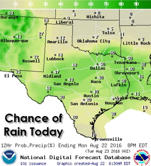
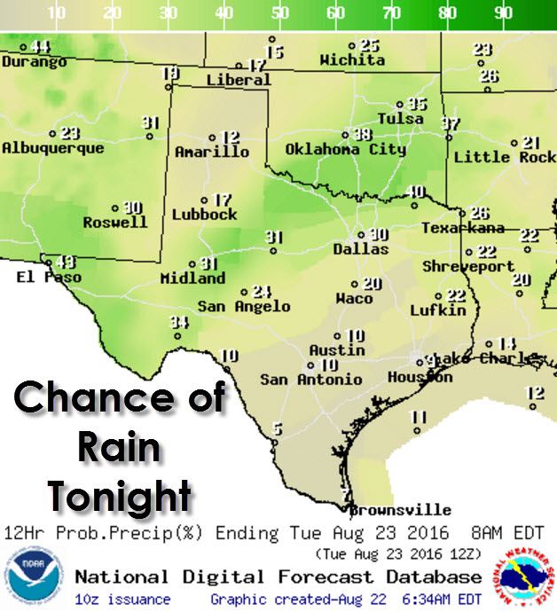
Scattered showers and thunderstorms are forecast today in Far West Texas, the Permian Basin, Big Country, Concho Valley, North Texas, Central Texas, Southeast Texas, East Texas, and Northeast Texas. Isolated storms will be possible in the South Plains, Rolling Plains, Northwest Texas, Deep South Texas, and the Rio Grande Valley.
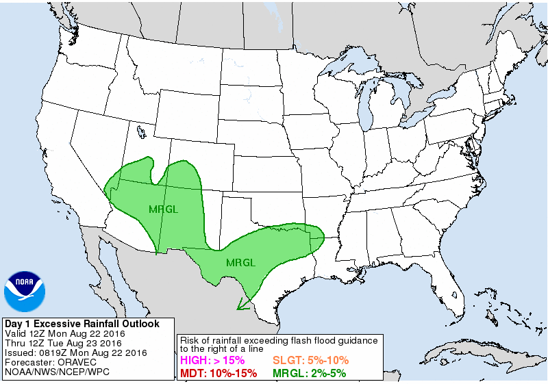
Flash Flood Outlook Today
Locally heavy rain will be possible with the stronger storms today. If these heavy rains fall over an area that has experienced flooding over the past week localized flooding will be possible. Widespread heavy rain and flash flooding is not anticipated today. Severe thunderstorms are not anticipated.
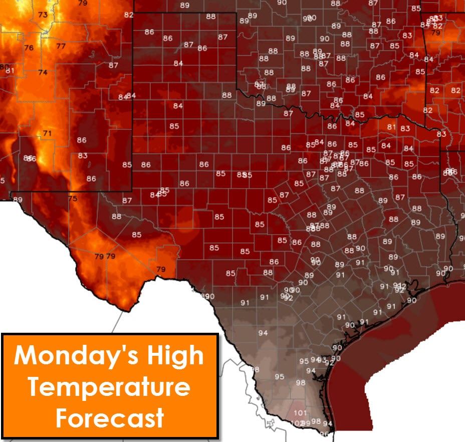
Temperatures are starting to slowly creep back up and will continue to rise this week. The Rio Grande Valley and Deep South Texas will be the hottest today with upper 90s to lower 100s. Lower 90s will be common across South-Central Texas, Southeast Texas, and into Central Texas. The remainder of the state should top out somewhere in the 80s – below average to late August.


0 Comments