
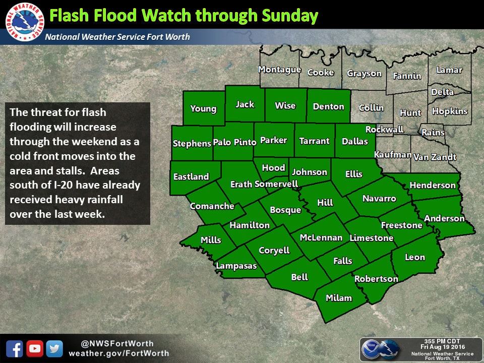
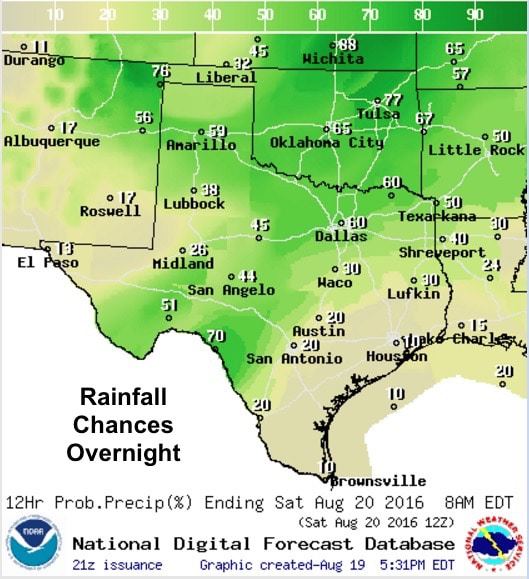
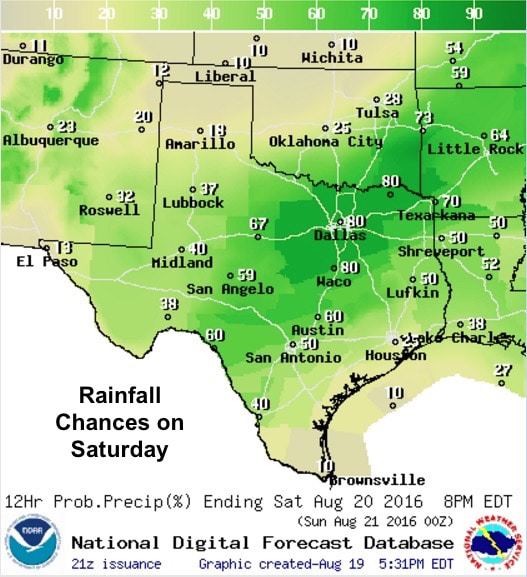
The chance for heavy rainfall and localized flash flooding issues will continue into the weekend for much of north and north central Texas. Rainfall amounts just from this afternoon across north central Texas have been prolific with some areas receiving 2 to 3+ inches since this morning. And we have more on the way! A cold front is expected to arrive by early Saturday and will stall somewhere along or just south of I-20 by late Saturday. Additional widespread showers and storms will arrive along with the front and linger across the northern half of Texas for much of the day on Saturday. Where the front eventually stalls will impact where most of the rain falls on Sunday. Flash Flood Watches remain in effect through Sunday before the heaviest rainfall is expected to move out with areas along and south of the I-20 corridor expected to be most impacted by additional rainfall as these counties have already seen several inches of rain over the past couple of days. The chance for scattered showers remains in the forecast this weekend for central and south central Texas, but rainfall amounts will be less than what is seen across northern Texas.


0 Comments