
I’ll start off with the good news about the upcoming holiday weekend. No widespread precipitation is currently in the forecast. Isolated afternoon thunderstorms will be possible in portions of the state – but nothing that would impact evening outdoor events. With that out of the way I’ll dive into the upcoming weather forecast for this weekend and Independence Day.
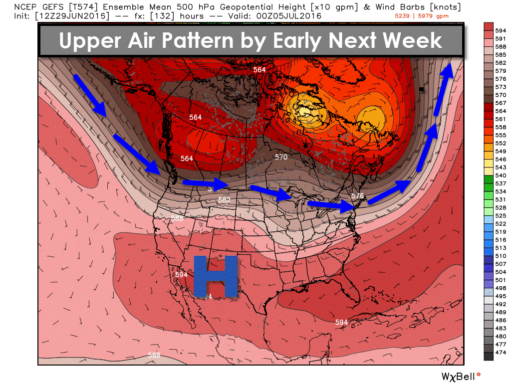
The usual area of upper level high pressure we dealt with last week has temporarily shifted west this week. The Southwest Untied States has been baking but we’ve been sligtly cooler and have had afternoon thunderstorm chances. Yesterday ended up being a fairly decent soaker for parts of Texas with numerous showers and thunderstorms. Coverage of afternoon popup storms was much lower today and will remain that way for Thursday and Friday. By the weekend the upper level high pressure will shift back east and intensify across the southern United States. High pressure results in sinking air versus rising air and an inherently lower chance for storms. The primary jetstream will be located well to our north on the Canadian border. The high pressure and sinking air also promotes more efficient heating during the day. The weekend and upcoming week’s forecast reflects an increasing temperature trend.
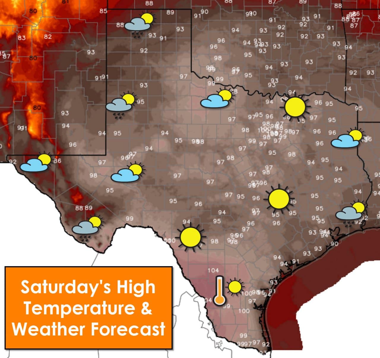
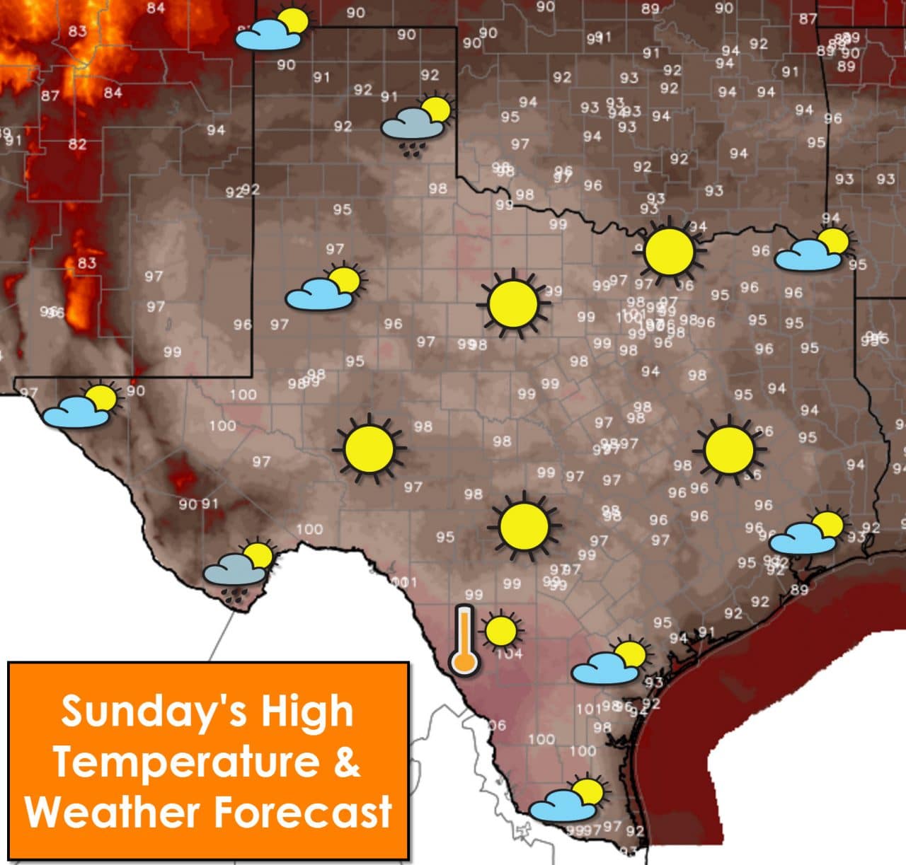
Very isolated afternoon showers are possible on Saturday and Sunday. Rain coverage is expected to remain below 20 percent at this time. That means a vast majority of folks won’t be dealing with rain this weekend. One benefit of a nearby shower would be a cool off from the heat – but even that is unlikely. High temperatures will range from the middle 90s to middle 100s (102-107°F). Heat index values along and east of Interstate 35 could exceed 105°F where humidity levels will be highest. Overnight temperatures will struggle to get below the middle 70s to lower 80s. The upward trend in temperatures this weekend extends to the overnight hours as well. With temperatures not getting as low at night those susceptible to the heat won’t get much relief.
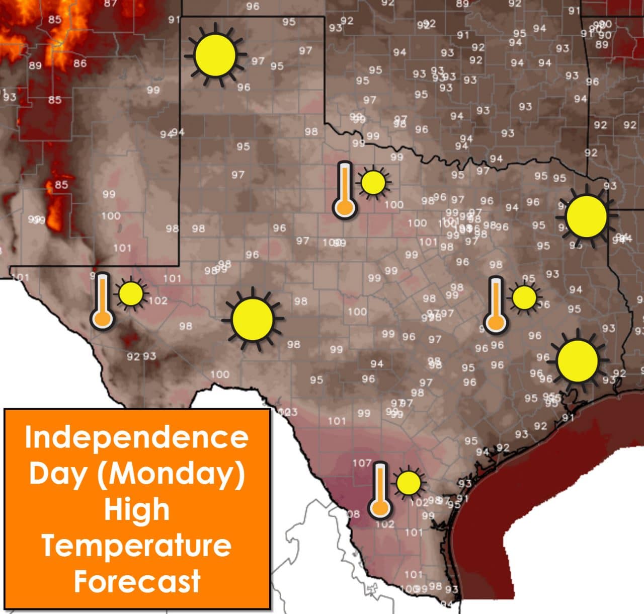
Monday, July 4, is looking mostly dry at this time with sunny skies. High temperatures will be hot with upper 90s to upper 100s (97-109°F). Heat index values could approach 107-110°F in some locations along and east of Interstate 35 where humidity values will be highest. Those attending outdoor events should plan for very hot conditions. Temperatures will drop into the 90s by sunset – still quite warm. Don’t plan on this being one of the cooler Independence Days. Heat advisories will probably be issued for portions of Texas this weekend. Some locations have not seen rain in a few weeks. With the hot temperatures surface fuels have started to dry. Please be mindful of launching fireworks near dry vegetation as the danger of grass fires is increasing – especially after all the spring growth.
I’ll leave you with several weather model projected temperature trends for the next week across Texas. Please keep in mind these numbers are generated from weather models and should not be taken as a literal, guaranteed forecast. We use these ensembles as a trending guide.


0 Comments