
The upper level low which has been responsible for all the rain and flooding issues over the past week across the state is finally beginning to drift south towards the coastal bend as a ridge of high pressure over the desert southwest begins to drift east. As a result, we’ll see the best rain chances shift south towards the coast today through Monday. This will allow areas across north and central Texas to begin drying out. While rain chances will continue for coastal areas for the next couple of days, it is not expected to be nearly as heavy or widespread after today…mainly scattered showers developing along the seabreeze front each afternoon, then retreating offshore during the night. This is also good news for residents along the coast who will finally get to see a decent drying out period by Tuesday/Wednesday. The ridge of high pressure to our west will build over the state by mid-week and we’ll see dry conditions for most areas and increasing daily highs through the work week, especially across the western half of the state. The western half of the state will likely see daily chances of scattered storms moving east from the eastern New Mexico plains each afternoon next week, but this is not expected to be a high impact rain or storm event. The ridge of high pressure won’t hang around too long though, and we may be seeing an uptick in rain and storm chances further east across the state again by next weekend. That’s the overall forecast outlook in a nutshell!
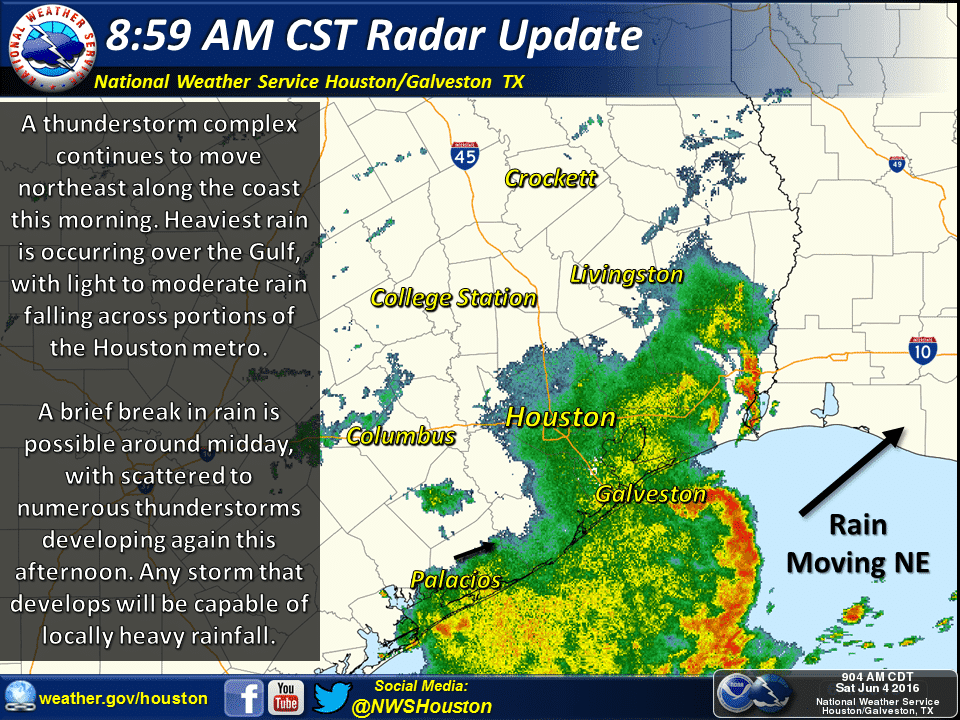
At this time, the area of heaviest rain continues just off the southeast Texas coast with only light to moderate rain across inland areas. This complex of storms will continue to move northeast along the coast this morning. Southeast Texas may see a lull in activity later this morning, then as we reach peak daytime heating, we will likely see scattered to numerous thunderstorms develop which will bring a threat of localized heavy downpours, lightning and gusty winds. Scattered showers and thunderstorms are also possible across west, central, north and east Texas this afternoon as well…though coverage will be more widespread than further south. Widespread severe weather is not expected with any of the activity developing today. 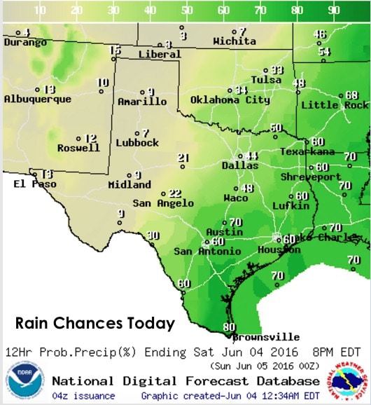
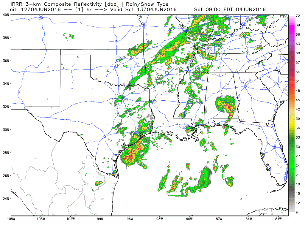
Animated simulated radar forecast between now and around 10pm this evening.


0 Comments