
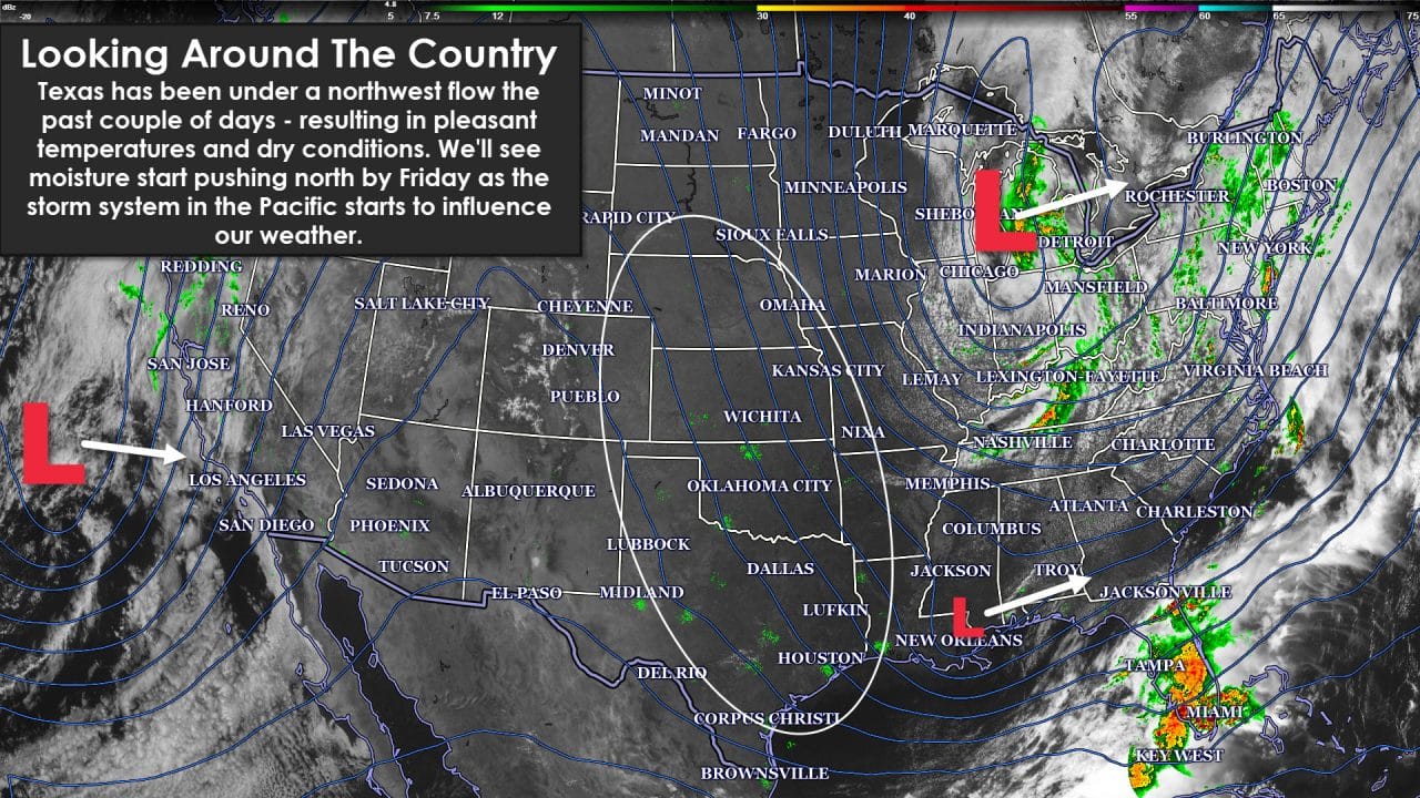
The first four days of May have come in like a lamb across the Southern Plains of the United States. I’ve been reliving major tornado outbreaks the past couple of days while enjoying clear skies and temperatures in the 60s and 70s. As a storm chaser its nice to have a little downtime after a busy end to April. As a resident its also nice not having to worry if my apartment would still be where I left it before a chase. As usual for May the quiet weather won’t last and we’ll undoubtedly have a little payback from Mother Nature. The eastern United States has been dealing with severe weather since Sunday with plenty of hail, wind damage, and a couple spin up tornadoes. Today folks in southern Florida are dealing with a threat of severe storms along with widespread rain. Meanwhile our state is clear with temperatures in the 70s to lower 80s just after lunch. We note that a strong storm system is heading towards the California coast. It’ll make landfall later tonight into Thursday. That storm system will bring a return of more active weather to western sections of Texas by Saturday. That storm risk will spread east on Sunday towards Interstate 35 with continued storm chances into next week. I’ll say now that the skill in forecasting specific severe weather threats five days out is very small. We’re not dealing with a synoptically evident event where a high-end severe weather risk is expected a long ways out. Its May and we deal with severe storms. Lets chat about the upcoming weather shift.
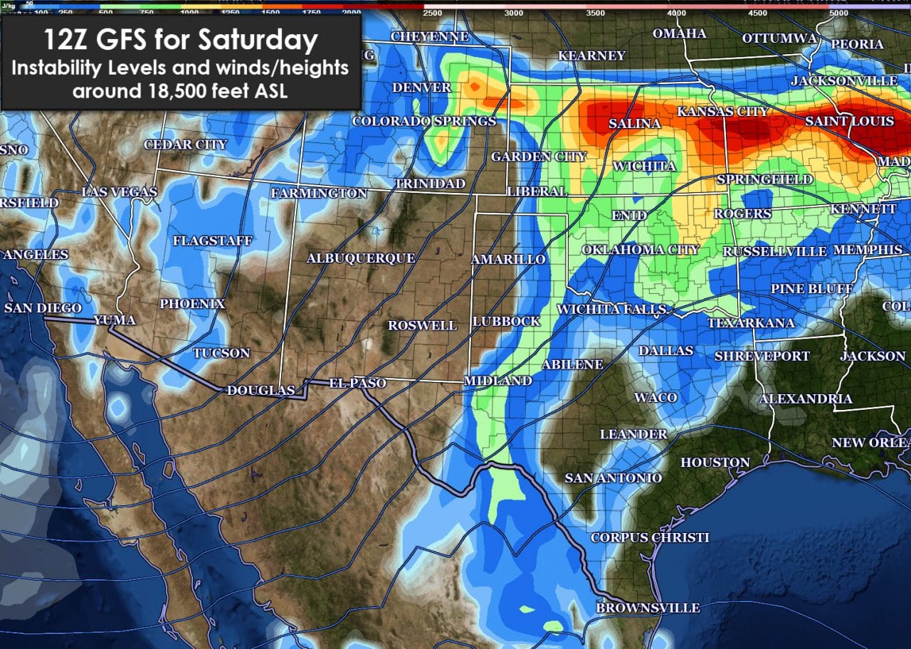
The Storm Prediction Center has highlighted Saturday and Sunday for possible severe thunderstorms. I wouldn’t be surprised to see them add Monday and Tuesday of next week to the risk maps as we get closer. For Saturday we’ll be watching the Texas Panhandle, South Plains, and Permian Basin as a dryline sets up near the TX/NM border. Moisture return will have begun in earnest on Friday with dewpoints in the 40s to lower 50s possible. Those dewpoint levels are fairly marginal but with the higher terrain could be enough for a few high-based supercells with large hail and damaging wind gusts. The tornado threat, if any, will depend on mesoscale factors and pockets of higher moisture. I really don’t see Saturday being a big tornado day but as always we’ll watch it.

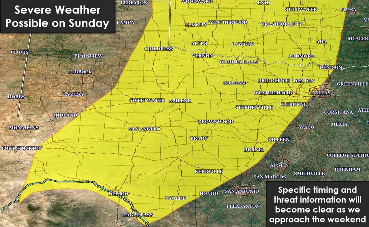
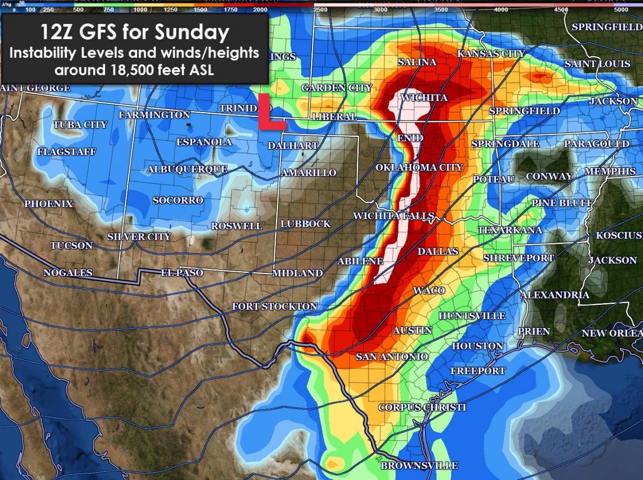
The severe weather risk on Sunday greatly expands in aerial coverage to include the eastern Texas Panhandle, Northwest Texas, Texoma, North Texas, the Big Country, Concho Valley, Hill Country, and Southwest Texas. That’s a large area under a severe weather risk on Sunday but not everyone will see storms or severe weather. With a lot of time between now and Sunday there will undoubtedly be refinements to the forecast. Compared to Saturday we should have dewpoints up into the 60s across the risk area. The dryline will be further east as an upper level storm system makes a closer approach from the west. If we were going to have more significant severe weather issues Sunday would probably be the day to watch. All we can do is watch data and wait to see how things set up. Don’t be surprised if the risk areas change as we get closer.
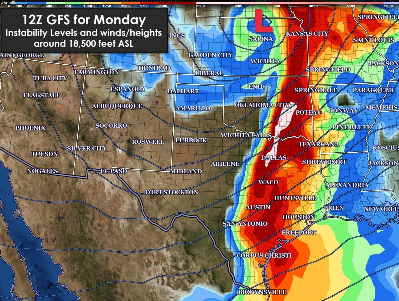
Monday is not highlighted in any risk outlooks at this time but could certainly bring a threat of storms to the I-35 corridor and Northeast and East Texas. Some storms may be severe. The previous two days will largely dictate how Monday sets up. This is May and storms are to be expected. Saturday should be good for most folks except up in the Panhandle and West Texas. Sunday will be muggier and with a increase in storms across more sections of Texas. Monday could be an I-35 and points east day as the dryline surges east. Take time while the weather is nice to review your severe weather safety plans.


0 Comments