
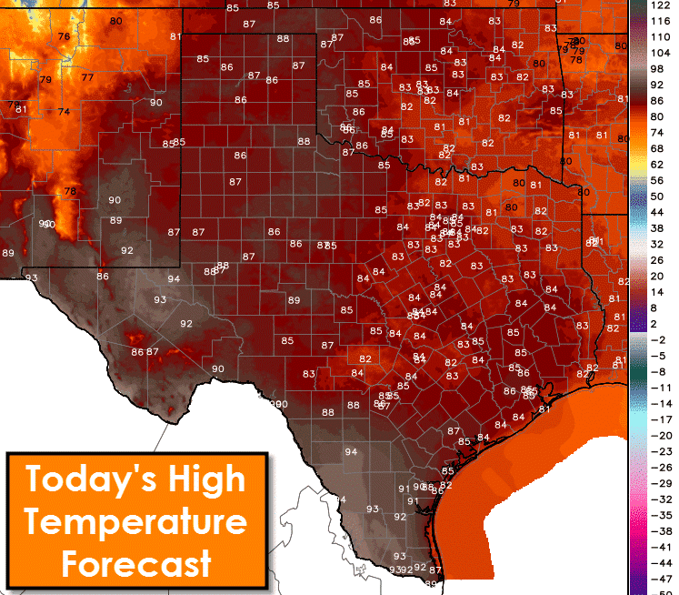
We have one more day of relatively quiet weather before thunderstorms return to the state in afternoon waves. For today though we don’t expect hazardous weather issues. Temperatures will be quite warm but nothing too unusual for May. The warmest regions this afternoon will be the Permian Basin, Far West Texas, South Texas, and the Rio Grande Valley. High temperatures in those areas will top out in the low to middle 90s. I wouldn’t be too surprised to see heat index values top out in the upper 90s in the Rio Grande Valley where moisture levels will be higher. Upper 80s are expected across the Texas Panhandle, West Texas, Northwest Texas, the Big Country, and the Concho Valley. Low to middle 80s are forecast across North Texas, Central Texas, the Hill Country, the Brazos Valley, Northeast Texas, East Texas, Southeast Texas, and the Coastal Plains. Southwest winds will become gusty up to 30 MPH across the Panhandle, West Texas, Permian Basin, and Far West Texas this afternoon. Some blowing dust could become a minor nuisance – especially near plowed fields.
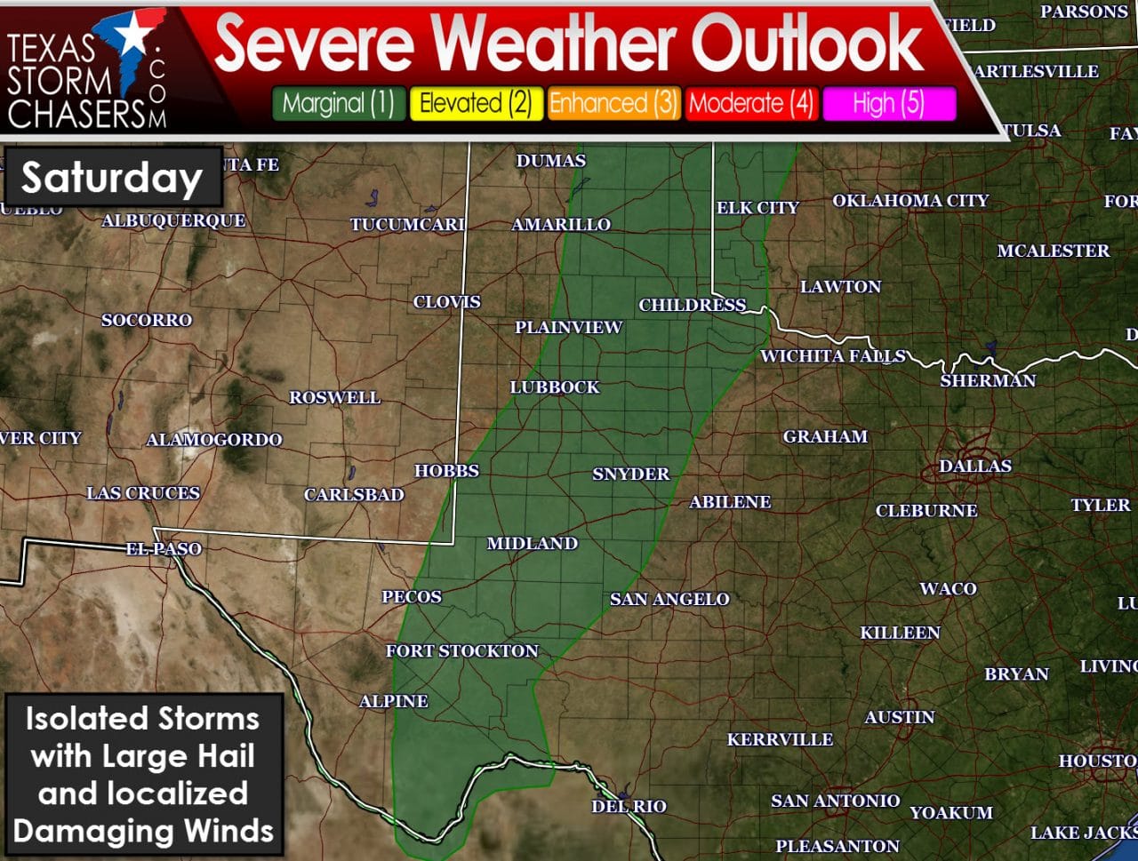
Our first chance for isolated severe thunderstorms will be Saturday afternoon. The Storm Prediction Center has highlighted a category 1 (marginal risk) of severe weather across the eastern Texas Panhandle, the Rolling Plains, the Caprock, south into West-Central Texas and the Permian Basin. A category 1 risk is the lowest on a scale from 1 to 5. It does not necessarily mean severe weather is unlikely – rather the chance of being impacted by a severe storm is low. Overall coverage of storms tomorrow will likely be isolated with perhaps only 2 or 3 storms across the entire risk area in Texas. Those storms that do develop will do so in an enviornment favorable for high-based supercells capable of producing large hail and localized damaging wind gusts.
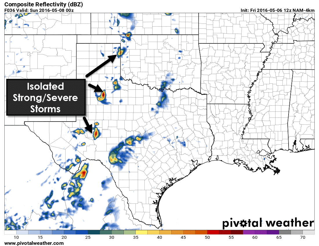
The 12Z morning run of the high resolution North American Model (NAM) shows tomorrow’s storm possibilities fairly well. A few storms will probably be underway by the late afternoon hours tomorrow east of the dryline. The strongest storms could produce hail up to the size of golfballs and localized damaging wind gusts of 50 to 65 MPH. The threat for a brief tornado is very low due to high cloud bases and marginal low-level moisture content. Storms should weaken a few hours after sunset as storms run into a stronger cap.
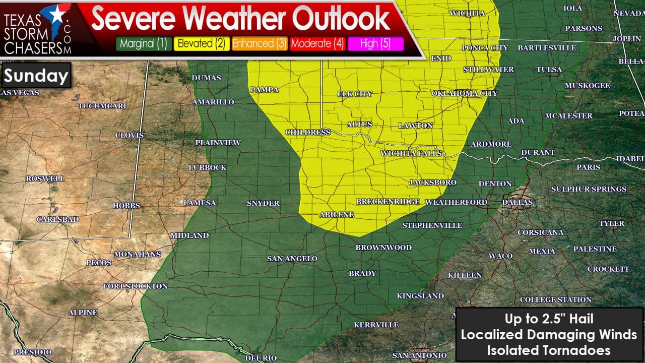
Things start to become a bit more interesting on Sunday as ingredients come together to support a higher possibility of severe weather. The Storm Prediction Center has placed the eastern Texas Panhandle, Northwest Texas, and the Big Country in a category 2 risk of severe weather. A category 2 risk is the standard risk level for most severe weather chances. A category 1 risk of severe weather includes the western half of North Texas, the Hill Country, Concho Valley, West-Central Texas, Rolling Plains, and the central Texas Panhandle. Severe weather hazards won’t differ between the category 1 or category 2 risk areas rather storm coverage will be higher in the category 2 risk area. By early afternoon Sunday the dryline will likely be set up across the eastern Texas Panhandle into Northwest Texas and the Big Country. As the cap weakens we should start to see isolated to widely scattered storms fire up by the mid-afternoon hours. The strongest storms could become supercellular with an unstable airmass and strong wind shear expected to be in place. Very large hail up to the size of tennis-balls and localized damaging wind gusts over 70 MPH will be possible with the strongest storms. Depending on how the overall setup evolves by Sunday there could be a threat of a couple tornadoes. Storms will move east/northeast into the early evening hours. By the evening hours storms may congeal into one or two clusters of squall lines with a threat of hail and damaging wind gusts as they move east. The overnight storm potential is one we’ll have to refine tomorrow once we get into range of higher-resolution weather model guidance.
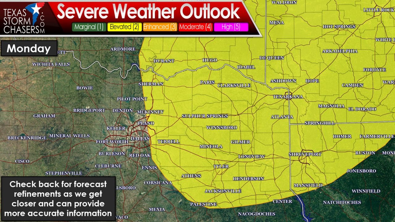
On Monday the Storm Prediction Center has placed Northeast Texas in a risk of severe thunderstorms. We’ll probably see storms fire up by early Monday afternoon as the dryline surges towards Interstate 35. Assuming the usual trend continues to hold true the dryline may end up 30-50 miles west of I-35/I-35W. That would require an extension of the severe weather risk into more of North Texas including the D/FW Metroplex. The strongest storms could produce large hail, damaging winds, and isolated tornadoes. Beyond that we’re too far out to provide an accurate forecast. Whatever happens on Sunday will help influence the setup for Monday.


0 Comments