
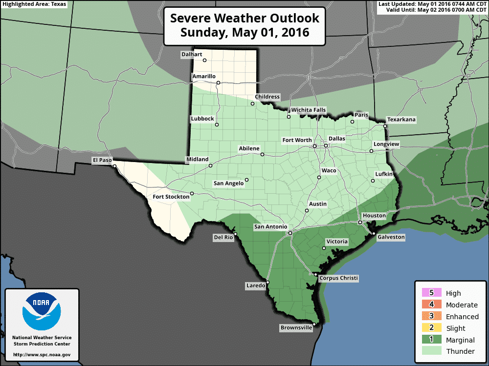
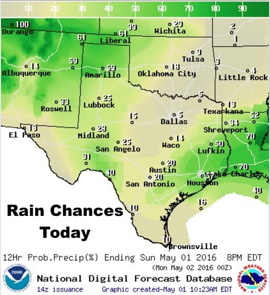
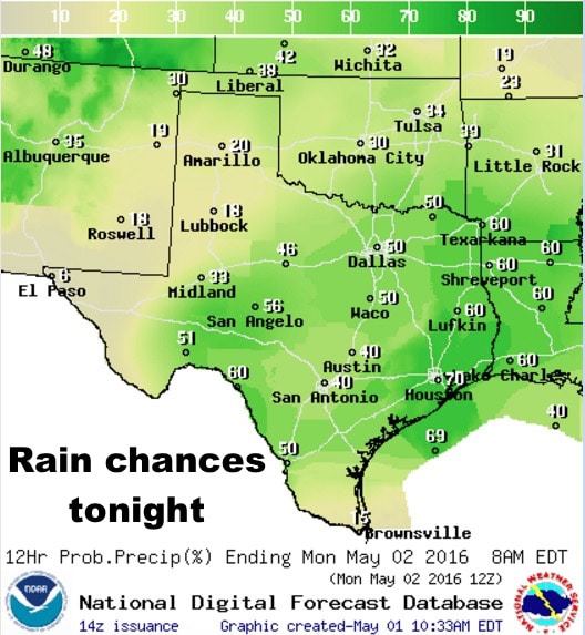
Cooler and drier air continues to filter in behind Friday’s cold front which is currently stalled out from about Texarkana towards Victoria and then west towards Del Rio. Areas near and south of the stalled front have the best chances for seeing storm development this afternoon during peak daytime heating with hail and wind being the primary threats. Most of the short-range models are generating the bulk of storms this afternoon from along the coastal bend up into southeast Texas, with another pocket of storm development out west in the Del Rio vicinity. A weak-ish upper level disturbance arrives from the west later this evening which will increase the chance for seeing more widespread rain and thunderstorm development overnight from deep south Texas all the way across central and north central Texas during the overnight hours. Storms that develop tonight across deep south Texas ahead of the cold front will have the best chance at becoming surface-based with the threat of large hail and perhaps an isolated tornadoes. The overall risk for tornadoes across the region covered by the “Marginal Risk” below is low, but is not zero. Further north across central and north central Texas and over into the rolling plains region, any storms that develop tonight are expected to be elevated in nature with just a lightning and gusty wind threat.
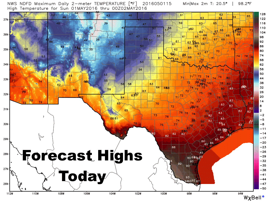
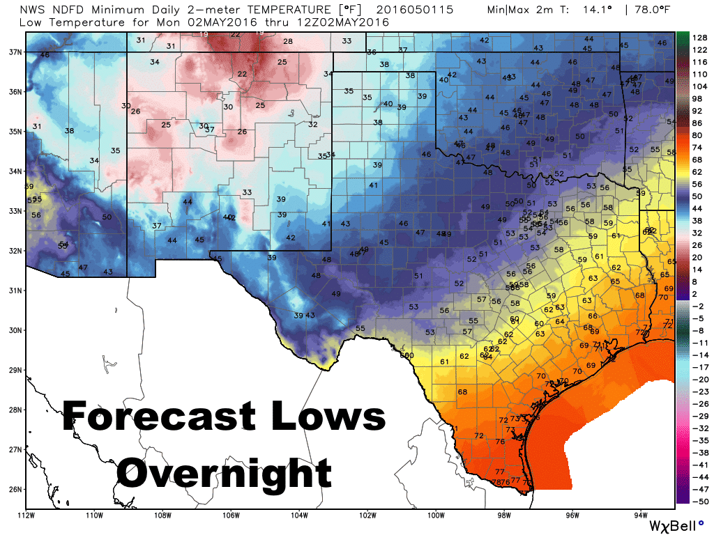
Forecast highs today, and the forecast lows expected overnight, reveal that we have pretty much the entire seasonal spectrum going on across our state once again. We are so special! Highs today will struggle to get into the 50s across the panhandle. Meanwhile down in deep south Texas, conditions will be quite muggy and warm with highs in the low 90s. Folks in north and central Texas will luck out with very pleasant highs in the mid to upper 70s. Lows tonight, quite chilly and in the mid 30s to low 40s across the panhandle, with much more mild and pleasant 50s and 60s across north and central Texas. Deep south and coastal regions will see lows only drop int0 the upper 60s to mid 70s overnight.
After tonight’s round of rainfall exits the state by Monday afternoon, we’ll be in for a more prolonged dry period with high pressure building over the state for much of the work week. It looks like we’ll remain dry until we get closer to the weekend and the arrival of our next upper level system which may generate storm chances across the western half of the state by next weekend. Still too early to be certain on any of the details, but we’ll be watching that threat closely later this week.


0 Comments