
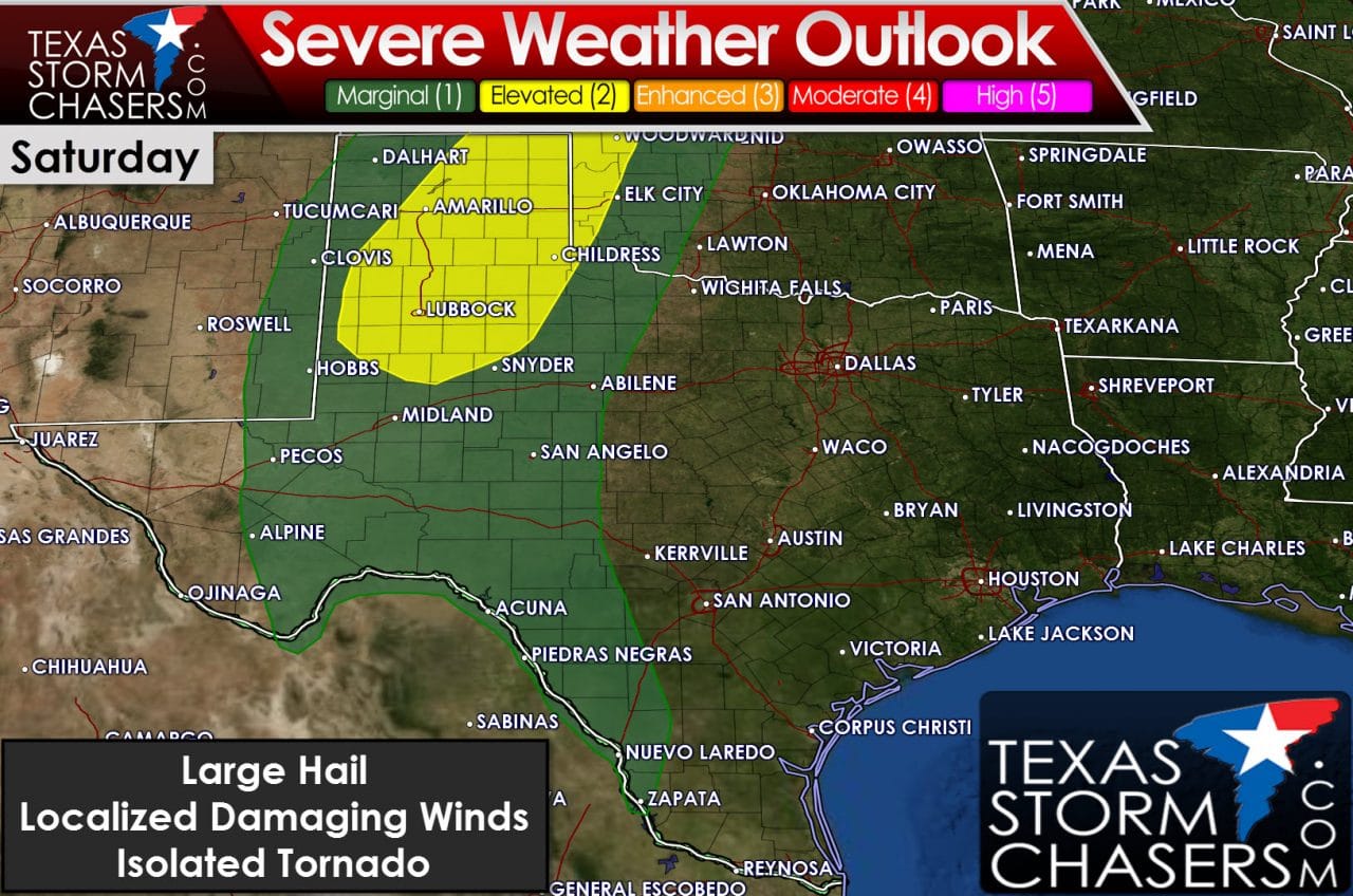
Today will mark a ‘down’ day for active weather before we start right back up over the next week. There will be a few showers in South Texas and Southeast Texas today – but by far most folks will remain dry. Moisture values will start to increase today and tonight from south to north as we see the moisture return process commence. The first chance of severe thunderstorms will begin late Saturday afternoon and early Saturday evening across the Texas Panhandle and the South Plains. A dryline will set up across the western area of the risk zone by late tomorrow afternoon. The enviornment east of the dryline will become unstable with wind shear values also supportive of organized thunderstorms. Since moisture return is just starting this today/tonight the quality of moisture is somewhat in question tomorrow. Regardless at least a few high-based supercells are expected with chance of large hail and localized damaging wind gusts. An isolated tornado is not out of the question especially with any sustained supercells in progress in the 6-9PM timeframe.
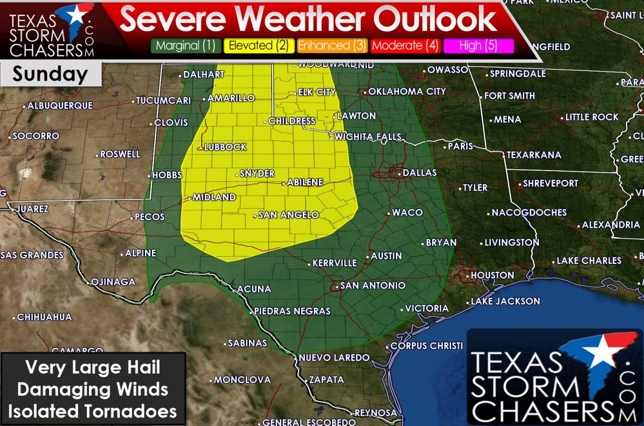
The severe weather risk on Sunday afternoon and Sunday evening will spread into the eastern Texas Panhandle, West Texas, Northwest Texas, the Big Country, and the Concho Valley. At least portions of the risk area may be supportive of a more significant severe weather threat. Supercells with very large hail, damaging wind gusts, and a couple of tornadoes will be possible. SInce we’re still 3 days out there will be refinements to the forecast. At this point the highest risk for significant severe weather (tornadic supercells) seems to be in the Panhandle, Western Oklahoma, into Kansas. I’m sure the specific threats and spatial impacts will be refined. Whatever plays out on Saturday will also have an impact on how Sunday plays out with outflow boundaries and residual cloud cover all factors.
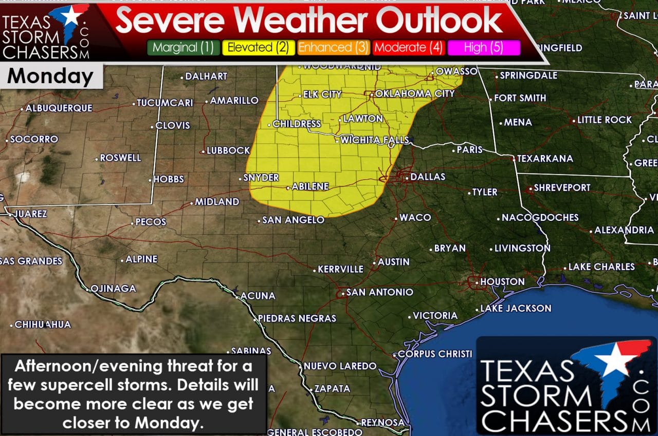
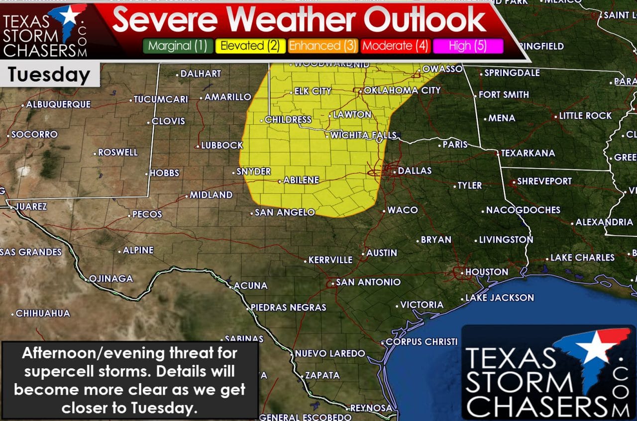
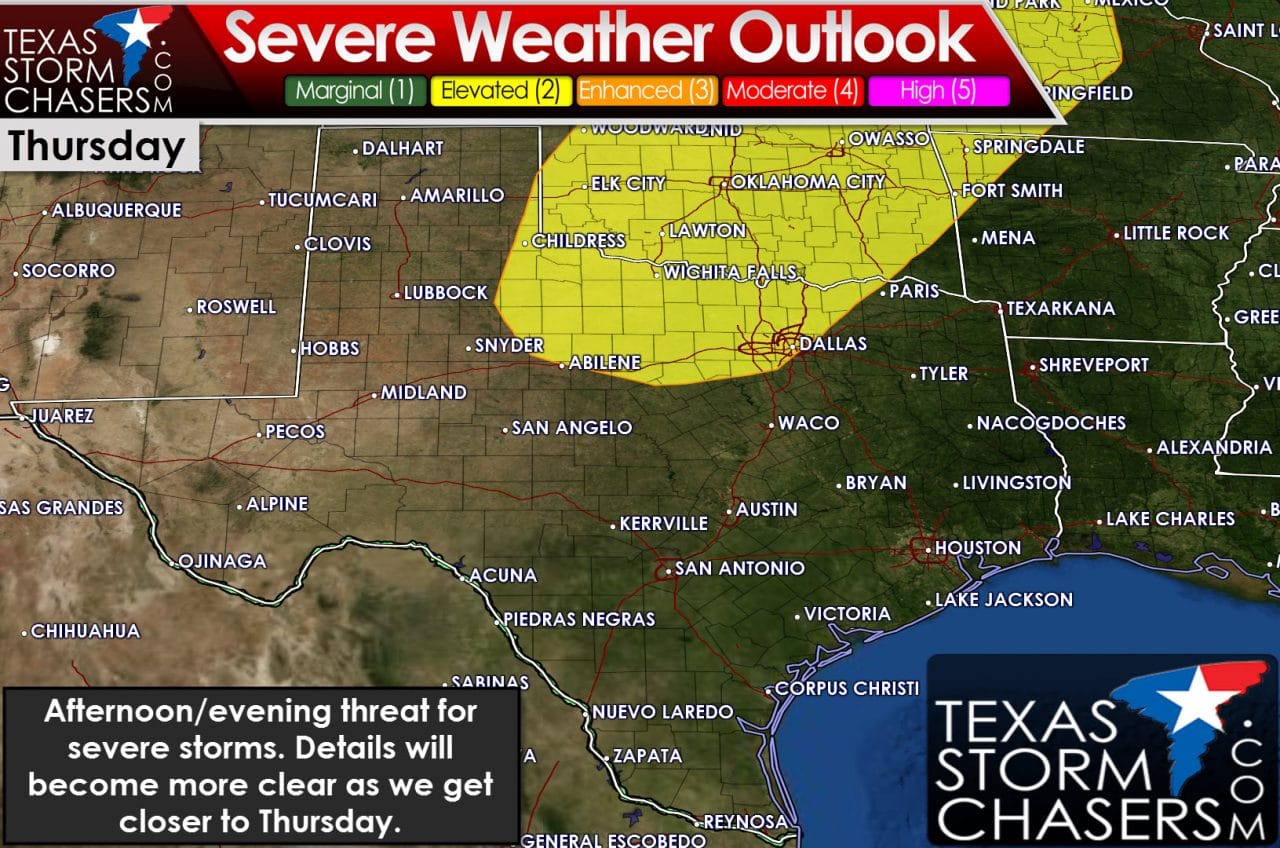
The dryline will push east on Monday with another round of supercells possible by the late afternoon hours across Northwest Texas, the Big Country, and western North Texas. Large hail and localized damaging winds will be possible. The tornado threat will be determined once we get closer and get a better idea of the overall setup. The threat for afternoon and evening supercells will once again occur east of the dryline on Tuesday, Wednesday (to a lesser extent), and on Thursday across Northwest Texas, North Texas, and the Big Country. We’re talking the extended range of the forecast and you can expect changes to each day’s forecast as we get closer. No one day stands out as a ‘outbreak’ type event but each afternoon will have the threat of severe thunderstorms with large hail at the least. If we are going to get a ‘down’ day it may end up on Wednesday as the dryline surges to or east of Interstate 35.


0 Comments