
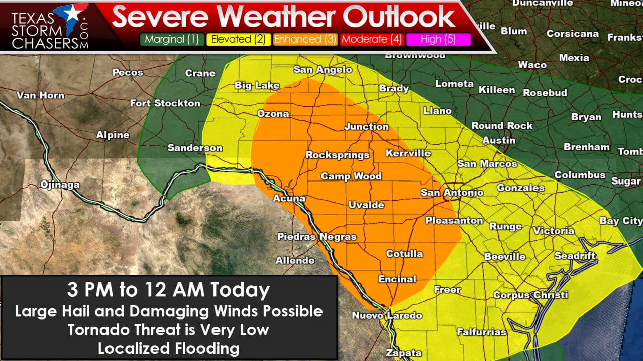
After looking over morning weather model data and more important, observational trends, there have been adjustments to the severe weather outlook today. The first change is a removal or reduction of severe weather probabilities across the northern end of the risk area. Most of the Big Country and all North Texas have been removed from severe weather chances today. Morning thunderstorms have stabilized the atmosphere in those areas. While we may see showers and even a storm later today the chance of severe weather is now very low. Likewise the severe weather probabilities have been shifted south as confidence continues to increase on where we will see severe thunderstorms this afternoon and evening. The category 2 and category 3 risk zones have been shifted south and now include the Concho Valley, Hill Country, South-Central Texas, and the Coastal Plains. The primary severe weather hazard initially this afternoon will be large hail up to the size of tennis-balls. As storms congeal into a cluster or squall line we’ll be watching for an uptick in thunderstorm wind gust potential. The tornado threat is low – but cannot be completely ruled out.
The first storms should begin to develop in the 2 to 4 PM timeframe across the Concho Valley. Some of these storms will likely become supercells with a threat of very large hail. Movement will be east/southeast around 20-30 MPH. The strongest of these storms may produce hail up to the size of tennis-balls. This inital discrete mode may last a couple of hours before storms start to congeal into a cluster or squall line. Additional storms may form by the late afternoon hours across South Texas with a threat of hail up to the size of golfballs. By early this evening the storms in the Concho Valley should be organizing into a squall line. That squall line will move southeast into the Hill Country and South-Central Texas. The strongest storms may remain west of the Interstate 35 corridor this evening depending on how far south the squall line and storms move. Damaging wind gusts over 70 MPH and large hail will be a threat with the squall line. Localized flooding may also occur.


0 Comments