
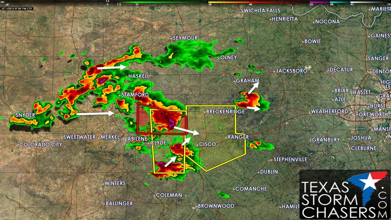
Primary focus over the last 45 minutes is the tornadic supercell over Shackelford County in the Big Country. A brief tornado was reported 15 miles west of Albany at 6:35 PM. What is more concerning is the widespread wind damage from Anson all the way east to Albany now. Wind gusts over 100 MPH has been possible for the past 30 minutes – although it looks like it may be ‘calming’ down to 70-75 MPH at the moment. This storm is moving southeast towards Stephens and Eastland counties – residents of both should be watching this storm carefully. Large hail up to the size of tennis-balls and 75 MPH winds are possible. A brief tornado is not out of the question due to the dynamics involved with this storm.
- New storms have developed from near Cross Plains and Putnam with a separate storm halfway between Breckenridge and Mineral Wells. These storms are moving northeast at 20 MPH and could become a hail threat as individual cells try to intensify. Current projections keep all this activity well west of the D/FW Metroplex through the early evening hours – although we’ll have to keep an eye on things to ensure a movement change doesn’t occur.
- Sub-severe storms are occuring from Snyder to Aspermont and Munday. These storms are occuring in a more stable enviornment behind the monster supercell near Albany. Can’t rule out some small hail with this activity as it moves east.
- New thunderstorm development is expected after midnight across Northwest Texas, Texoma, and portions of North Texas. Those storms won’t be related to the dynamics of whats going on now. Some of the storms overnight could become strong to marginally severe with a threat of hail up to the size of ping-pong balls.
Advertisements


0 Comments