
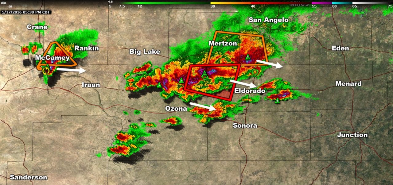
A cluster of severe thunderstorms is underway in the Concho Valley. A cluster of storms is located from 25 miles south of San Angelo to 20 miles northwest of Eldorado to 12 miles north of Ozona. These storms are now making slow progress to the east/southeast at 20 MPH. The strongest storms in this area have a history of producing hail up to the size of tennis balls and are capable of producing damaging wind gusts over 60 MPH and flooding. There have been brief circulations that have required tornado warnings. A new storm is now going up 13 miles east of El Dorado and will become severe shortly with a large hail threat.
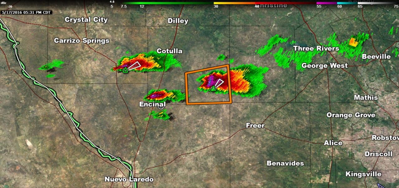
A severe thunderstorm is located 15 miles east of Encinal in South Texas. Additional storms are going up in the general vicinity with surface temperatures in the 90s. These storms may become strong to severe with a threat of large hail. Movement is very slow to the east/northeast at only 10 to 15 MPH. A monster tornadic supercell is underway about 45 miles west of Eagle Pass in Mexico. That storm is downright scary looking on radar but will remain well west of the international border.
Storms across the Concho Valley are now organizing into a small cluster. As the organization continues we should see the threat for damaging straight-line winds increase as the storms move southeast. It is unknown how far east they’ll make it this evening before weakening but those from Kerrville to Rocksprings should keep a close eye on the weather.


0 Comments