
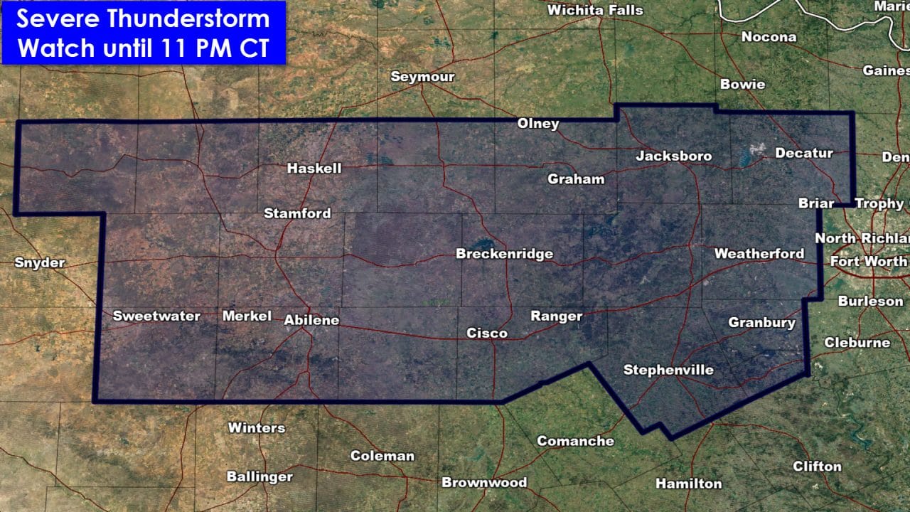
The National Weather Service in combination with the Storm Prediction Center have issued a severe thunderstorm watch for the Big Country and western sections of North Texas. This watch is in effect until 11 PM this evening. Sweetwater, Abilene, Haskell, Cisco, Breckenridge, Graham, Stephenville, Granbury, Weatherford, and Decatur are included in this watch. At this time the watch does not include the D/FW Metroplex. The strongest storms this afternoon and early this evening may produce hail up to the size of a lime and localized damaging wind gusts up to 70 MPH.
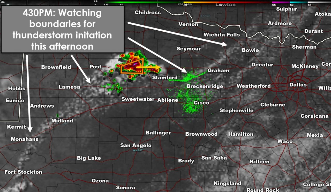
Visible satellite data indicates a boundary from just northwest of Bowie to Stamford to Midland to Fort Stockton. Thunderstorms have initiated west of Aspermont and are now severe with large hail. That activity is moving east. Additional activity may form on the boundary located in western North Texas over the next few hours. The ongoing storms in the Big Country along with new development is expected to move into western North Texas by the early evening hours.


0 Comments