
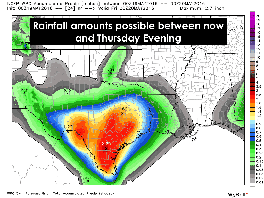
Right now, the radar is much more quiet than it’s been over the past few days. But that will begin to change with additional rainfall developing across west, southwest and south central Texas overnight and spreading east throughout the day tomorrow. The upper low to our west will begin to slowly advance east and spread additional lift across the state over the next 24 to 36 hours. This next round of rain and storms is not expected to begin until closer to midnight, and spread east from the Rio Grande into the Edwards Plateau, south central and south Texas before daybreak. Further north across the panhandle, an ongoing area of showers will also track east overnight across the south plains and into western north Texas by tomorrow morning. Rainfall across the northern half of the state will likely range from 1/2 to 2 inches. Across central, south central and south Texas 2-4 inches is likely with some locally higher accumulations where the heaviest storms end up tracking. Flash Flood Watches are in effect tonight through Thursday across much of the Hill Country, Concho Valley, Big Country, Edwards Plateau, Big Bend region, Rio Grande Plains and Rio Grande Valley.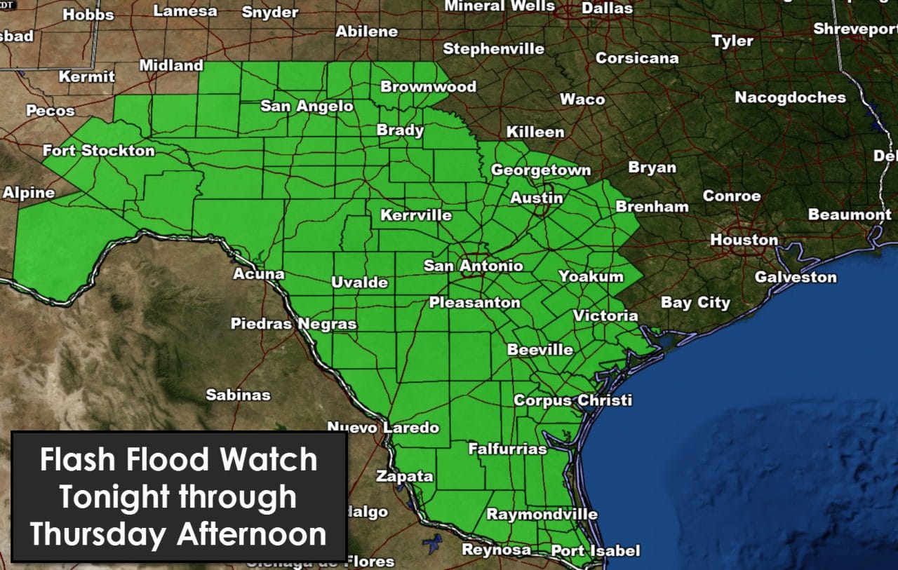
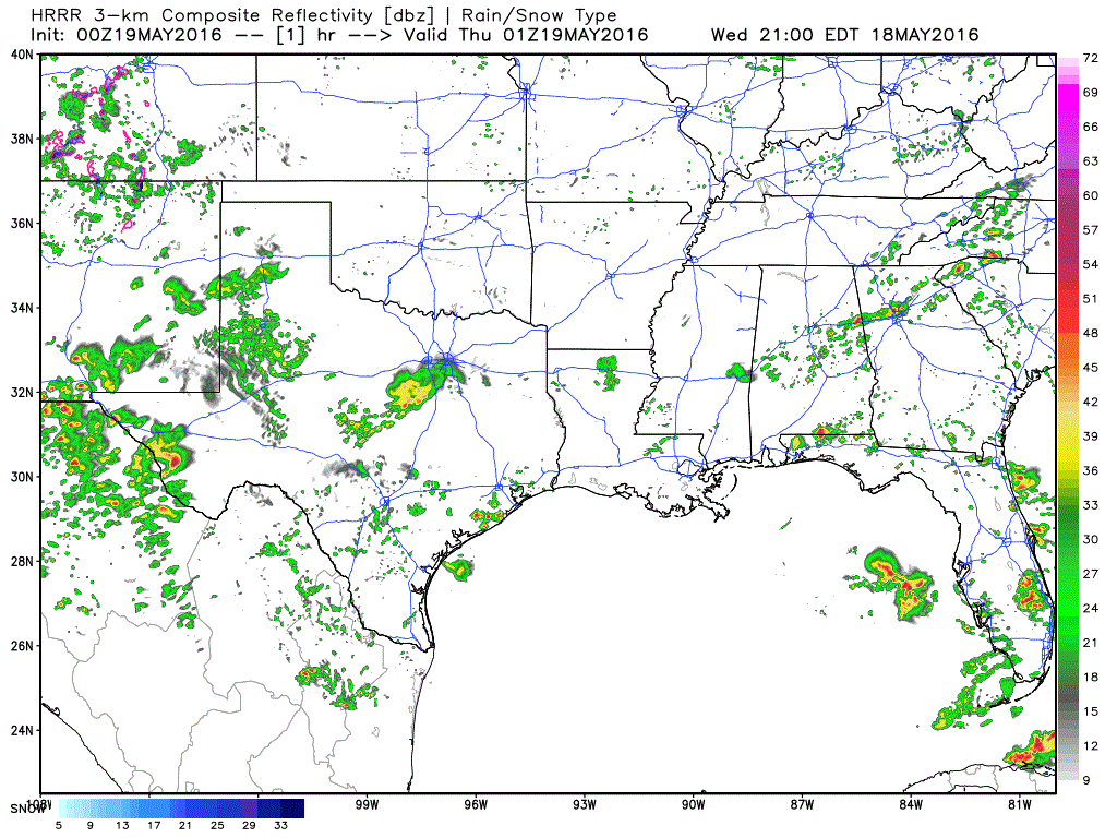
SIMULATED RADAR from the HRRR short-range forecast model through early tomorrow morning….
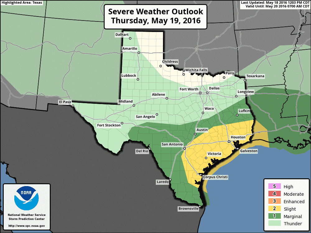
For tomorrow, the rain will continue to expand eastward. Pretty much all but far east Texas will have a chance at seeing at least moderate rainfall during the day on Thursday, but the heaviest rainfall will remain primarily south of the I-20 corridor. We will also have a risk of seeing strong to severe storm development, mainly across the coastal plains from the central coast towards Louisiana. Confidence in severe storm development is not high at this time and will depend on how unstable the atmosphere across these areas and get by early tomorrow afternoon. Ongoing heavy rain and cloud cover may end up working against any severe weather potential, but wind shear is expected to be sufficient to overcome any lack of instability. Also noteworthy, at least two of the short range forecast models we use are hinting at the development of a squall line of strong storms developing and moving through south central Texas by late morning which may eventually impact the Slight Risk region on the map below by early to mid-afternoon. If this pans out, the threat of damaging wind gusts will certainly be realized, along with the chance for heavy rain, hail and dangerous lightning. We will be monitoring this tomorrow morning and will provide the updated Outlook with our morning blog.


0 Comments