
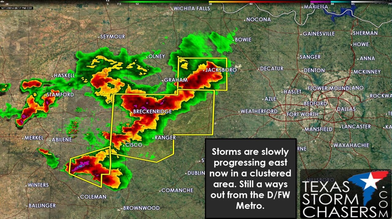
A cluster of strong to severe storms currently extends from Jacksboro southwest through Breckenridge, Cisco, to Cross Plains. These storms have varying degrees of movement and speed. Most activity is generally moving to the east at 15 to 30 MPH – but some cells are moving northeast, east, and southeast. With weak wind shear aloft that’s what usually happens after several hours of convective evolution. The significant severe weather earlier from Anson to Albany has diminished. The strongest storms are currently capable of producing ping-pong ball size hail and localized damaging wind gusts over 60 MPH.

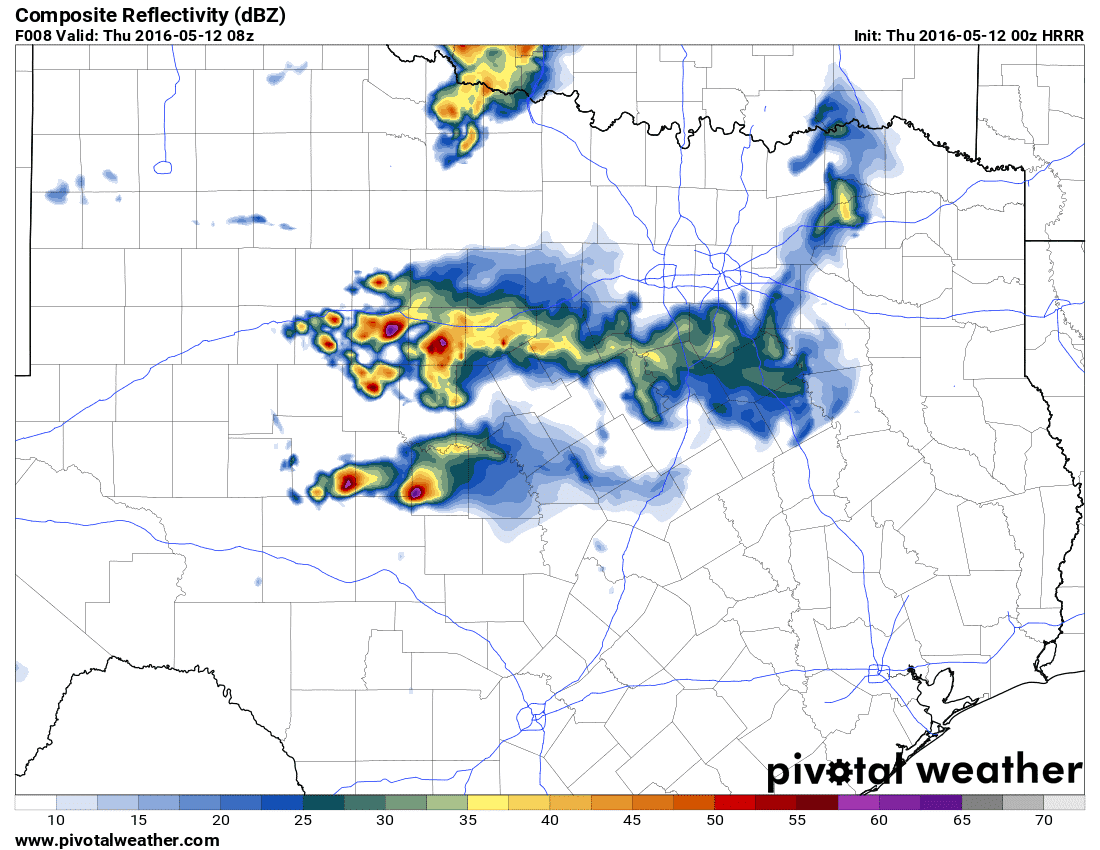
7 PM run of the HRRR weather model. Simulated radar at 11 PM
There remains some uncertainty on how things will evolve over the next few hours. Logic would seem to indicate a slow eastward progression of storms currently located across western North Texas. The storms themselves aren’t in any hurry right now. The latest hourly run of the HRRR weather model has the line of storms moving into western sections of the D/FW Metroplex between 10:30 and 11:30 PM in a weakened state. I do anticipate the threat for severe weather will tend to lower by the time storms make it into D/FW. Thats not to say we won’t have isolated severe hail or wind in D/FW with these storms – I just don’t expect it’ll be particularly widespread.
7 PM run of the HRRR weather model. Simulated radar at 3 AM Thursday
By 3 AM Thursday the initial complex of storms should have dissipated near the D/FW Metroplex. New storms will be ongoing across the Big Country and possibly the Concho Valley and Northwest Texas. These storms will be in part due to increasing lift associated aloft and residual outflow boundaries. Being in the middle of the night these storms should be elevated above a cap. The strongest storms could be marginally severe with a threat of hail up to the size of ping-pong balls. Most weather model guidance indicates this activity will be well west of the D/FW Metroplex – but we’ll have to see. If the storms were to impact D/FW it would likely be well after midnight.


0 Comments