
This will be a brief update on the ongoing thunderstorm situation and a short-term forecast on expected thunderstorm evolution in the next few hours. For simplicity sake we’ll use a bullet-point style to keep this short and sweet. As a whole we’re seeing activity increase east of a surface dryline across the Concho Valley, western Hill Country, and western North Texas. The strongest storms through 7 PM may produce hail up to the size of baseballs and damaging wind gusts up to 70 MPH. Not all storms will be severe or produce destructive hail.
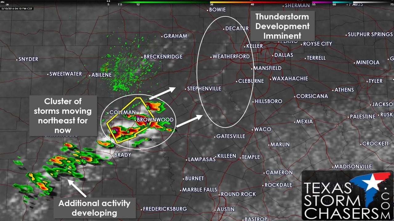
- Severe thunderstorms are located from near Winchell northeast to Brownwood to just northwest of Comanche. These storms are moving northeast at 25 MPH. So far we’ve received hail reports up to the size of quarters. As storms intensify the hail sizes may increase over the next 45 minutes.
- Agitated cumulus is increasing on visible satellite data from near Decatur south through Weatherford to Glen Rose and Meridian. There is a diffuse boundary located in this area. The increasing cumulus indicates the cap is weakening and thunderstorm development may be imminent. Storms would move northeast around 20-25 MPH. The enviornment is very unstable and some storms may become severe with large hail and localized damaging wind gusts. At this time we don’t have activity near D/FW but that could change in the next hour.
- As storms around Brownwood continue to organize over the next few hours they could hook a right and start moving more easterly. If they are able to organize into a mesoscale convective system, a fancy word for a thunderstorm complex, they could move east towards Central Texas with large hail and straight line winds over 60 MPH. We’ll have to see how things trend over the next few hours.


0 Comments