
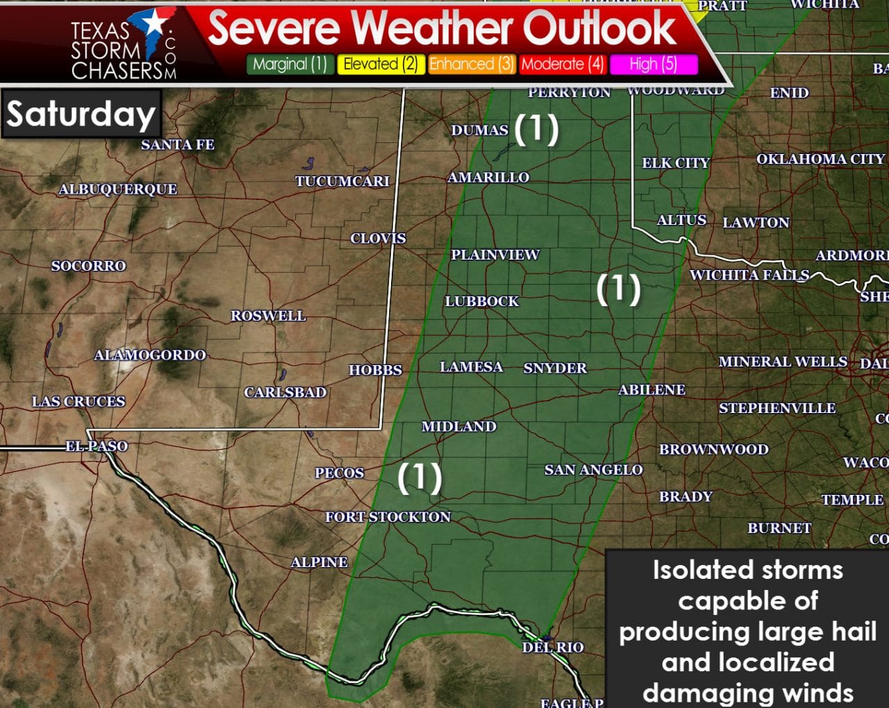
The first chance of isolated to widely scattered storms will be Saturday afternoon across the Texas Panhandle, West Texas, and the Permian Basin. The best severe weather chances are expected to be north of the state up in eastern Colorado and western Kansas. Limited moisture is expected to limit the overall severe weather threat in our state on Friday. A dryline will set up near the Texas/New Mexico border by the late afternoon hours Saturday. Isolated storms are expected to develop and move into the Texas Panhandle and West Texas. There probably won’t be many storms – but those that do form could be severe with a threat of large hail and localized damaging wind gusts. Limited moisture levels and uncertainty regarding low-level wind shear means the tornado threat is anticipated to be very low. I can’t rule out a tornado but we’ll have to refine that threat as we get closer.
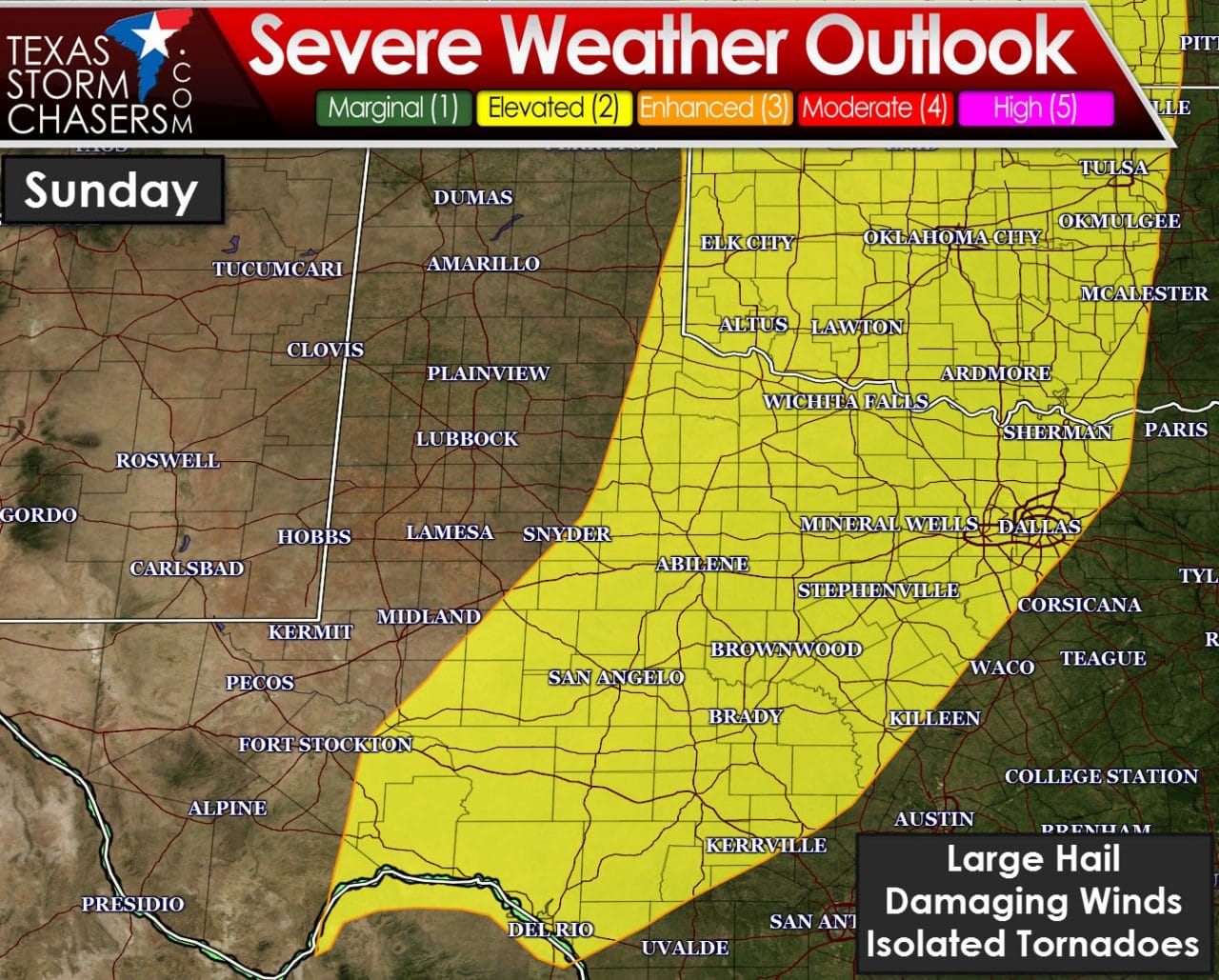
The threat for severe storms will shift east on Sunday to include Northwest Texas, Texoma, North Texas, the Big Country, Concho Valley, and the Hill Country. We’ll likely see storms start to fire up by mid-afternoon ahead of the dryline which will be pushing into Northwest Texas and the Big Country. Depending on mesoscale factors we may also see a few storms fire up well ahead of the dryline. The threat for storms will continue into the evening hours as they move east towards I-35. Very large hail, damaging wind gusts, and isolated tornadoes are possible with the strongest activity. Being 72+ hours out means a lot will probably change between now and Sunday. Please check back for forecast refinements and more specific information once we get closer.
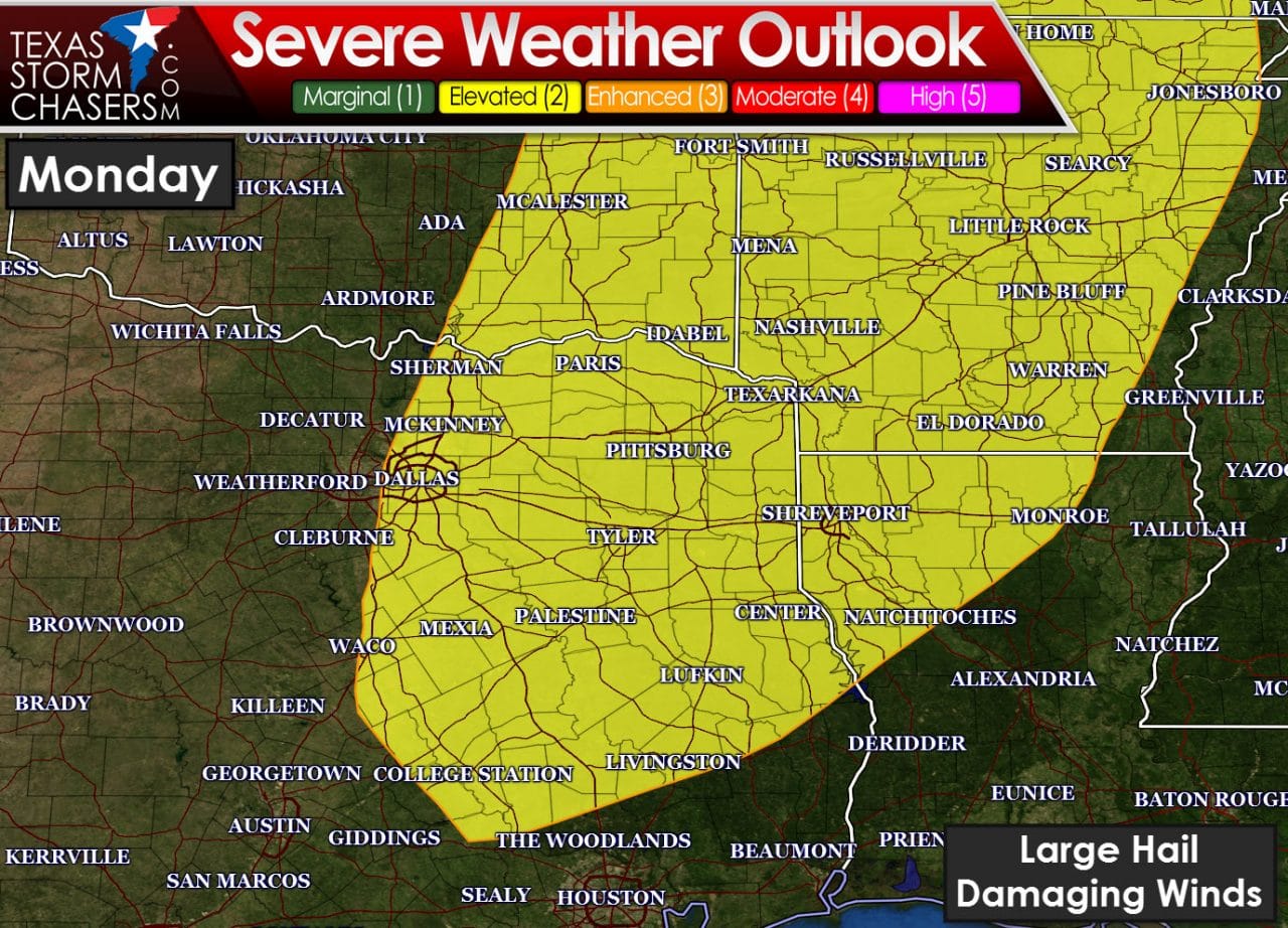
As expected yesterday the Storm Prediction Center has highlighted the eastern half of North Texas, Northeast Texas, the Brazos Valley, and East Texas for Monday. Storms will probably start to increase in coverage by the afternoon hours as a dryline surges east. At this point I’m not even going to waste your time by trying to get specific on timing or threats. At this point it looks like large hail and damaging wind gusts would be the primary threats. We’ll also have to be on the watch for localized flooding issues.
Here are the National Weather Service forecasts for day-by-day precipitation chances. We won’t have a wash-out this weekend or early next week. Some folks are definitely going to have wet periods.
Depending on what weather model guidance shows as it comes in this morning we may put out a more detailed post this afternoon/evening. Jenny should have her usual evening weather roundup published tonight. No hazardous weather is expected this evening or on Friday.


0 Comments