
Light to locally heavier rain is ongoing across the Permian Basin into the Hill Country, Central Texas, and Southeast Texas this morning. Even though the radar is showing rain in Northwest Texas it appears the low-levels of the atmosphere are causing it to evaporate before reaching the ground. Temperatures have remained warmer than expected across the South Plains this morning. The winter weather advisories previously in effect have been discontinued. Most precipitation that falls in the South Plains and Permian Basin should remain in liquid-form today. I can’t rule out a little snow mixing in but temperatures will remain too warm for accumulations. We have had isolated stronger storms in Central Texas overnight with small hail. The severe weather threat is very low today and I doubt we’ll see many problems. The coverage and intensity of precipitation will decrease as we head into the afternoon hours.
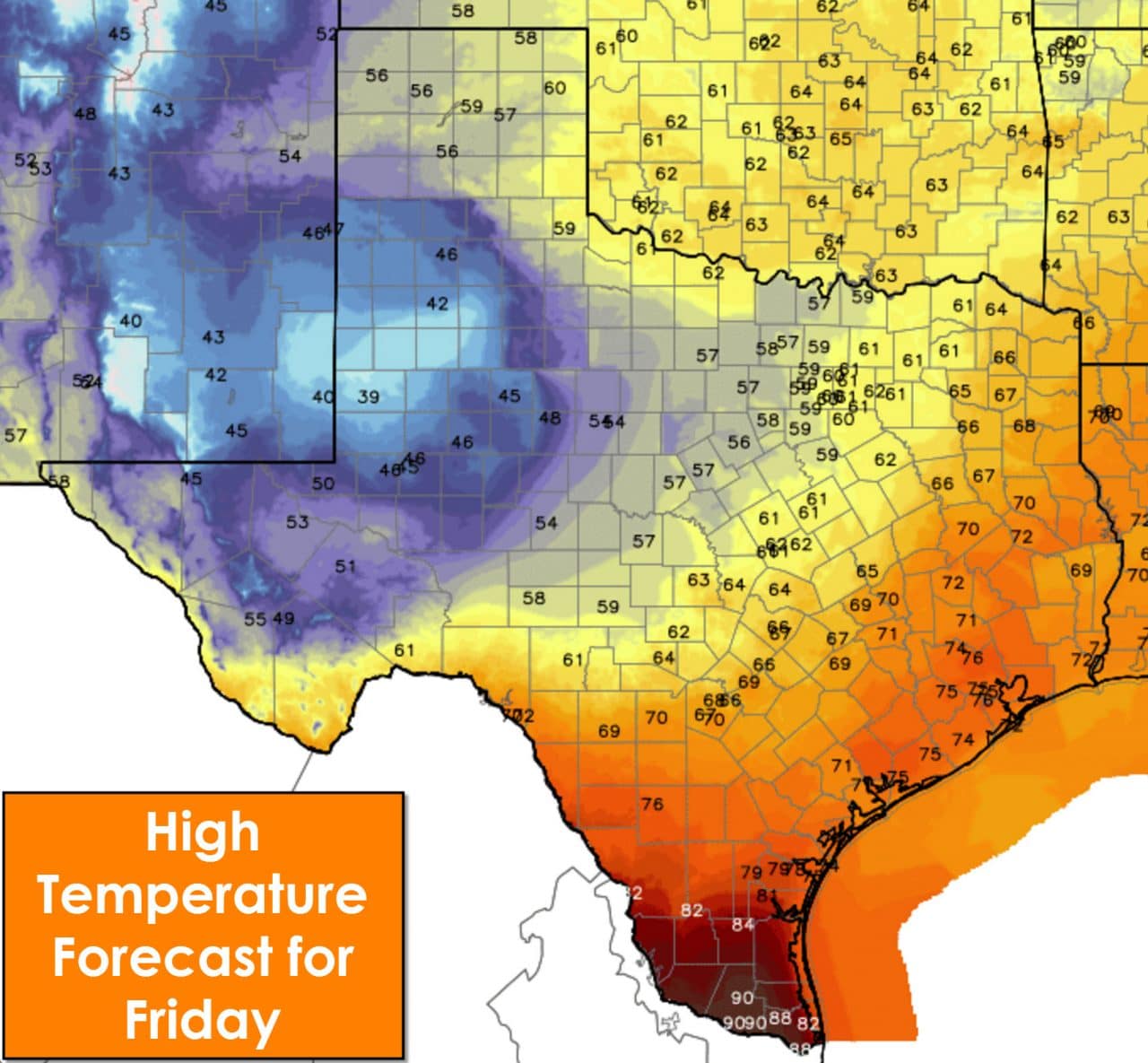
Overcast skies and north winds will make today a cool first day of April across the Permian Basin, South Plains, Permian Basin, and Big Country. Temperatures will struggle to hit 60 degrees in North Texas this afternoon. Considering the warm winter I find it slightly amusing we’re starting off April on a cooler note. Temperatures will top out in the 70s across East Texas, Southeast Texas, and South-Central Texas. The Rio Grande Valley and Deep South Texas will make it into the 80s to lower 90s this afternoon.
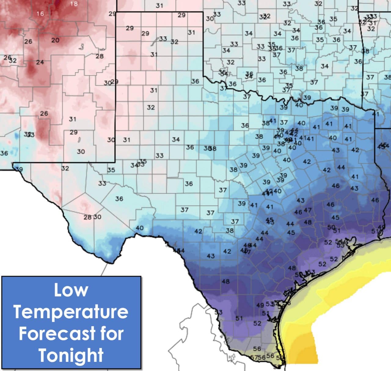
Cold temperatures tonight will make a light jacket a good idea. A freeze to and/or frost is possible across the Texas Panhandle, West Texas, Permian Basin, Far West Texas, Permian Basin, Big Country, Concho Valley, and Northwest Texas. It wouldn’t be a bad idea to protect more sensitive vegetation.


0 Comments