
There are two areas of concern for a severe weather threat later this afternoon and this evening. We’re actually sitting in Altus, Oklahoma right now awaiting thunderstorm development in one of those concern areas. This won’t be an overly long blog since I’m typing this using a rather slow mobile connection.
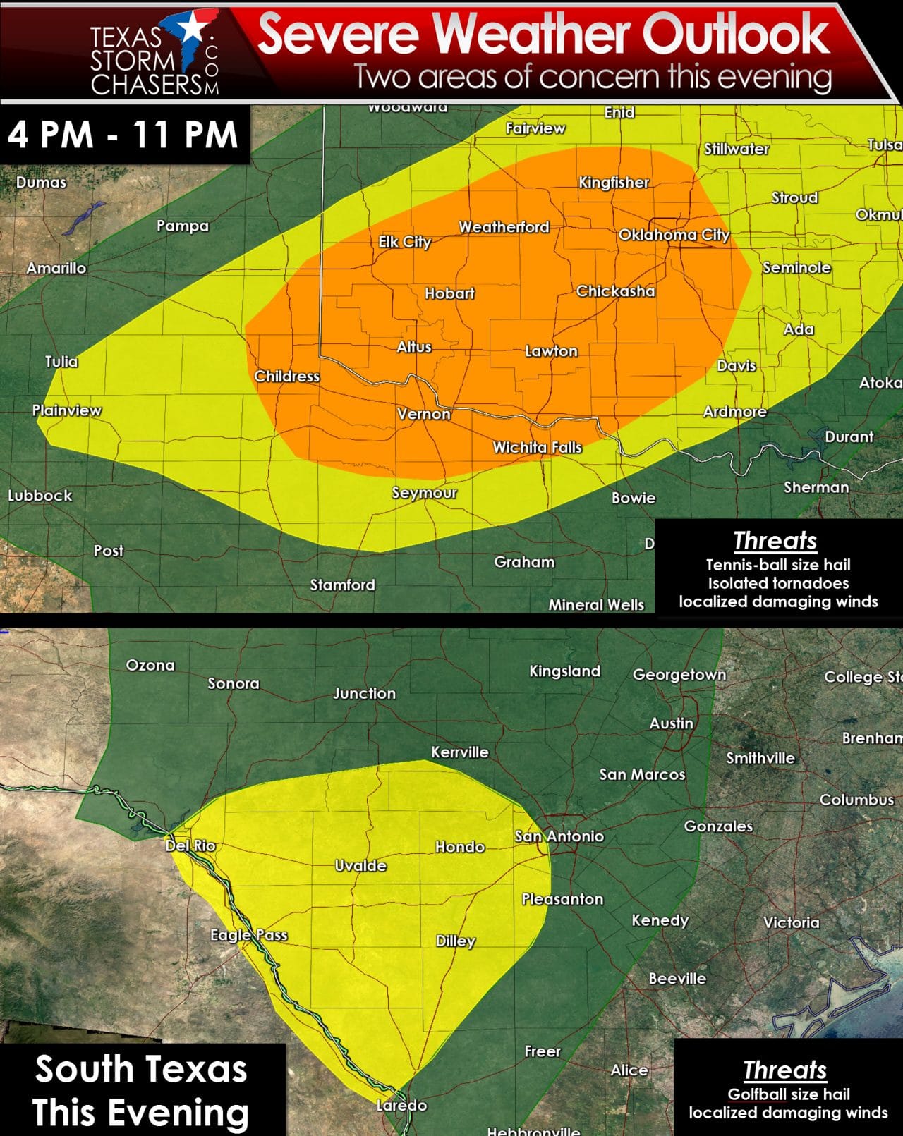
The first area of concern is across Northwest Texas and Texoma. An enhanced risk of severe weather – level 3 out of 5 – is in place for that region. We expect scattered supercell development to occur between 4 and 6 PM. Those storms will move east/northeast near the Red River and a few counties on either side of the river. The strongest of these supercells could produce very large hail up to or exceeding the size of tennis-balls. A tornado threat is not out of the question – especially between 7 and 10 PM. A strong cap should keep storms from developing too far south along the dryline. For that reason the severe weather risk quickly lowers with southward extent from the Red River. A few severe storms may try to make it to Interstate 35 from Oklahoma City south to Gainesville by 11 PM this evening. If they do make it that far east they should be weakening by the time they arrive.
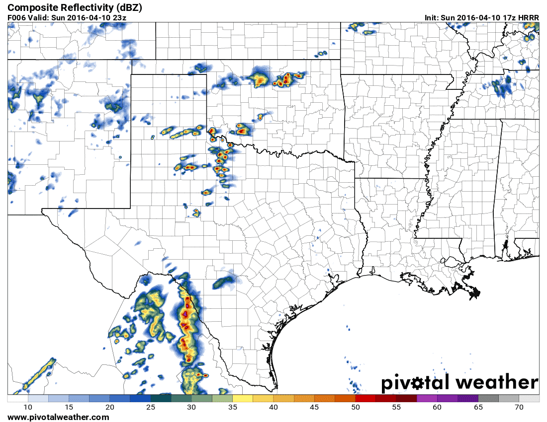
Simulated radar at 6 PM
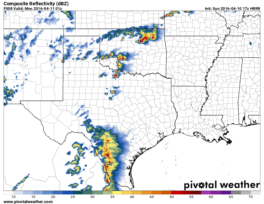
Simulated radar at 8 PM
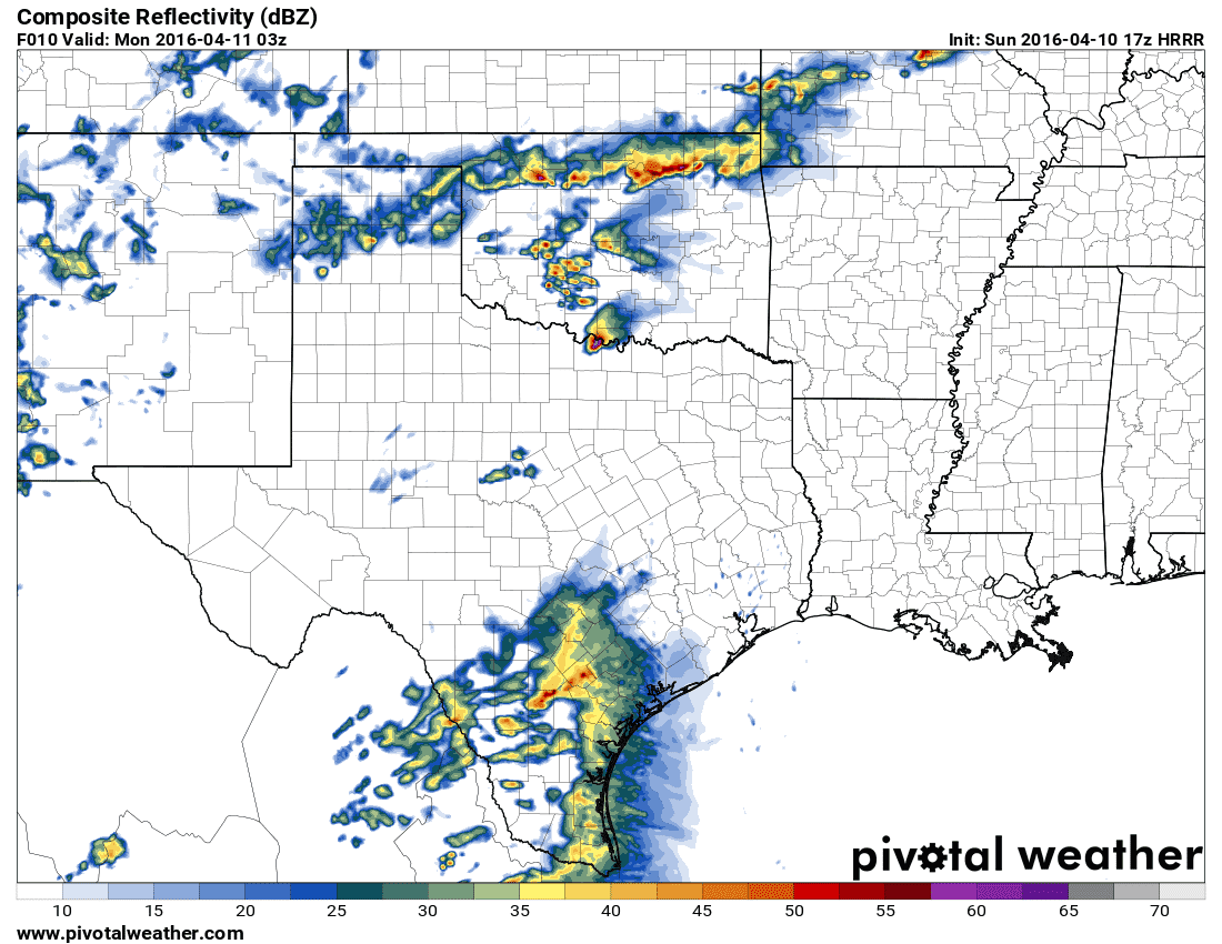
Simulated radar at 10 PM
The second risk area is across Southwest Texas and South Texas. Thunderstorms are expected to develop this afternoon in the higher elevations of Northern Mexico. Those storms will likely organize into a cluster or line that move east towards the Texas border by 6 PM. After 6 PM that line may move into Texas. An elevated risk of severe weather – level 2 out of 5 – is in place to account for that possibility. The line of storms should weaken as they move east towards the San Antonio Metro by 10 PM. Hail up to the size of golfballs and damaging wind gusts over 60 MPH are the primary threat with storms in this region this evening.
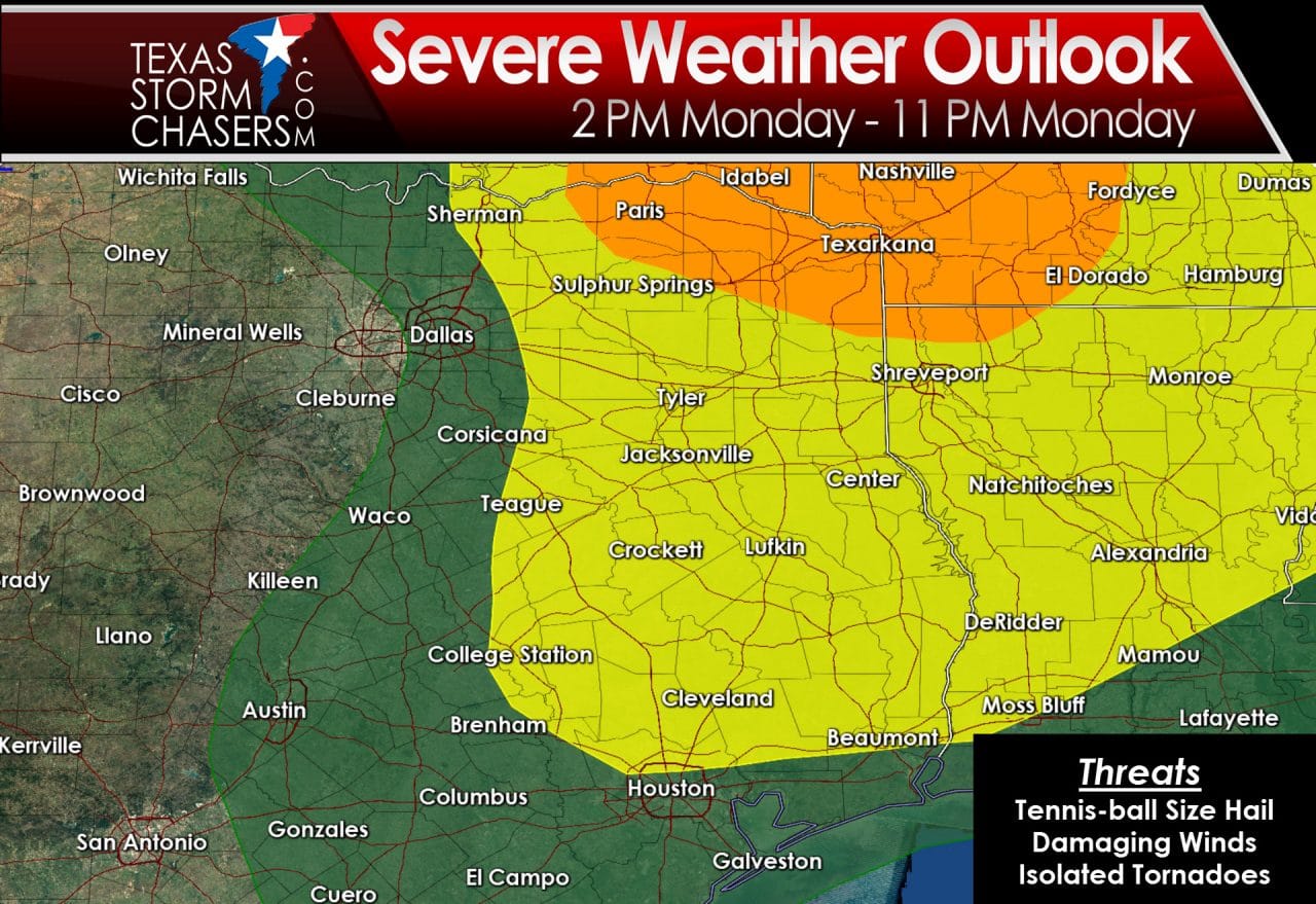
The severe weather threat shifts east on Monday. The Storm Prediction Center has upgraded Northeast Texas to a enhanced risk of severe weather. On a 5 level risk scale an enhanced risk is level 3 – meaning numerous severe weather reports are possible along with a couple significant reports. An elevated severe weather risk – level 2 out of 5 – includes all of East Texas and much of Southeast Texas. Thunderstorms are likely to develop tomorrow afternoon. Some storms will be severe with the potential of tennis-ball size hail, localized damaging wind gusts, and an isolated tornado. The ‘best’ chance of severe weather will be in Northeast Texas where wind profiles will be more favorable. If the storm system or dryline slows down the risk of severe weather would have to be shifted west. Check back for forecast updates tonight and on Monday for the latest severe weather projects.


0 Comments