

The elevated risk of severe weather has been expanded north and east to include Kerrville, San Antonio, New Braunfels, Gonzales, and just northwest of Victoria. Del Rio and Eagle Pass are already in the risk. The strongest storms could produce large hail up to the size of golfballs – maybe a bit larger if we get really intense supercells. Localized damaging wind gusts over 60 MPH are also a threat. The tornado threat is low this evening – but not zero. Storms are already developing in Northern Mexico this afternoon. Those storms will move east towards Del Rio and Eagle Pass by 7 PM. From there the storms are expected to push east and make impact the San Antonio metro around 9-10 PM. If storms are able to organize into a cluster then storms could continue east and impact the Coastal Plains and eventually Southeast Texas late tonight. Large hail up to the size of ping-pong balls, 70 MPH wind gusts, and isolated tornadoes would be the main threat if a cluster develops tonight. I expect we’ll see a severe weather watch issued by dinnertime for portions of South-Central Texas.
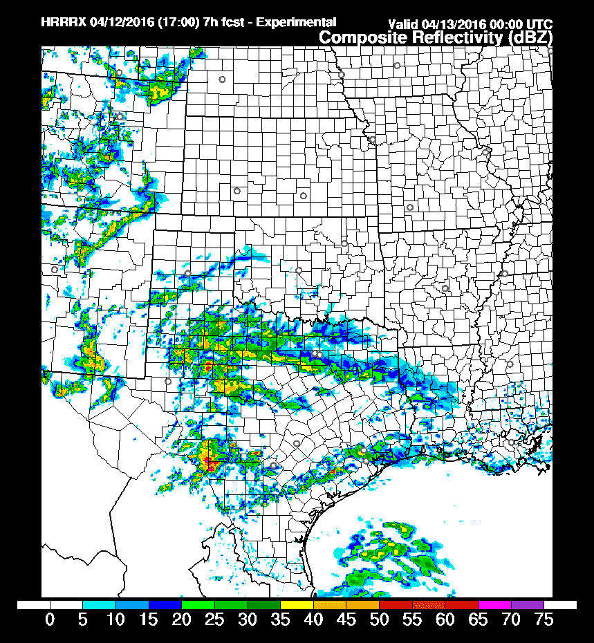
17Z HRRR – Simulated radar at 7 PM this evening
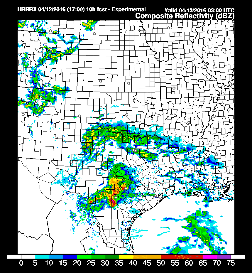
17Z HRRR – Simulated radar at 10 PM this evening


0 Comments