
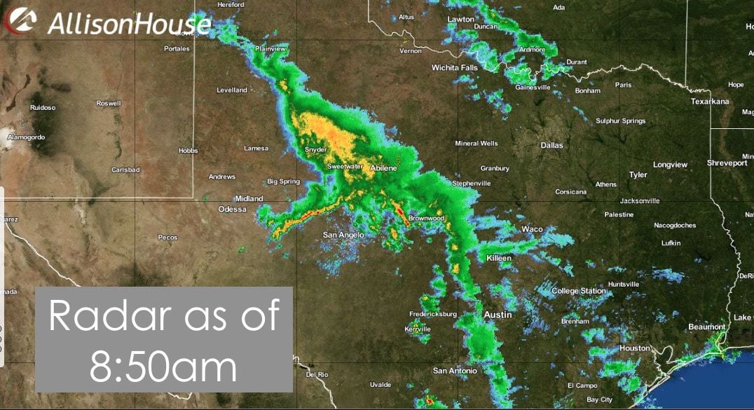
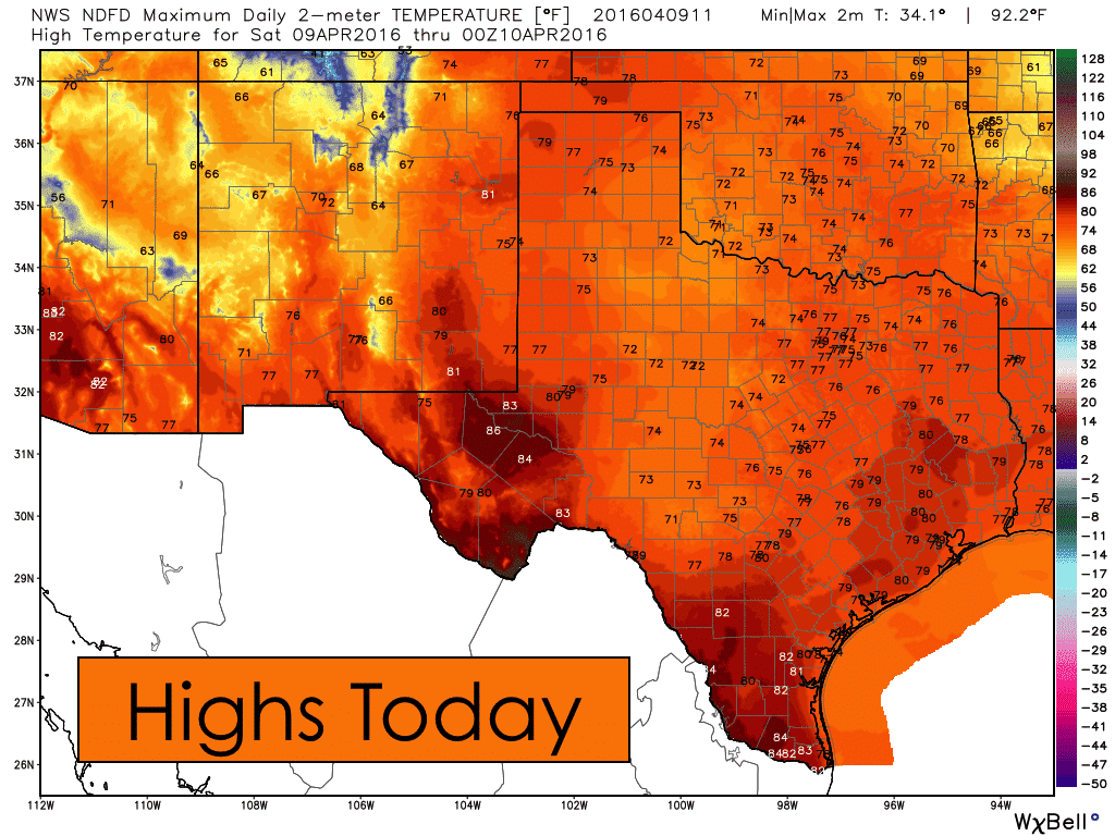
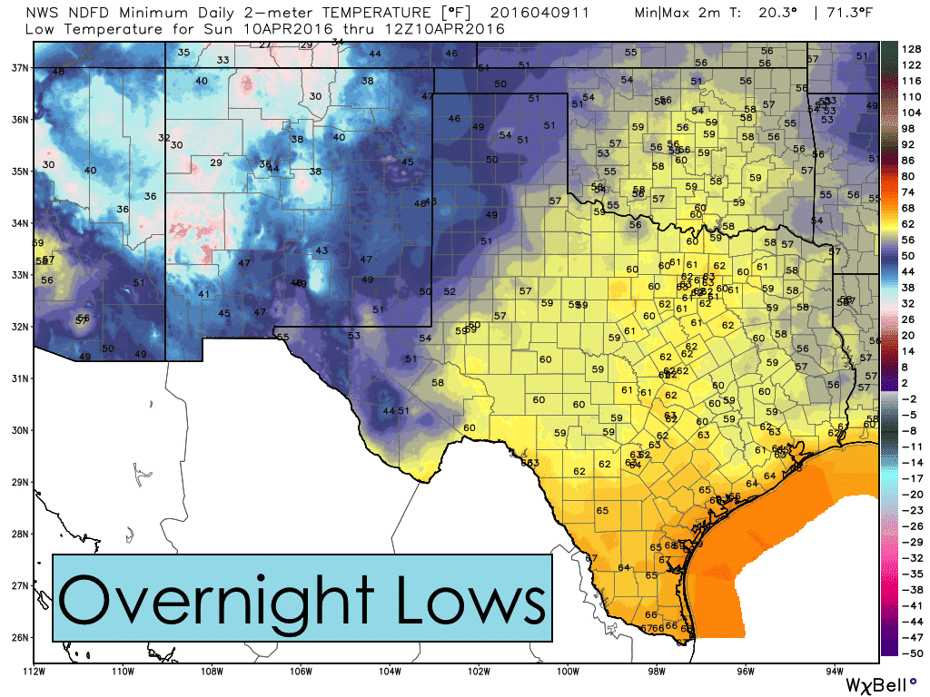
Areas of rain and thunder across west central Texas will continue to slowly track east/northeast this morning, diminishing in coverage as we get into the afternoon hours. Severe weather is not anticipated today, but some of the stronger cells within the current complex of storms will carry the threat of lightning, gusty winds and perhaps some small hail. Highs today will be slightly above normal for this time of the year across all of the rain-free areas by this afternoon. Storms will dissipate by nightfall with quiet conditions expected overnight. As gulf moisture continues to stream north into the state, this will keep lows tonight much warmer than last night.
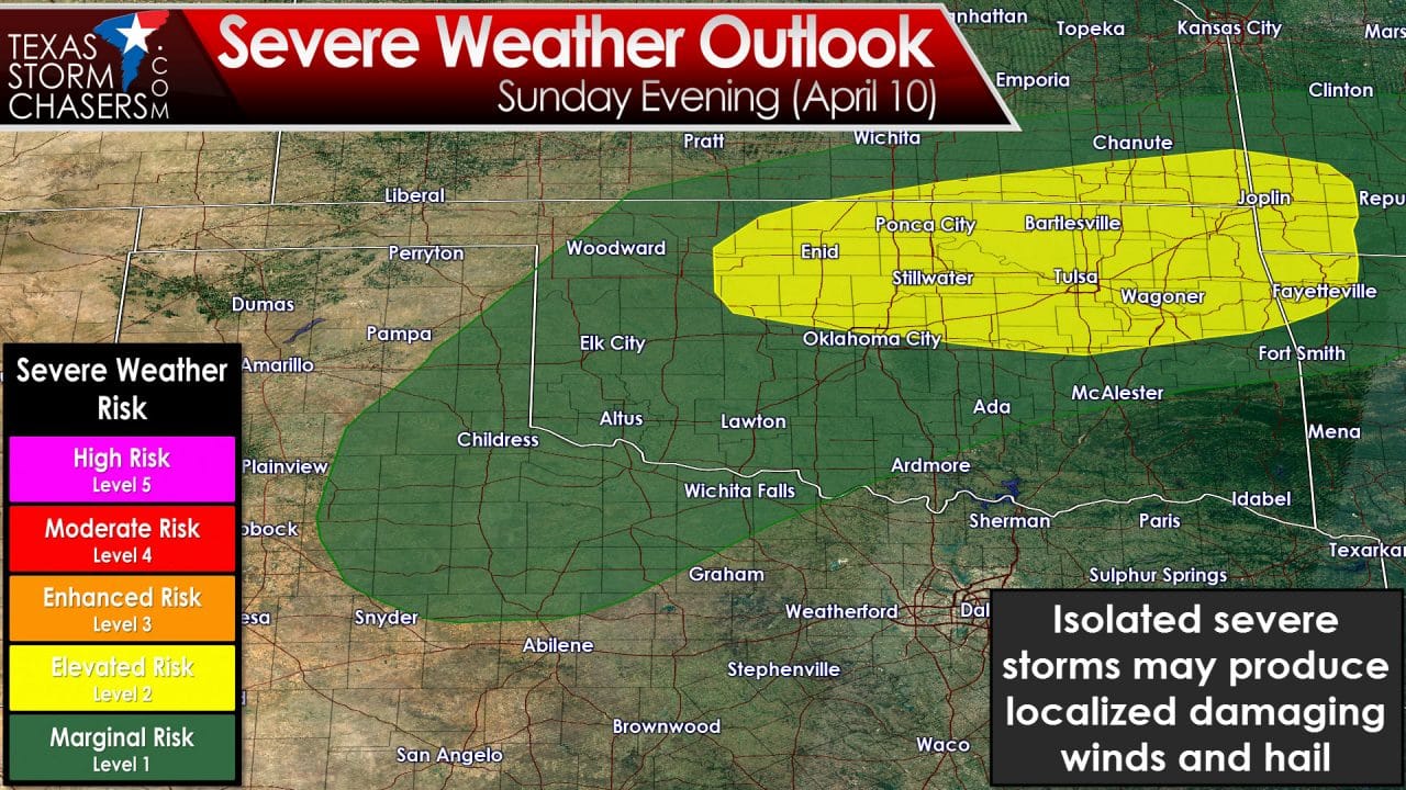
Most of the day tomorrow will be quiet, but by late Sunday afternoon, lift from an approaching upper level low currently sitting off the coast of California will be arriving. In advance of that, a dryline is expected to set up across the central panhandle and down into west central Texas. Heating and pooling of moisture east of the dryline will increase instability values to moderate levels as we get into the afternoon hours across the rolling plains of western north Texas. A few isolated strong to severe (supercell) thunderstorms are expected to form by late afternoon near the dryline and track northeast into western/southwestern Oklahoma by nightfall. Storm coverage will not be widespread, and not everyone will see the threat of severe weather. But the potential is there, for what can develop, to become severe with large hail as the primary threat. Overnight on Sunday, the threat of continued severe weather development is expected to remain north of our state up into Oklahoma.
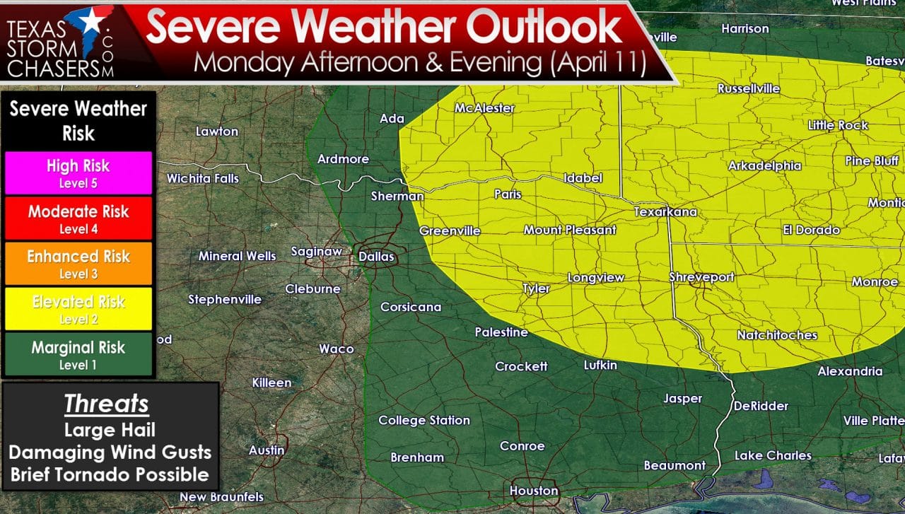
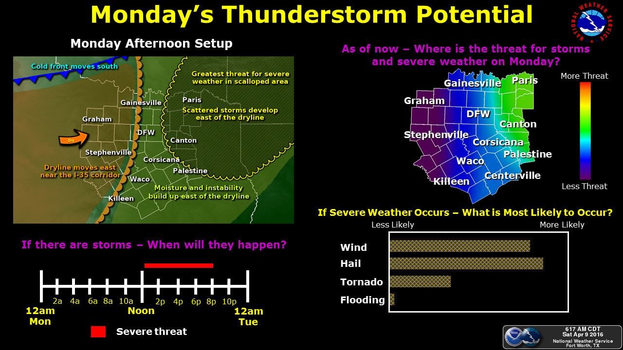
On Monday, the dryline will push east towards the I-35 corridor by mid-day. Lift will be increasing from the approaching upper level disturbance, but we’ll also have a pretty strong cap over much of the area through early afternoon hours. Best chances of seeing severe weather development on Monday will be along and east of the I-35 corridor region into northeast Texas. Once again, large hail, damaging winds and possibly an isolated tornado or two are possible with the storms as they head east by Monday evening. As the upper level system which is bringing this threat of severe weather is still off the west coast and not sampled by our weather balloon networks just yet, we expect there to be some refinement of this forecast by tomorrow, so be sure to check back for additional updates!


0 Comments