
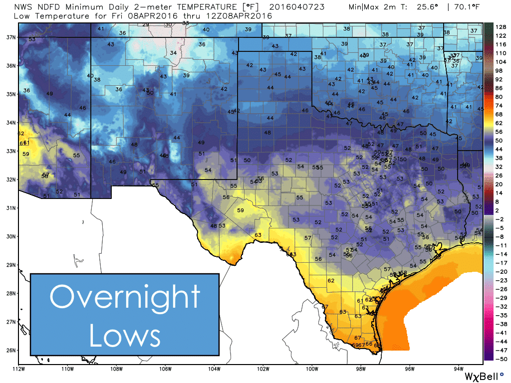
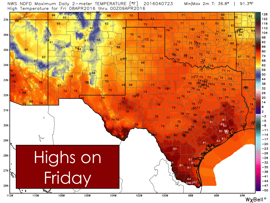
A cold front is currently working its way south across the state this evening. The frontal boundary is clearing the DFW metroplex at this time, and is working its way south of the I-20 corridor across into western Texas. Brief periods of gusty winds will follow behind the front, but should begin to diminish within a few hours after the front has passed. This front will drop temps back to around normal for this time of the year, but will not have any other significant impact. Lows tonight and highs tomorrow will still be fairly seasonal and not too out of line with what we expect this time of the year.
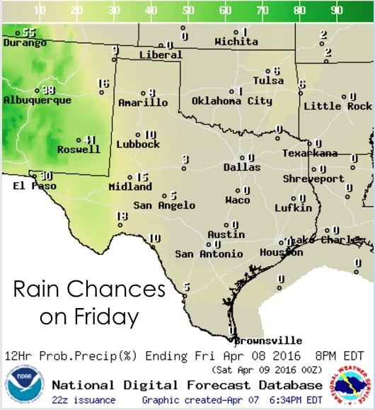
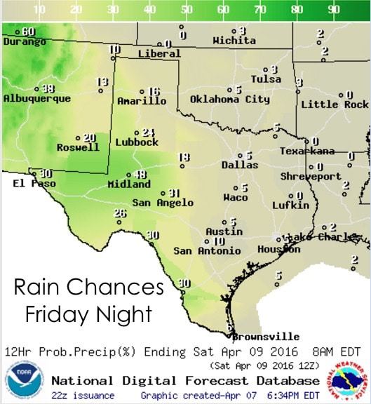
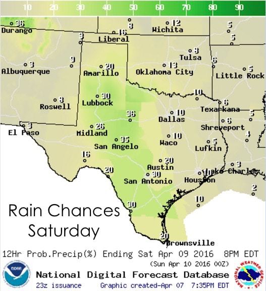
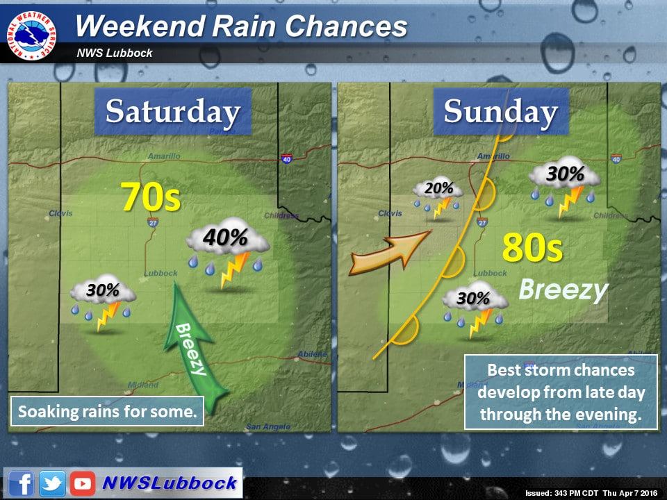
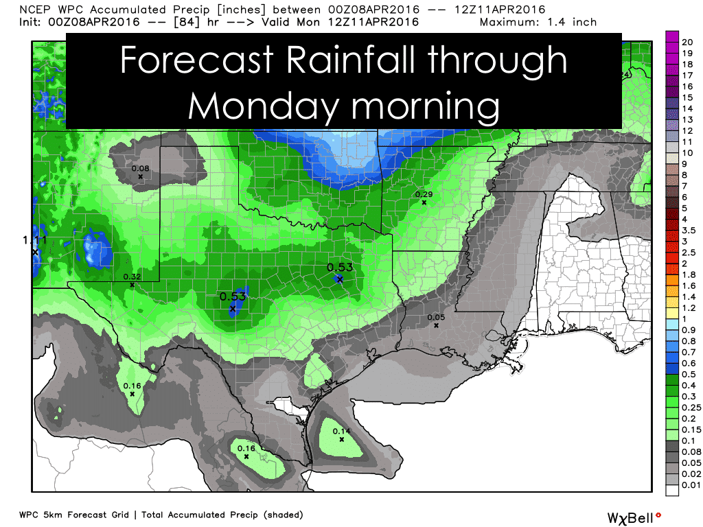
Rain chances return this weekend with a couple of rounds of scattered showers and storms expected beginning Friday and continuing through Sunday night as our next upper level disturbance arrives. At this time, severe weather is not expected to impact western Texas on Friday or Saturday. Some of these showers will bring a nice bit of rainfall to parts of the southern panhandle rolling plains, Trans Pecos and Permian basin as they move from west to east across the area during the day on Saturday. A few of these storms could become strong with gusty downburst winds and small hail as the main threats, but widespread severe weather is not expected. On Sunday, storms become more isolated, but the threat for seeing strong to severe storm development increases as better forcing arrives from the approaching upper level disturbance. A diffuse dryline is expected to develop from north to south across the panhandle, which in and of itself may not provide enough of a kick to generate storms along its boundary, but increasing moisture during the afternoon, heating and the potential for additional forcing from the arriving upper level disturbance before sunset may be enough to kick off a few isolated strong to severe storms off the caprock. A lot will depend on everything coming together just right. We will continue to monitor the forecast and update you as the storm potential becomes more clear.


0 Comments