
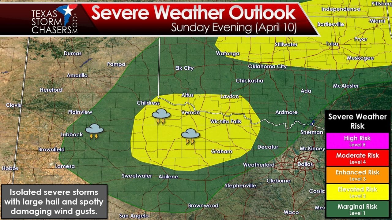
An isolated severe weather threat may develop late Sunday afternoon across Northwest Texas. A diffuse dryline will set up shop just east of the Caprock into the Rolling Plains. Dewpoint values east of the dryline will climb into the upper 50s to lower 60s. With surface temperatures expected to peak in the upper 80s the dewpoint temperature won’t be especially high. What will be high is cloud-bases on any storms that develop. With a ~25 degree temperature/dewpoint difference the lifted condensation level (LCL – aka cloud bases) will be pretty high up. The cap will be on the stronger side of the spectrum and that should keep storm coverage limited tomorrow. What I believe could happen is a few storms firing up after 4 PM in the Rolling Plains into western parts of Northwest Texas. Storms will move off to the northeast around 25 MPH. With high cloud bases the tornado threat will be very low tomorrow. What could fall would be large hail. Storm coverage will be low since the cap will only allow a few storms to develop. Depending on how many storms form tomorrow afternoon we could have a small cluster move northeast into Northwest Texas tomorrow evening. That cluster would likely move northeast into Oklahoma. It’s a spring storm setup but a marginal one. We’ll probably be out chasing tomorrow since its the weekend and chasing has been hard to come by since March 13.


0 Comments