
No hazardous weather is expected today with warm weather continuing all of this week. Skies will be mostly sunny today with light winds. Relative humidity values will be low across the western half of Texas but the lackluster wind speeds will keep the overall fire weather threat tame. Little rainfall is expected this work-week. We may see a chance of thunderstorms begin increasing by the latter half of the weekend. Until then our biggest issue will be fire weather concerns starting on Tuesday.
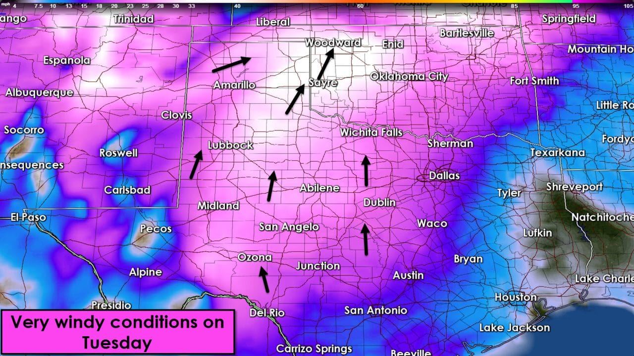
Relatively low fire weather danger today will crank up on Tuesday as a low-pressure takes shape in Kansas. A dryline will surge east with very dry conditions across the Panhandle, West Texas, Northwest Texas, Big Country, Concho Valley, Permian Basin, and Far West Texas by the afternoon hours tomorrow. A tight pressure gradient will set up which will result in very strong winds tomorrow. Sustained winds of 25 to 40 MPH are expected across the Panhandle and 20 to 30 MPH sustained in West Texas, Northwest Texas, into the northern Permian Basin and Big Country. Wind gusts could approach 55 MPH in the Texas Panhandle for a few hours tomorrow afternoon. Minimum relative humidity values will be near or under 10 percent in the Texas Panhandle, the South Plains, Rolling Plains, and Northwest Texas tomorrow afternoon.

Extremely critical fire weather conditions will likely materialize across the Panhandle. These conditions are similiar to those that caused several major wildfires a few weeks back near Pampa, Shamrock, and the monster on the KS/OK border near Alva. Understand tomorrow could be a very significant wildfire day with the most dangerous combination of ingredients in the Panhandle. Critical fire danger will extend into the South Plains, Rolling Plains, Caprock, Big Country, and Northwest Texas. I wouldn’t be surprised to see the critical risk zone expanded south and east in later updates.
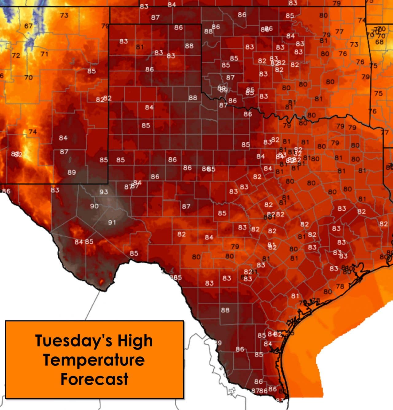
Even with a dryline surging east tomorrow the atmosphere will remain capped. No precipitation is expected but it’ll be windy across most of the state. Temperatures will make it into the 80s statewide on Tuesday with the Permian Basin pushing up into the lower 90s. Warm conditions will continue through the week. Wednesday will likely be another day of dangerous fire weather conditions.


0 Comments