
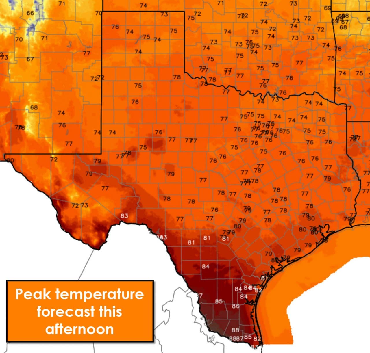
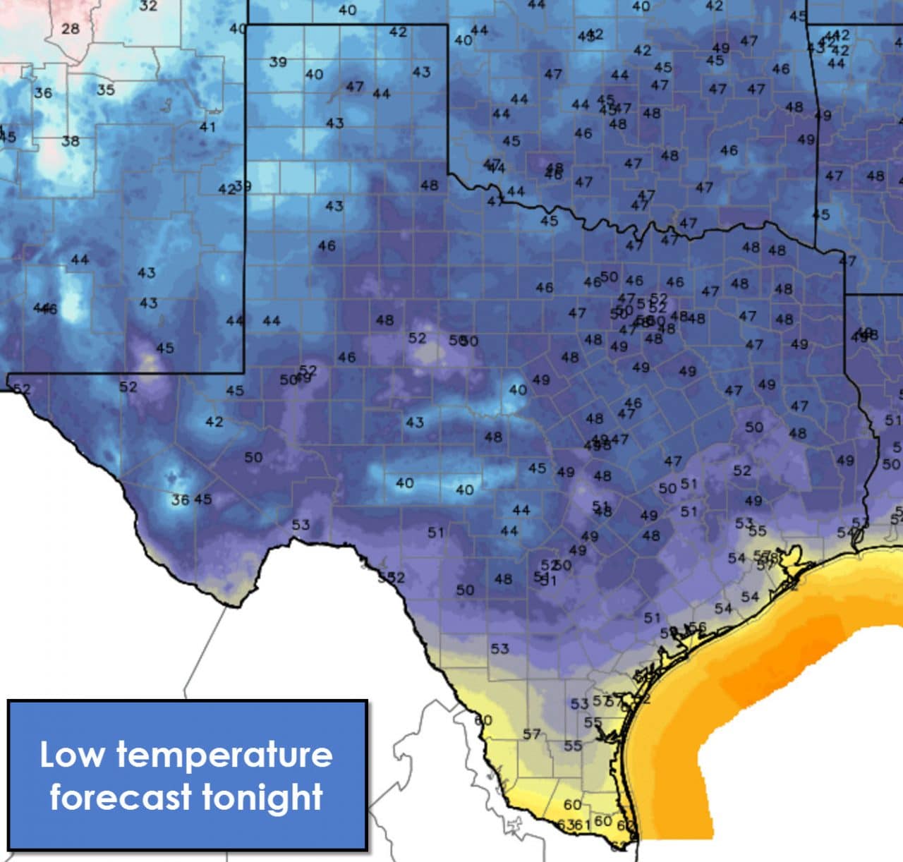
Congratulations on making it half way through the work week! No significant weather hazards are forecast today. A cool front will make progress moving south throughout the day. Temperatures won’t be noticeably cooler on the north side of the front but winds will become northerly. Compared to Tuesday we will see temperatures top out around 10 degrees cooler this afternoon – still quite pleasant in the 70s and 80s. I can’t rule out a brief shower in Southeast Texas today but overall rain chances are very low. Winds this morning through around noon will be gusty behind the cool front out of the north. The pressure gradient will start to slacken this afternoon and wind speeds should start to come down. Due to very dry air north of the cool front there will be very high to near-critical fire danger across the state today. Relative humidity values will climb after sunset and winds will become light. Our next chance for showers/storms looks to begin on Sunday as an upper level storm system moves into the region. The severe weather potential is unclear but we are in April so it will have to be monitored. Have a great Wednesday!


0 Comments