
The weather has been fairly active over the past few hours from Benjamin northeast through Seymour up to Wichita Falls. At 9 PM we now have a broken squall line in the formation phases. A storm which was our big supercell of the day in Northwest Texas is now north of Muenster moving northeast towards Marietta, Oklahoma. Additional storms now extend southwest through Seymour, Munday, Aspermont, to north of Snyder and Gail. Some of these storms are severe with a threat of hail up to the size of golfballs and localized damaging wind gusts over 65 MPH. Over the next few hours I would expect the severe weather threat to slowly lower with the hail threat becoming much less of an issue. After midnight we will still likely have a few stronger storms with small hail and damaging wind gusts over 60 MPH. We do have to be on the lookout for a few brief, weak tornadoes overnight. Most storms will be under severe limits. Most of the storms are currently moving east/southeast at 25-30 MPH. Some flash flooding is a possibility.
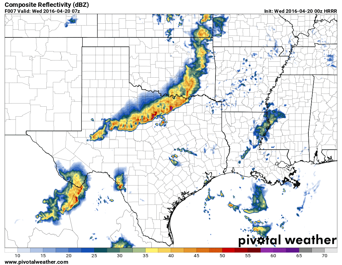
0Z HRRR – Simulated radar around 2 AM CT Wednesday
The 0Z run of the High Resolution Rapid Refresh (HRRR) seems to have a decent idea of the squall line’s timing overnight. As always no weather model will get it completely right so don’t be surprised if timing is off by an hour or two. At this point it looks like a line of strong to locally severe storms will be moving into the D/FW Metroplex between 12 AM to 4 AM. The main threats with the squall line will be wind gusts of 40 to locally 65 MPH. Small hail may also occur although we don’t expect the hail threat to be a major issue. Hail sizes will certainly not be near what we saw last week by the time storms get into North Texas. The threat for a couple brief tornadoes will depend on how organized the squall line becomes tonight. The tornado threat should remain low. By 6 AM the squall line should be comparatively weaker as it moves south into the Concho Valley, Central Texas, and East Texas.
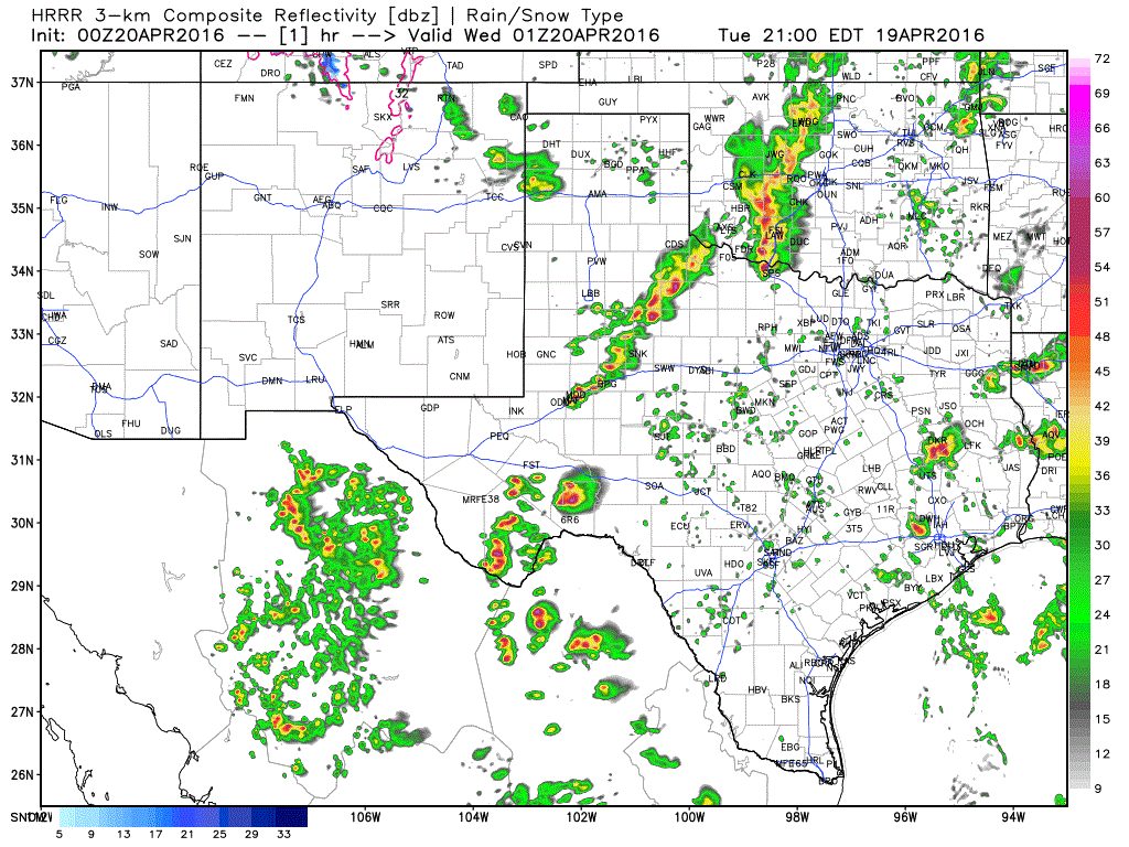
ANIMATION: 0Z HRRR simulated radar overnight
Here’s a loop of what the 0Z HRRR shows radar-wise tonight. Keep in mind timing may be off by an hour or two and the line may not develop as far southwest as indicated by the model. Times are in eastern in the top-right portion of the graphic.


0 Comments