
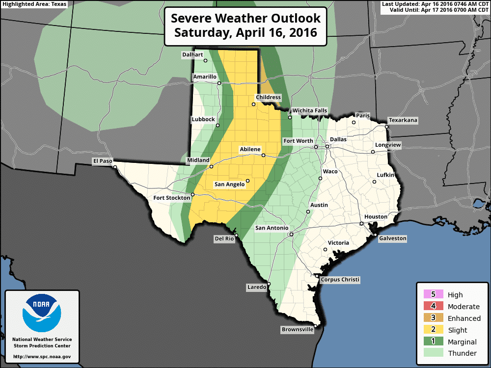
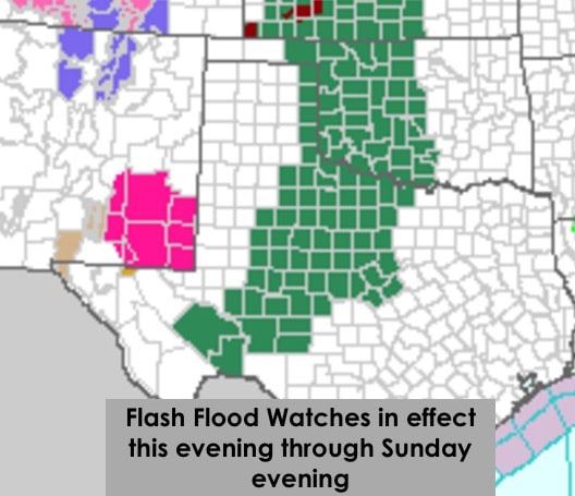
The latest update from the Storm Prediction Center continues the Slight Risk over parts of the eastern Texas panhandle stretching down through the rolling plains, trans pecos, permian basin and big country regions. The dryline is forecast to shift further east this afternoon than we saw yesterday which will shift the risk of strong to severe storm development just off the caprock. Storms are not expected to initiate until after 3pm and current trends have them developing across northwest Texas and the northern to eastern panhandle first, then building south/southwest along the dryline later in the evening hours. The initial storm mode between 4pm and 7pm is expected to be isolated supercells in the eastern panhandle down into northwest Texas/rolling plains region which will carry a threat of large hail, damaging winds and perhaps a few tornadoes. Additional more widespread thunderstorm development is expected further south towards I-20 and down into the eastern Permian Basin/Big Country region where the potential for embedded supercell thunderstorms and widespread heavy rain will impact the area into the late evening and early overnight hours. Overnight, bands of heavy rain will develop with the chance for flash flooding likely, especially where training or bands of storms can set up. Flash Flood Watches across these regions will be in effect from this evening through Sunday evening.
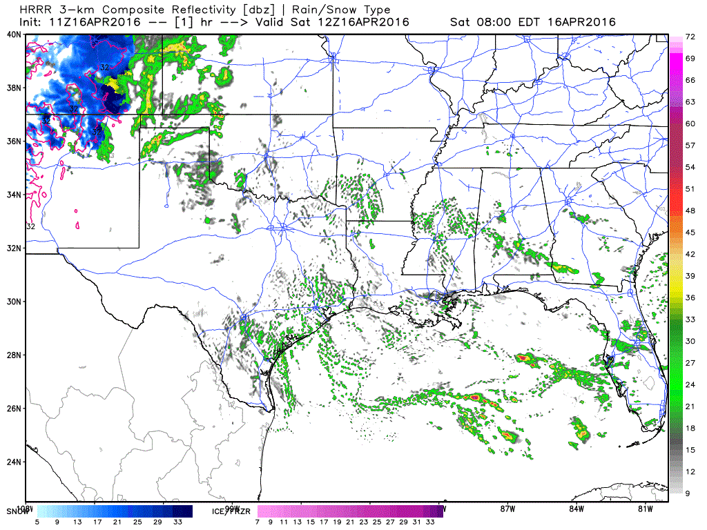
Current high-resolution model forecast animated loop through 9pm this evening.


0 Comments