
We’re watching a couple areas of precipitation at 4 PM. At this time we’re not dealing with anything particularly significant but that is expected to change this evening. For ease of reading we’ll break this down.
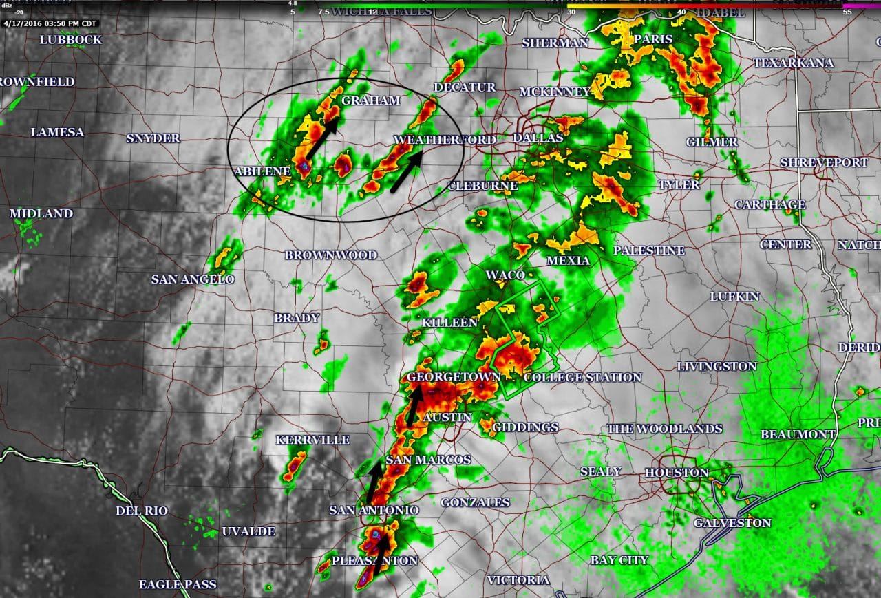
Strong thunderstorms have developed from near Pleasanton north to San ANtonio to east of Blanco to west Austin and Round Rock. All this activity is generally moving north and ‘training’. Training convection is noteworthy because it results in very heavy rain accumulations over the same locations. 1 to 3 inches of rain per hour are possible with this activity and flash flooding will become more likely as we head towards dinner. Isolated hail and damaging wind gusts are also possible with a brief tornado threat. Frequent cloud to ground lightning is occuring in the strongest cores.
There are indications that very heavy rain/storms will develop over Central Texas tonight. In fact the area of storms ongoing in Central Texas may just keep going into the night and not move very much. 3 to 6 inches of rain are possible with isolated totals over 10 inches where we see training storms tonight. The risk of flash flooding – including significant flooding – will likely occur where all of that sets up. We’ll be watching closely for additional storm development and for signs where the heaviest rains will fall tonight.
Additional shower and thunderstorm development is occuring across western North Texas. Most activity is moving north/northeast across western North Texas. Its likely additional activity will build into the evening hours and move east back into the I-35 corridor. Some flooding risk may occur along with a couple strong storms. We’ll watch this activity is it builds and makes progress to the east.


0 Comments