
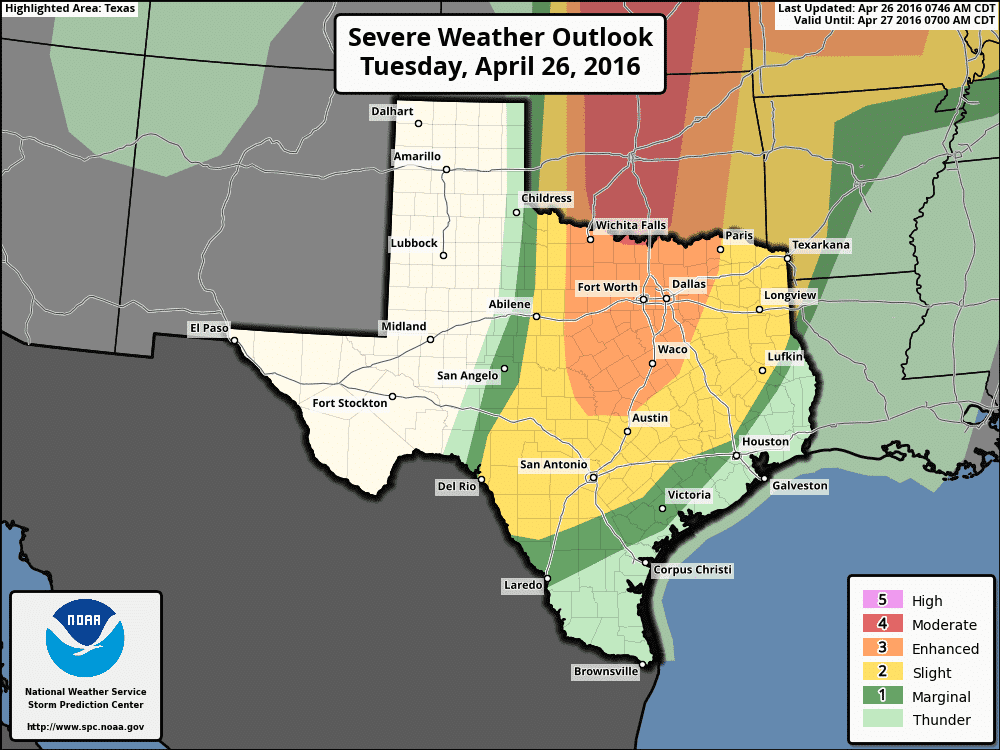
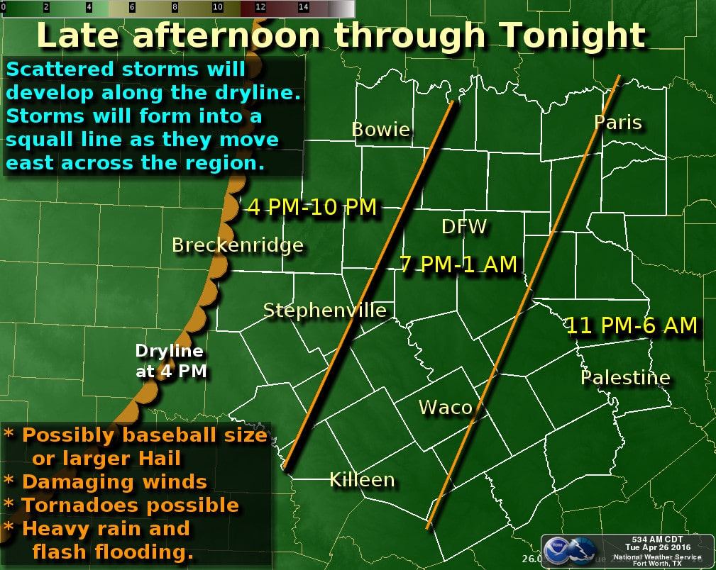
The Storm Prediction Center continues to show areas of Slight to Enhanced Risk of severe storm development this afternoon across parts of north and central Texas. Isolated storm development is expected to begin after 3pm along the dryline which is expected to drift east to a roughly Vernon down to Abilene then down towards Brownwood. Instability levels will support the development of isolated (supercell) storm structures which will carry the threat of very large hail, winds in excess of 70mph and possibly a few tornadoes. The storms are projected to eventually congeal into a squall line which will march east across central and north Texas towards the I-35 corridor by late evening. Individual cells will move northeast, but the line itself will head directly east. Large hail and damaging winds will be the greatest threat with the squall line this evening and overnight. It’s expected that the tornado threat will decrease somewhat after dark, but will still remain a possibility. Overall, the greatest potential for significant tornadoes will remain up into Oklahoma, Kansas and southern Nebraska today..but that does not mean north or central Texas is completely out of the woods. Residents across all of north and central Texas will need to remain very weather aware this evening. Have local radio or TV on and monitor conditions as we get into the afternoon and evening hours. Have a way to receive weather warnings if any are issued for your particular location. Both David and I will be out chasing today and will update if cell data permits.


0 Comments