
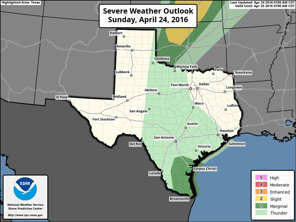
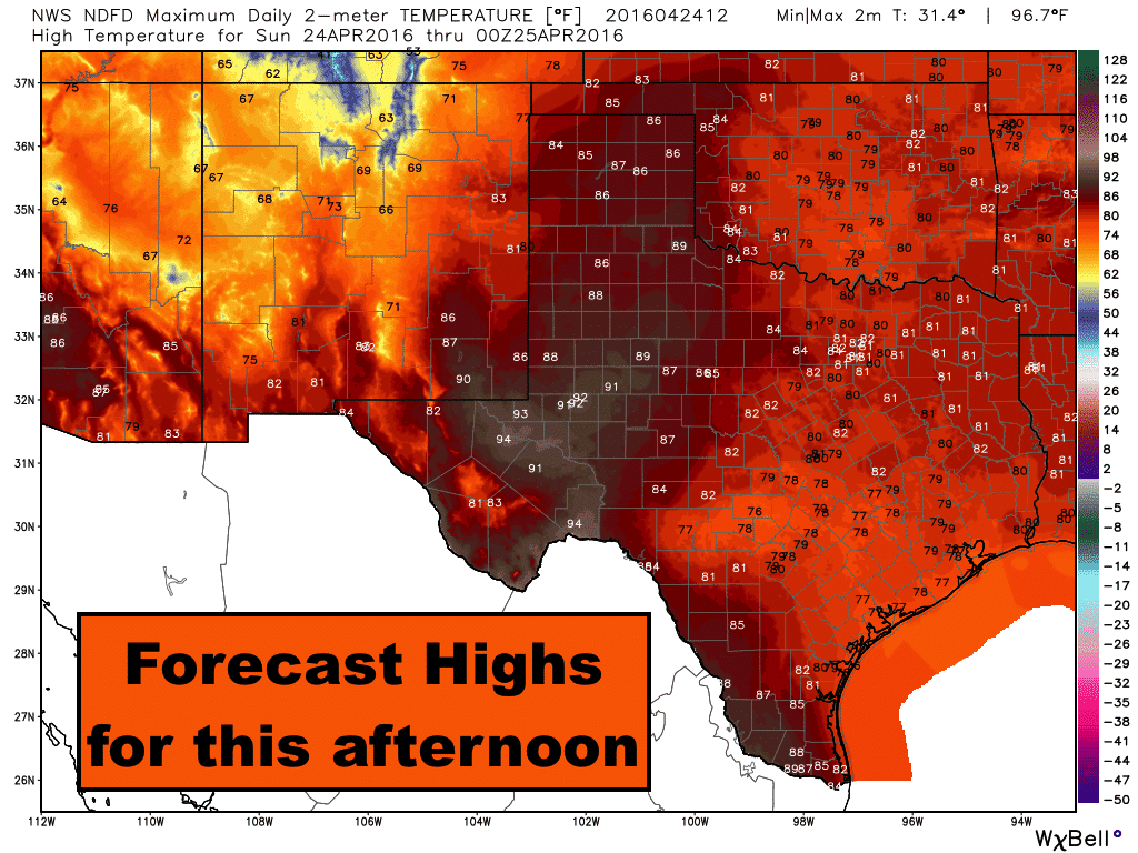
Good morning and happy Sunday everyone! Today’s chances for storms will reside south and along the coastal bend and deep south Texas early to late afternoon as a weakish mid-level disturbances moves east across the region. A few of the storms could become strong to severe with a damaging wind threat, especially as we get into the late afternoon hours and peak daytime heating, but the overall threat of widespread severe is low. This disturbance may be able to generate a widely scattered showers and storms as far north as the I-20 corridor, but that threat will be minimal this afternoon. Elsewhere today, skies will be mostly sunny, breezy by later this afternoon with an elevated to critical risk of wildfires behind the dryline across far west Texas.
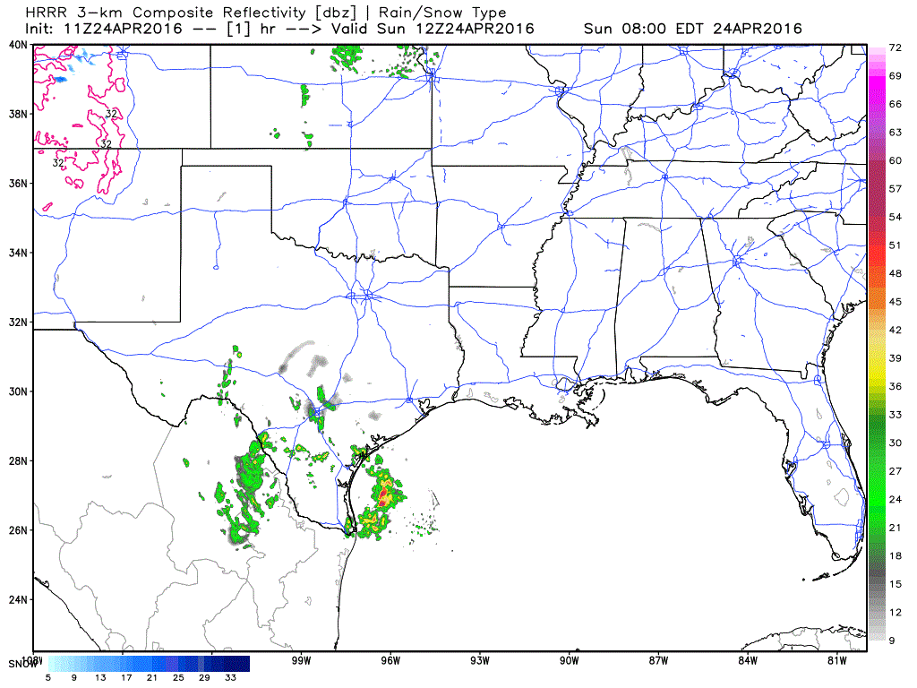
Simulated Radar through 9pm tonight….
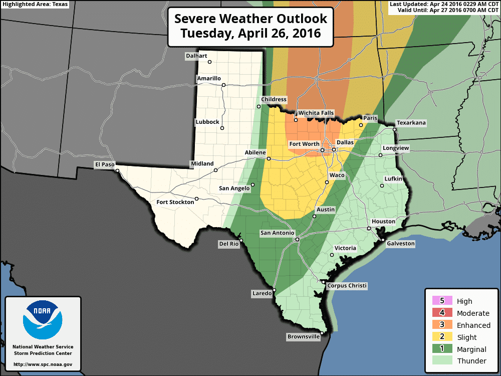
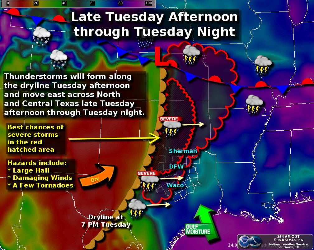
Monday, we have a little break from rain and storm chances, but by Tuesday that changes with the arrival of a strong upper level system across the southern plains. For several days now, we’ve been talking about the threat this system will bring the chance for severe weather across western north Texas and north central Texas from the DFW metroplex up towards the Red River. How strong the cap will be at that time continues to be a determining factor in limiting storm development. Latest data rolling in overnight suggests that this upper level system may arrive with sufficient forcing to erode the cap along the dryline in western north Texas on Tuesday afternoon and generate at least a few isolated supercell thunderstorms. These will generate the threat of very large hail…potentially up to the size of baseballs…along with the possibility of a few tornadoes. Further south into central Texas, isolated storm development is also possible but not as likely as it will be further to the north. This upper level system will arrive on the west coast by early tomorrow, and with better data on it being ingested into our weather balloon network, we expect to see further refinement in this forecast by tomorrow evening, so be sure to check back with us!


0 Comments