
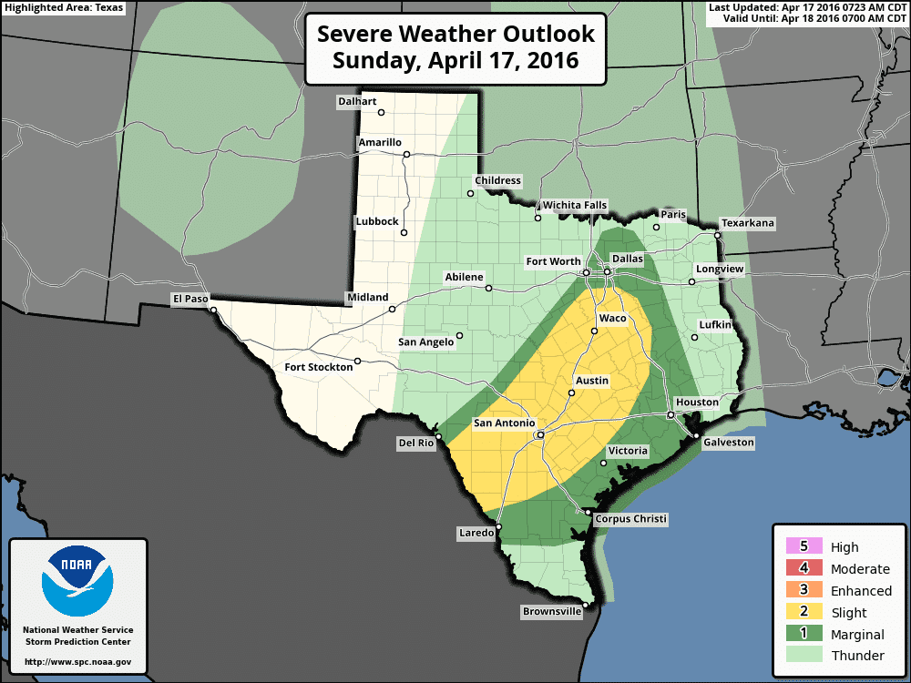
Severe weather outlook for today
Widespread precipitation is underway across the western half of North Texas with more isolated activity into the Hill Country and south towards Del Rio. The severe weather threat today will be across Central Texas, South-Central Texas, and South Texas where the atmosphere will be more unstable. The Storm Prediction Center has highlighted their standard category 2 risk zone for those regions. A category 1 risk extends north through the D/FW Metroplex and into Southeast Texas with a non-zero tornado threat possible through tonight. I don’t believe we’re going to see a widespread or significant severe weather threat today but isolated tornadoes will be possible throughout the day. Low-level wind shear is quite strong but the convective mode will be more messy. We’ve already had a few tornado warnings this morning in Central Texas and that threat will continue through the afternoon. Be ready to act if a tornado warning is issued for your area.
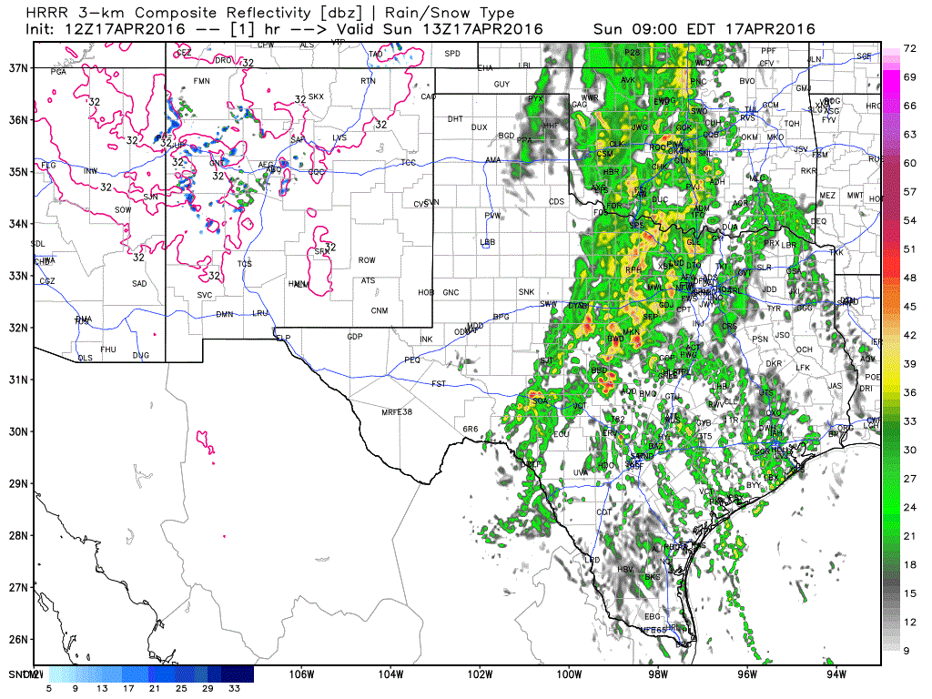
12Z HRRR Simulated Radar Forecast through early evening.
The widespread shower/thunderstorm activity won’t make too much of a push east through the afternoon hours. This is one reason why concern is high over flooding since several inches of rain could occur. The threat for flooding will increase tonight through Monday across Central Texas, the Brazos Valley, North Texas, East Texas, and Southeast Texas. An additional 4 to 8 inches of rain is possible over those regions with isolated totals over 10 inches by Tuesday. Mesoscale factors such as outflow boundaries and storms moving over the same regions (training) will determine where the heaviest rains fall over the next two days. We’ll be watching trends to pinpoint down areas of major flood potential.


0 Comments