
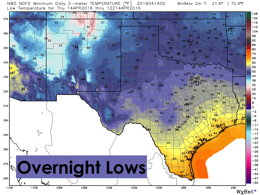
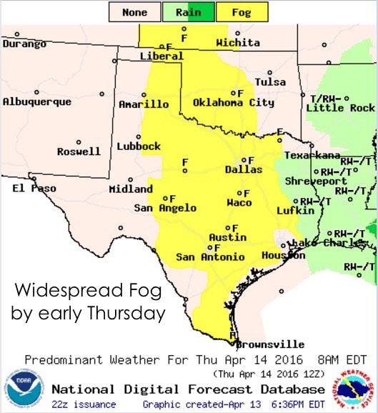
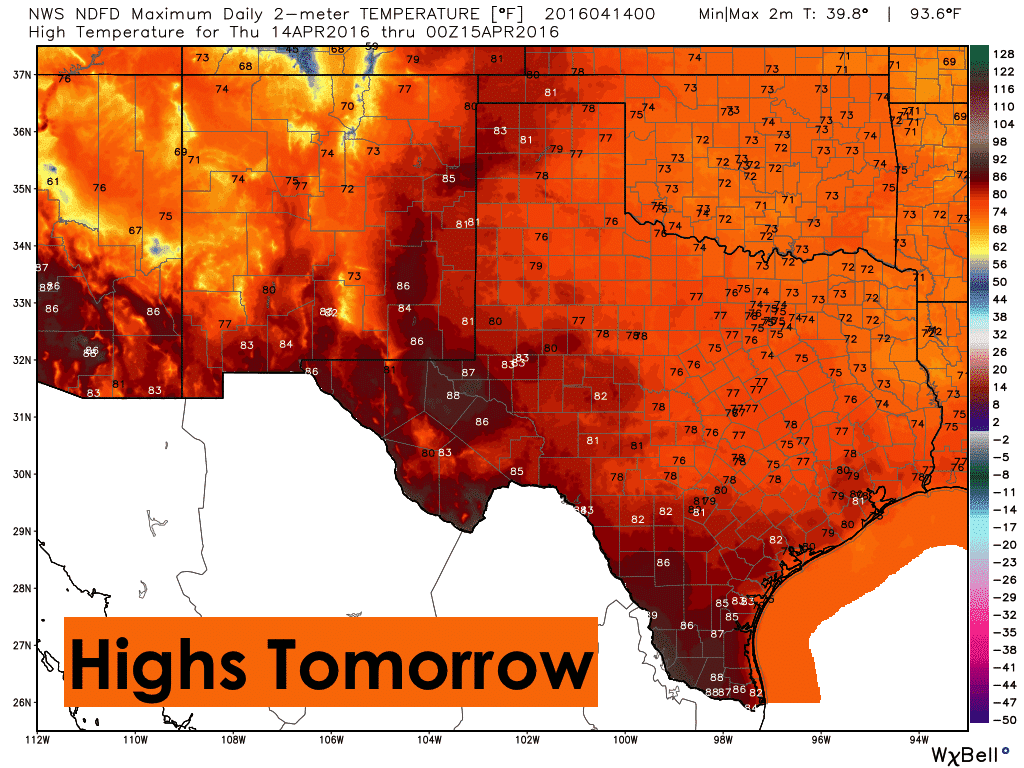
Lingering rain across far north central/northeast Texas will likely continue through the late evening hours. For a majority of the state, conditions overnight will be quiet with seasonal lows with no additional rain expected. Widespread patchy to dense fog is likely by early morning across a large swath of the state from the coast all the way north into the eastern panhandle. Keep that in mind as you head out tomorrow and allow extra travel time if your area is experiencing dense fog. Currently, we have no dense fog advisories in effect, but that may change by morning. Highs tomorrow will be pleasant and seasonal with mostly clear skies once the morning fog burns off. No rain is expected for Thursday or Thursday night.
 Our weather pattern gets busy by Friday afternoon with the approach of our next upper level system. A strong ridge of high pressure will build across the eastern US will cause this system to stall out just west of the state for a few days. You can see it spinning off the coast of western Canada now. By Friday, this low will set up over the four corners region and linger across the region likely through the coming weekend. Current forecast models differ on how long the low will linger before it either moves east or dissipates. But what we do know right now is that we’ll see widespread rain chances beginning late Friday across west Texas with additional rain chances Saturday and Sunday further east across west central, central and north central Texas. Not everyone will see rain the entire time, but the potential is there for some healthy rainfall totals by the time this system eventually moves out. Since this rainfall will be spread out over several days, widespread flooding should not become an issue. However, if we see lingering clusters of storms producing heavy rain over several hours, localized flash flooding may become more problematic.
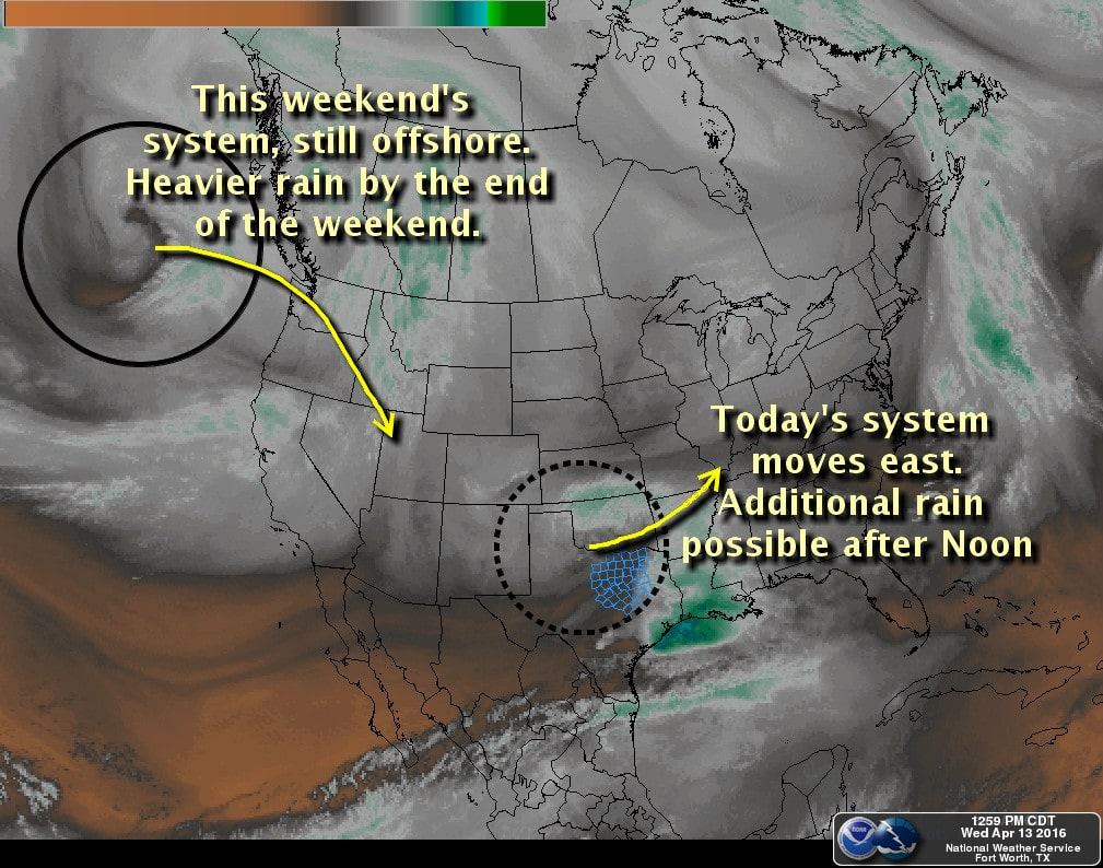
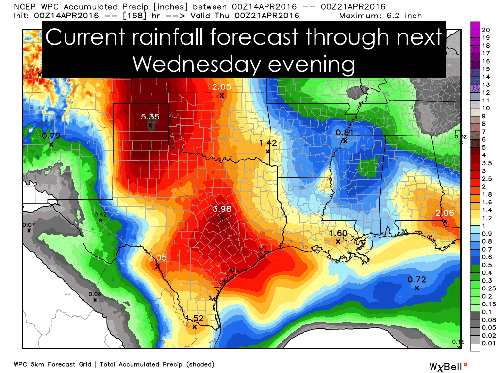
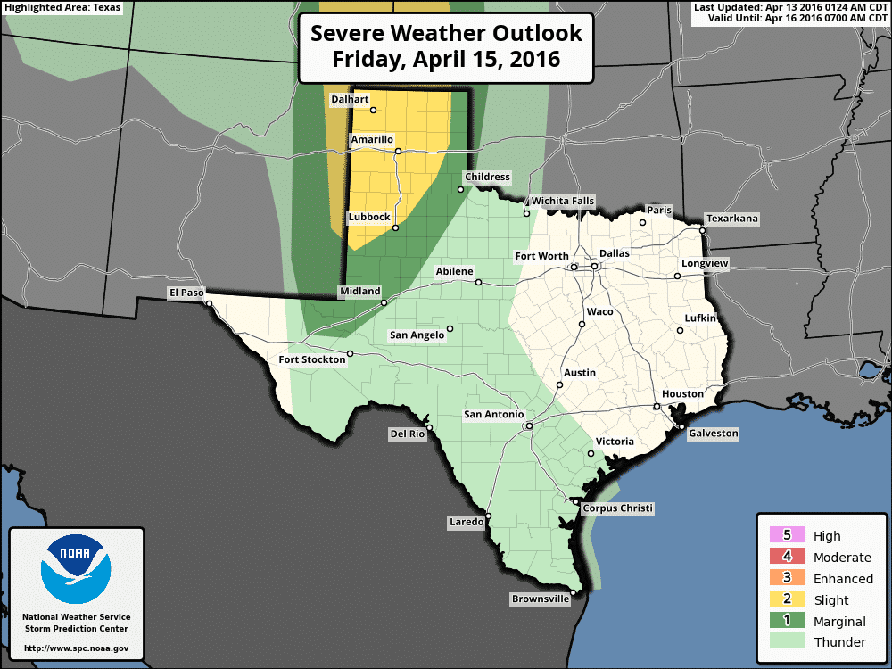
We will also see a chance for severe storms across the western panhandle Friday evening. A dryline will form across near the Texas/New Mexico border by Friday afternoon. Even with the likelihood of cloud cover east of the dryline, instability values look to increase by late afternoon which is expected to be sufficient to generate scattered strong to severe storms across the western panhandle region Friday afternoon into the late evening hours. Storms will initially develop as isolated supercells, but after time should begin to congeal into larger clusters and move almost directly north/northeast. Large hail and damaging winds appear to be the two main threats at this time; however an isolated tornado or two cannot be ruled out. It’s still too soon to get into specifics. As this system moves onshore and becomes sampled by the weather balloon networks, we’ll likely see some refinement to the forecast by tomorrow evening, so be sure to check back later!


0 Comments