
Yesterday’s cold front has cleared the coast and pushed all the remaining rain and storms offshore. Much cooler and drier air is filtering in behind the front across the state which will leave highs this afternoon a good 10 to 20 degrees below where they should be this time of the year. The sky has mostly cleared out across parts of the panhandle, north and west central Texas, but we’ll still see lingering clouds today across east, southeast and parts of south Texas through the afternoon. No rain is expected, so the only issue we’ll have to deal with today will be the gusty post-frontal winds and the cooler temps.
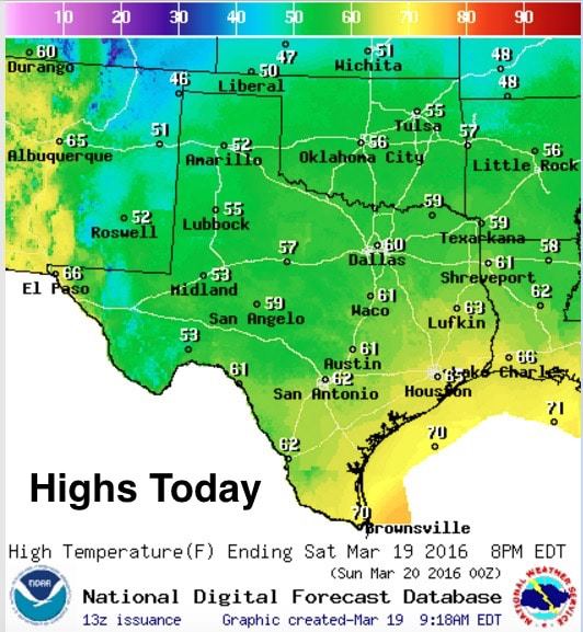
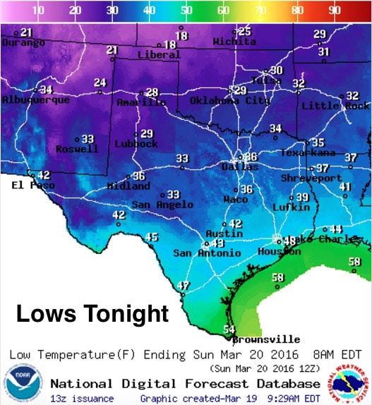
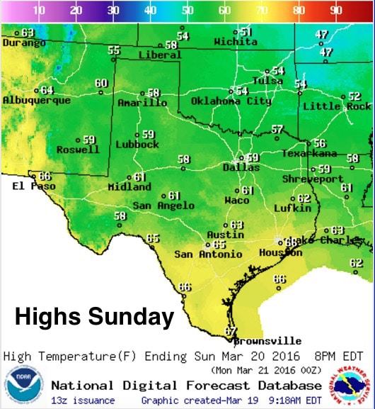
Highs Today will only reach the low 50s across the panhandle, west and west central Texas. North Texas will see highs ranging from the mid 50s to low 60s later today. Central Texas will see highs in the low 60s, and the coastal and inland counties will see highs only reach the low to mid 60s. The much drier air being pulled in across the state behind the front will allow temps to quickly drop down into the 20s and 30s tonight across the panhandle, west and north Texas overnight. If you have sensitive plants already out in the garden, it might be a good idea to cover them before heading off to bed this evening. For central and coastal/inland counties, temps will remain above freezing and only drop into the mid to upper 40s tonight. Highs on Sunday will be a few degrees warmer, and we’ll continue to see increasing warmth through the first part of next week. Looks like our next chance for seeing rain and storms will arrive around Thursday of the coming week. We’ll have more details out on that as we get closer!


0 Comments