
We have an active weather pattern setting up for this week with a parade of cold fronts moving in and out. While we may have started off this week feeling more like June, by the end of the week, it looks like a good portion of the state will be feeling more like February. Typical Texas weather, right? Rainfall amounts are not impressive this week, but we will see some chances which we’ll talk about later in the blog.
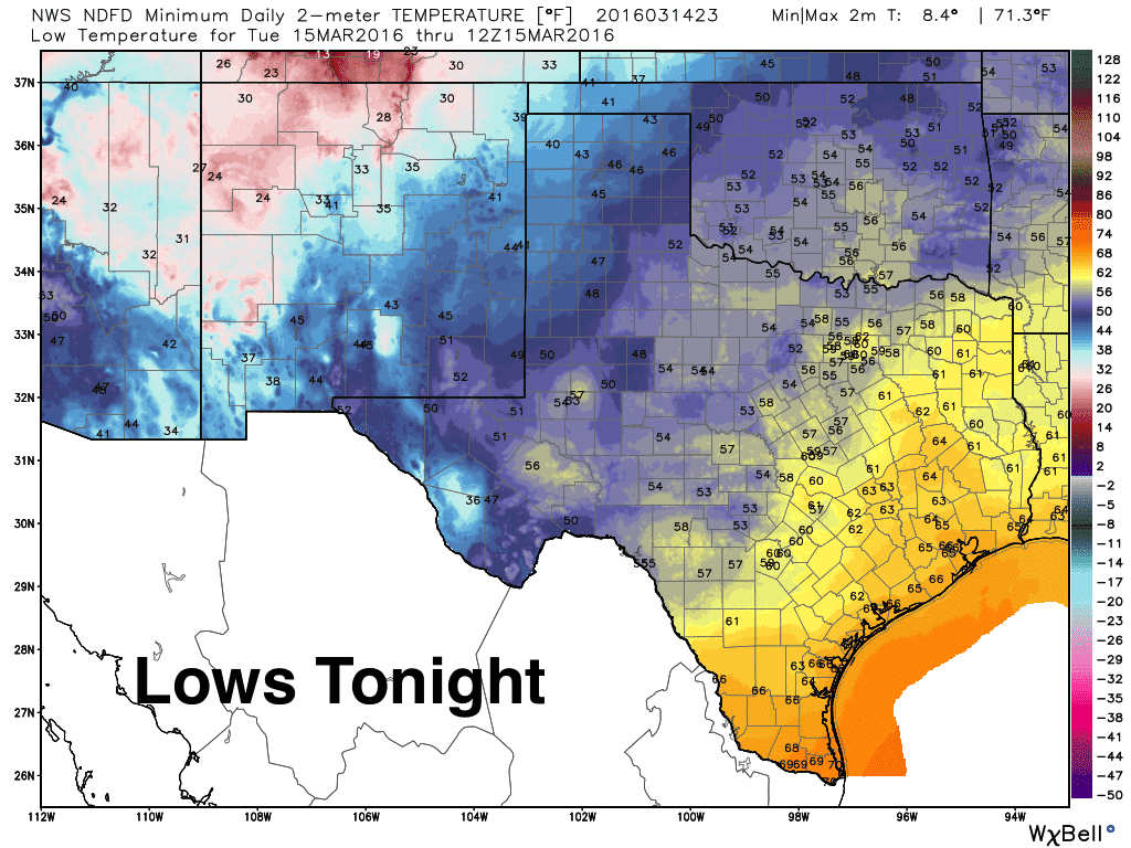
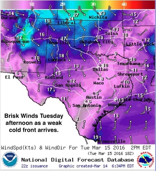
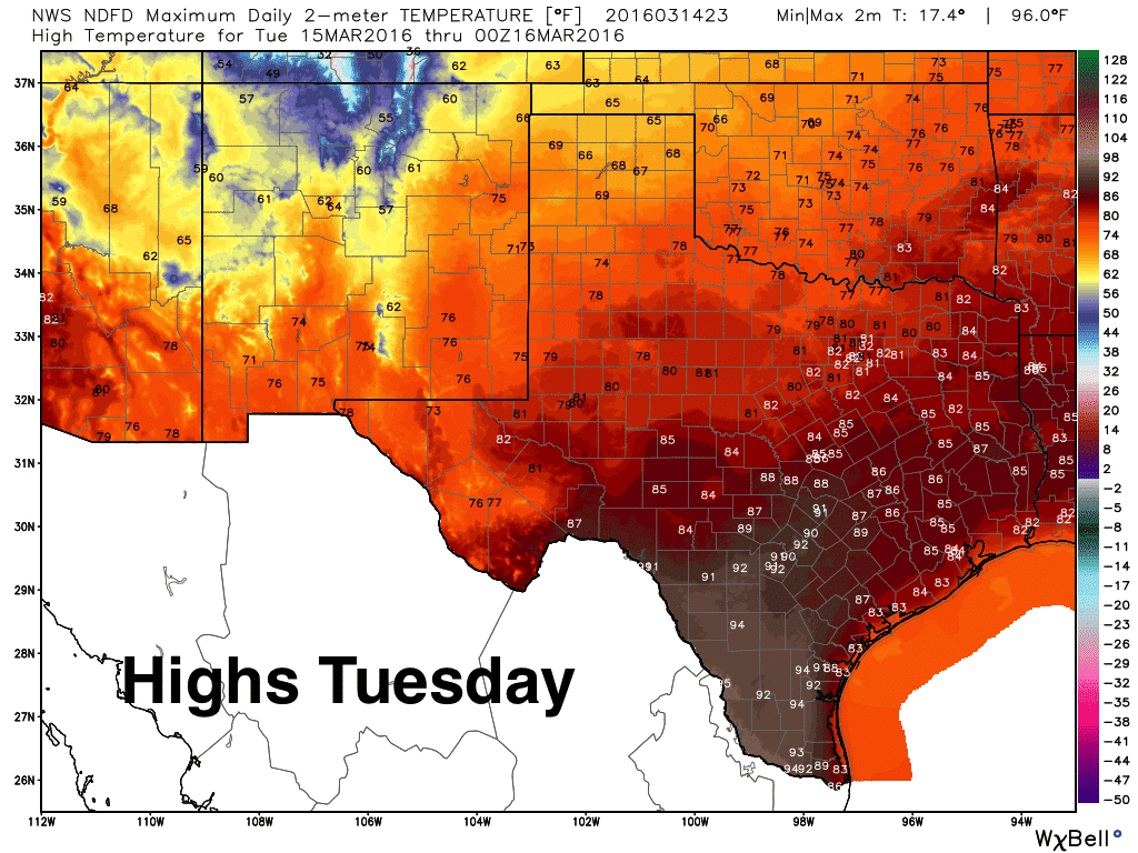
For tonight, lows will drop down into the 40s across the panhandle, 50s across the rolling plains, Permian Basin and far West Texas. Warmer and in the upper 50s to mid 60s further east and south. A weak cold front moves in on Tuesday which will knock highs back down a few degrees across the northern half of the state. It will also bring breezy west/northwest winds along with it especially for the panhandle and western half of north and central Texas by mid-day tomorrow. The warmest highs we see on Tuesday will be across south/southwest Texas where we’ll likely see widespread 90+ degree readings. Rain or storms with this front look highly unlikely, but a couple of the short-range models are showing a few light showers possible along the leading edge of the front as it moves across east and southeast Texas late Tuesday.
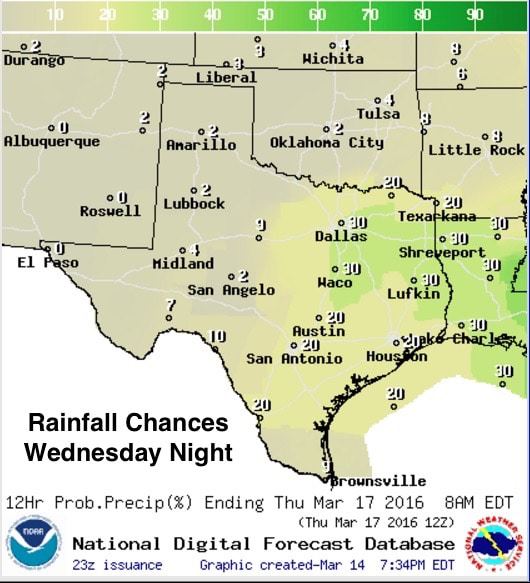
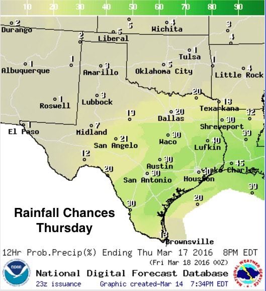
A Look Ahead: Another weak cold front arrives Wednesday afternoon dropping south through north and central Texas during the overnight hours. This front will also not have too much of an impact on temps during the day Wednesday as it will arrive later in the day, but it will generate chances for rain along and behind the front across parts of north, central and southeast Texas during the overnight hours into Thursday. No severe weather is expected during this time period.
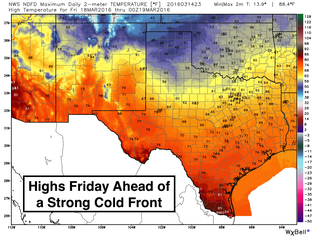
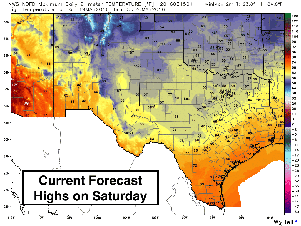
On Friday, the cold front will lift back north as a warm front at the same time a much stronger cold front will be dropping south out of the midwest. This will be the most impactful front of the week in terms of temperatures plummeting down a good 10-15 degrees below seasonal averages by Saturday. But, thankfully this trend appears short-lived as we pop right back up close to seasonal averages again by Sunday.
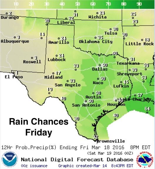
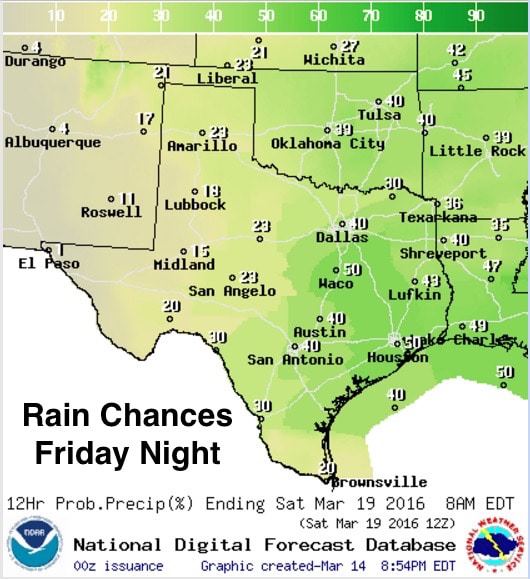
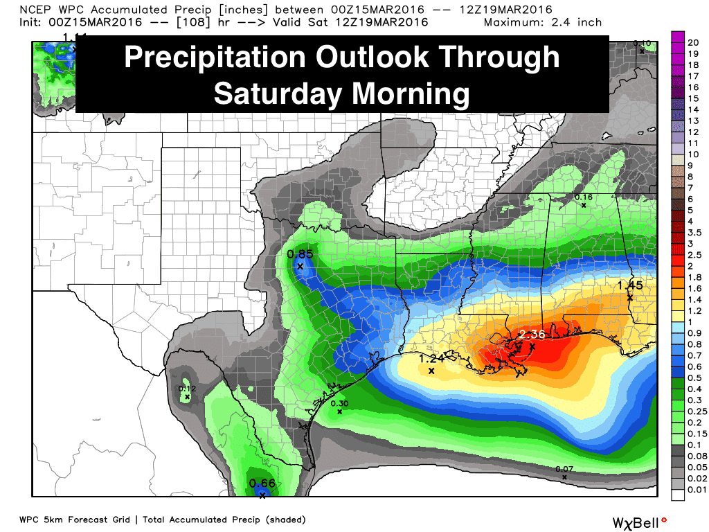
Rainfall chances will also be best Friday through early Saturday along and ahead of the front as it dives south eventually ceasing its forward momentum along the coast of deep south Texas during the day Saturday. Thankfully, this round of rainfall will be light overall and should not aggravate lingering wet conditions still present across the eastern and southeastern half of the state. There’s also a chance of seeing a bit of wintry weather across parts of the Texas panhandle late Friday with this strong front, but forecast confidence in this right now is pretty low. It will be something that we’ll monitor during the week and provide updates as we go along!


0 Comments