
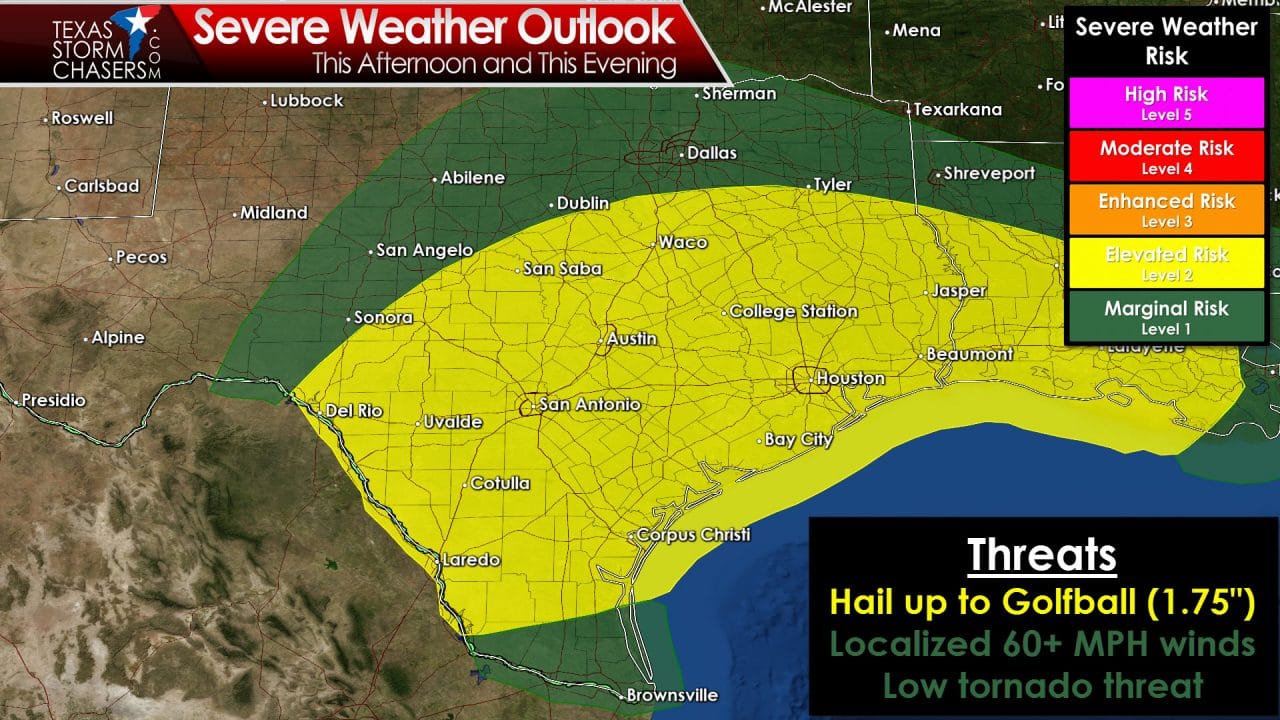
The Storm Prediction Center has indicated the potential for a few severe thunderstorms today. They use a five-level threat system with one being the lowest and five being the highest. Their severe weather outlook issued earlier this morning places South Texas, Central Texas, the Brazos Valley, the Coastal Plains, the Coastal Bend, Southeast Texas, and East Texas in a level 2 risk of severe weather today. A level 1 risk includes the Big Country, Concho Valley, North Texas, Northeast Texas, and the Rio Grande Valley. A level 2 risk indicates an elevated risk of severe weather. A level 1 risk indicates a marginal risk of severe weather. The timeframe for severe weather could start as early as late morning across the northern risk areas. That risk will translate south by this evening and could continue into the nighttime hours across Central Texas, South Texas, and Southeast Texas. The strongest storms could be capable of producing large hail up to the size of golfballs. If storms are able to organize into a line this evening we’ll also have to be on the lookout for a few damaging wind gusts. Low-level wind shear will be very weak today. At the same time a southward moving cold front will likely keep most thunderstorms high-based. Both those factors will keep the tornado threat very low today. I can’t completely rule out a brief tornado if a storm were to latch onto an outflow boundary or interact with a stationary warm front over Central Texas this afternoon.

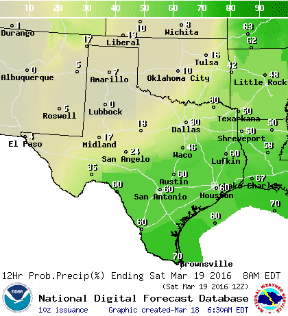
Chance of showers/storms this morning and this afternoon
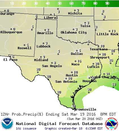
Chance of showers/storms this evening and overnight
Chance of showers during the first half of Saturday
Not all thunderstorms will be severe today. In fact there is a decent chance for showers and thunderstorms beginning late morning across Texoma and North Texas. It won’t rain everywhere and it definitely won’t be raining all day. The best chance for scattered showers and storms today will be across North Texas, Northeast Texas, East Texas, and Central Texas. The highest rain chances this evening and overnight will shift into South-Central Texas, Southeast Texas, the Brazos Valley, the Coastal Plains and Coastal Bend, into the Rio Grande Valley. A few strong to severe storms will be possible among activity tonight. I’ve included a couple graphics from local National Weather Service offices. These will help provide more specific timing information for your local area.
Temperatures behind the cold front tonight and on Saturday will be noticeably cooler than the past couple of days. Temperatures will peak in the 50s and 60s. By Sunday morning temperatures will fall back to levels we haven’t dealt with in a couple of weeks. We’ll have to be on the lookout for a freeze across the Texas Panhandle, West Texas, and perhaps patchy frost in parts of the Big Country, Concho Valley, Northwest Texas, and North Texas. This shouldn’t come as a huge surprise since we usually have a decent cold snap right around Easter. Temperatures have been above-average the past couple of weeks – well most of winter – but it is still winter. There are signs we may have to deal with our usual customary cold snap around Easter as well.
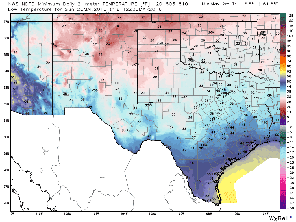
Forecast low temperatures Sunday morning


0 Comments