
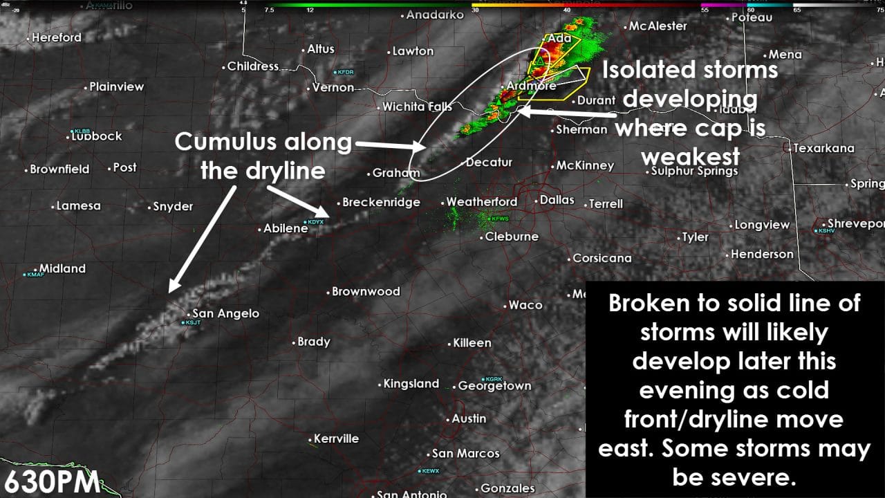
Agitated cumulus are visible along the dryline from west of Gainesville southwest to near San Angelo. The dryline has been capped which is preventing severe thunderstorm development. A couple storms have fired up just north of the Red River near Ardmore where the cap is weaker. Those storms quickly became severe and are moving east/northeast. A few attempts at storm development have been seen across Montague county. Thus far those attempts have failed. We’ll likely have to wait for more upper level forcing to arrive. Current projections have that forcing arriving between 8 and 9 PM. Once that occurs the development of severe thunderstorms are likely from southern Oklahoma into western North Texas. Storms should quickly grow upscale into a squall line. That squall line will slowly move east with some storms in it containing large hail and damaging wind gusts. A tornado can’t be ruled out. That squall line will move east to the I-35 corridor after 9-10 PM. Some storms will be severe with large hail and damaging wind gusts as they move through the D/FW Metroplex.
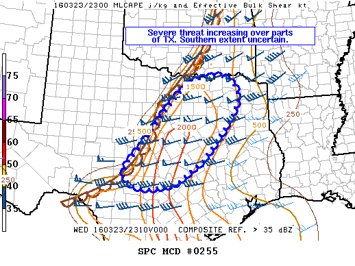
The Storm Prediction Center just issued a mesoscale discussion indicating a severe thunderstorm watch will likely be issued soon for North and parts of Central Texas. There remains some uncertainty on how far south the squall line will develop tonight – but it certainly may try at forming as far south as the Hill Country and western Central Texas. We’ll just have to wait and see.


0 Comments