

Mostly cloudy skies will slowly filter north from the Rio Grande Valley today. By late this afternoon skies should be mostly cloudy across South Texas and into South-Central Texas around San Antonio. Otherwise mostly clear skies will remain across the remainder of the state today. Winds will be out of the south across the western half of Texas with southeast winds across the eastern half of Texas. Those winds will become gusty up towards 35 MPH this afternoon across the Panhandle, West Texas, and Far West Texas. Fire concerns today will be highest around El Paso and Far West Texas. The snowfall yesterday morning has temporarily lowered fire danger in the Panhandle and West Texas. That’ll change Tuesday as a dryline surges east and brings a return of very dry conditions and strong west winds. High temperatures this afternoon will be warmest in Far West Texas, the Permian Basin, and the higher elevations around Alpine with low to middle 80s. The Rio Grande Valley will also top out around 80 degrees today. The rest of the state will make it into the upper 60s to upper 70s today with those southerly/southeasterly winds.
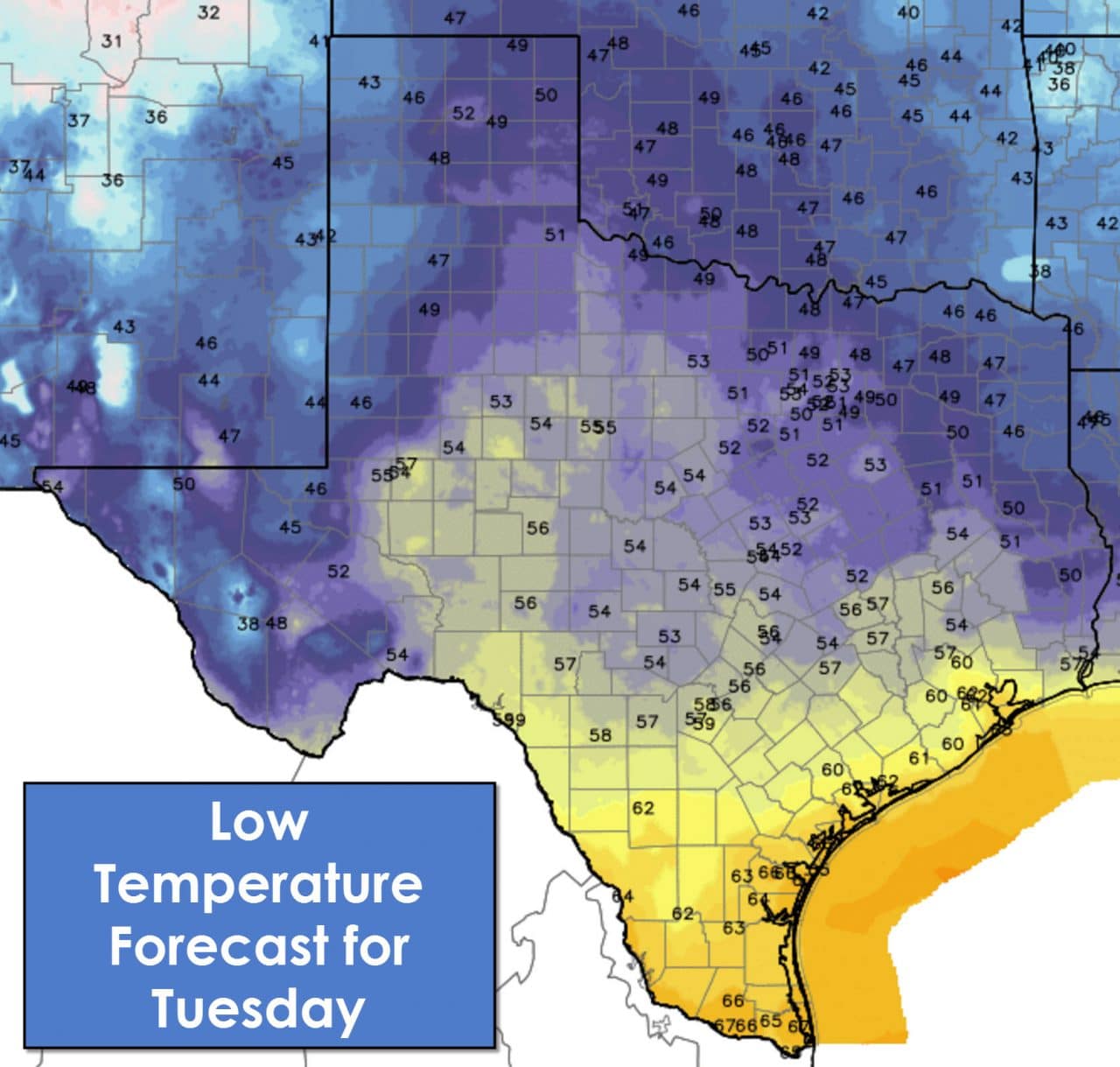
Southerly winds will start to feed moisture back into Texas tonight from the Gulf of Mexico. That’ll result in widespread clouds and fog the Concho Valley, Hill Country, South Texas, and the Rio Grande Valley. Temperatures accordingly will also be warm tonight only making it down into the upper 50s to middle 60s. Locations further north and northeast will drop into the 40s to low 50s tonight. Amarillo will only make it down to 48 degrees tonight. Definitely a far cry from the lower 20s with snow only twenty four hours ago.
Rain chances begin to increase on Tuesday. Isolated to scattered showers are possible on Tuesday across coastal regions of the state along with Southeast Texas and South-Central Texas. I can’t rule out a rouge thunderstorm but I doubt we’ll see much of significance during the day tomorrow. The chance for showers and thunderstorms will increase Tuesday Night across South-Central Texas, Central Texas, North Texas, into Northeast Texas and East Texas. Some storms may become strong with small hail and locally heavy rain. The risk of severe weather and flash flooding is low Tuesday Night but don’t be surprised if you get woken up by a boomer. Wednesday and Wednesday Night will feature scattered to numerous thunderstorms along and east of Highway 281 from Texoma south into the Hill Country. This is the timeframe we’ll have to watch for severe weather and the potential for localized flash flooding. There will likely be two rounds of thunderstorms on Wednesday. The first will be from what develops Tuesday Night and moves east into Northeast Texas and East Texas by the early afternoon.
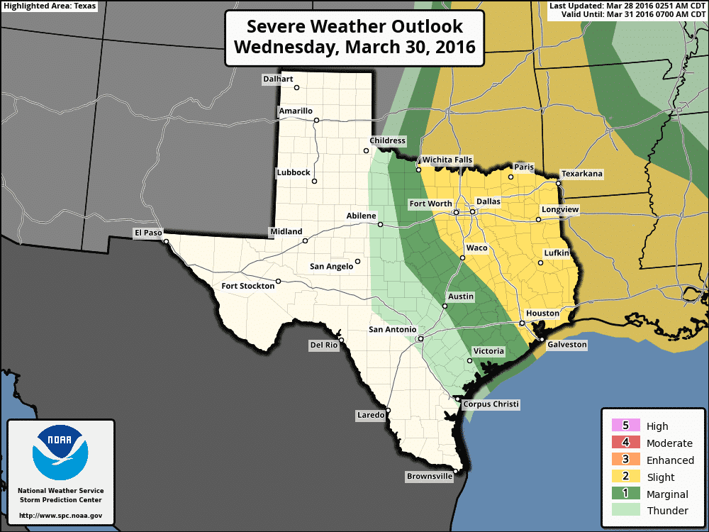
Severe weather outlook for Wednesday afternoon and Wednesday night
The second round will depend on what happens with morning convection and how quickly it kicks out east. A dryline will setup somewhere between Highway 281 and Interstate 35 by mid-afternoon Wednesday from Kansas all the way south into Texas. Scattered supercell thunderstorms may develop off the dryline by late-afternoon and move east. The strongest of those storms would likely be severe with very large hail, damaging wind gusts, and a tornado threat. The aerial extend and significance of the severe weather threat will hinge on how long the morning storms hang around. This is our spring severe weather season and Wednesday has the potential to live up to that. Please keep tuned for updates and plan on having a way to receive weather warnings on Wednesday. A few showers/storms will remain possible on Thursday across Southeast Texas and South Texas.


0 Comments