
Shortly after noon we were watching two distinct areas of interest. The first is across Northeast Texas, East Texas, and eastern North Texas. The second area is along and east of Highway 81 from Wichita Falls south to Breckenridge and Brownwood for later this afternoon. The forecast remains fairly complex so we’ll try and sort it all out.
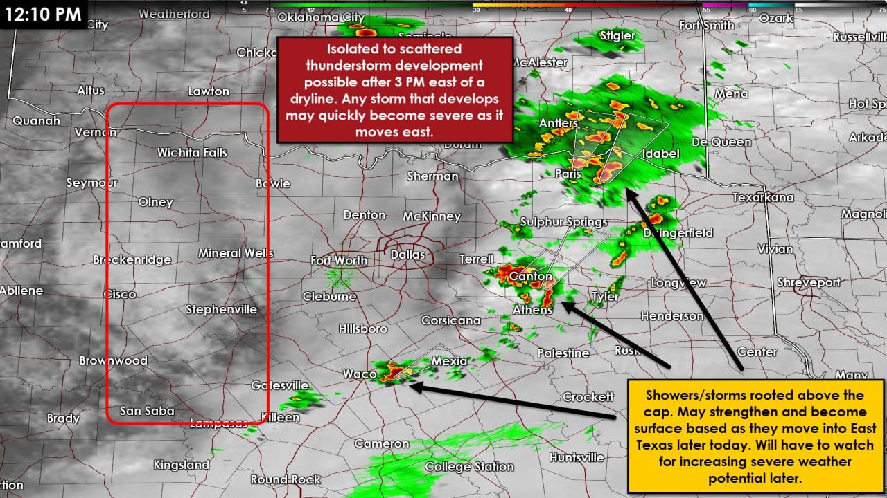
- Isolated thunderstorms are moving northeast across Northeast Texas and eastern sections of North Texas. These storms have not been severe and are rooted above the cap. Known as elevated they are not able to tap into surface-based instablity. That keeps the tornado and damaging wind threat nearly zero. They do have access to cold air aloft and elevated instability values – meaning they could strengthen and produce hail. So far that has not occurred. An atmospheric disturbance near D/FW will move into Northeast/East Texas by late afternoon. Some on-going storms or new storms may become surface-based with an increase in the severe weather threat. This is not related to the dryline setup further west. The strongest storms across Northeast Texas and East Texas later this afternoon and evening could be severe. Large hail up to the size of golfballs, localized damaging wind gusts of 60-70 MPH, and a couple tornadoes would all be possible. If we see any discrete supercells really become established then we will have to watch for an elevated tornado risk. The highest severe weather threat should be from 3 PM through 10 PM or until storms move into AR/LA.
- The second area of concern for thunderstorms will be east of the dryline by mid-afternoon. Depending on how far east the dryline makes it by mid-afternoon we could see isolated to widely scattered storms start firing from southern Oklahoma into western North Texas. The first storm might be going up as I write this near Snyder, TX. That’s indicative that the cap is weakening ahead of an eastward moving dryline. The thunderstorm risk should be highest along and east of Highway 281 – although I can’t rule out storms first firing up west of the highway. Storms may rapidly intensify as they will be in a very unstable enviornment. Supercell storm structures are expected with the most intense storms capable of producing very large hail. Some hailstones could approach the size of tennis-balls. The tornado threat will be low due to fairly weak low level wind shear. The tornado threat, however, will not be zero and we’ll have to watch for an isolated tornado with the most intense storms. By the early evening hours we should have a couple storms moving towards I-35/I-35W and the western outskirts of the D/FW Metroplex. The cap is expected to be stronger in D/FW so there is some question on how far east the storms will be able to push before weakening. Some of the new short-term weather model guidance I’ve seen keeps the storms intact into D/FW by 7-8 PM. I encourage folks to keep an eye to the sky and check back for forecast updates. This won’t be a day to only read the forecast now and not check back for updates. There will be changes and probably at least a couple surprises.
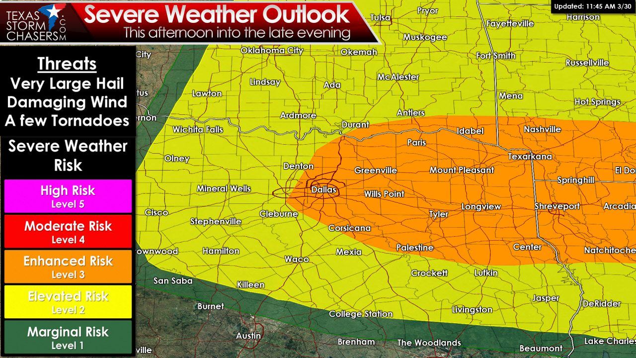
I’ll leave you with the severe weather outlook for this afternoon and evening. All the colors and numbers don’t mean much but I know some folks will want to see a graphical representation of the risk areas. The difference between the category 2 and category 3 risk areas is miniscule at this point. If you end up with a storm near you – it’ll likely be severe this afternoon and evening. Storms don’t read maps and don’t care where the highest risk areas are located.


0 Comments